The Silent North: A Forensic Analysis of the Domesday Book of 1086
The Silent North: A Forensic Analysis of the Domesday Book of 1086
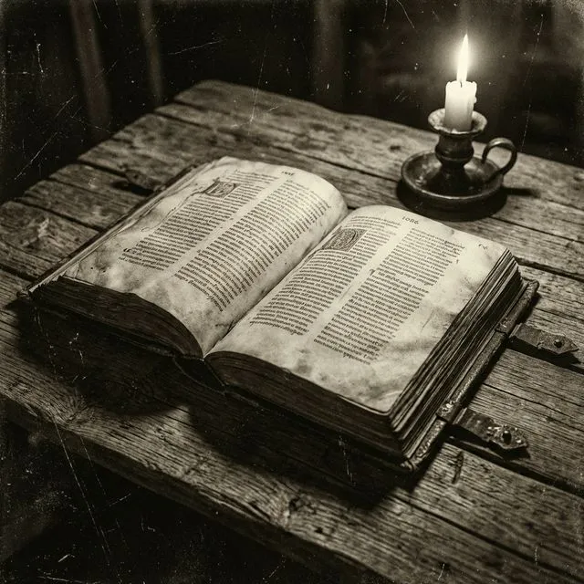
In the vast and storied archive of English history, few documents command the authority, the mystique, or the sheer terror of the Domesday Book. Compiled in 1086, it stands as an administrative achievement without parallel in medieval Europe. To the casual observer or the lay reader, it is often characterized reductively as a census - a mere headcount of the peasantry and a list of livestock. However, to the historian, and particularly to those studying the turbulent and scarred history of Northern England, the Liber de Wintonia (Book of Winchester) serves as a witness of a much darker nature.
It is a document of dual identity. On one hand, it is the primary evidence for the imposition of rigid Norman feudal structures upon a fluid Anglo-Scandinavian society. On the other, it acts as a grim, bureaucratic catalogue of the devastation wrought by the Conquest itself. While the southern shires are recorded with orderly precision, the Northern folios reveal a fractured landscape. They tell a story of silence, of omission, and of the stark, repetitive annotation that haunts the pages of Yorkshire and Cheshire: vasta est (“it is waste”). This article aims to decipher those silences, exploring the geopolitical crisis that spawned the survey and the human tragedy it quietly documents.
1. The Geopolitical Crisis of 1085: The Genesis of the Survey
The creation of the Domesday Book was not born from bureaucratic curiosity or a desire for administrative neatness. Its genesis lies in an acute existential crisis for the Norman regime. The genesis of this monumental task can be traced to a specific moment in time: Christmas, 1085.
The Anglo-Saxon Chronicle records that King William I held his court at Gloucester during the festive season. It was here, following what the chronicler describes as “deep speech” (deope spaece) with his council, that the King ordered a survey of the entire kingdom. The catalyst for this unprecedented decision was not internal policy, but external threat. The kingdom faced the imminent danger of invasion by King Canute IV of Denmark, who had formed a potent alliance with Robert of Flanders to challenge the Norman claim to the English throne.
To defend his conquered realm, William needed to ascertain the precise military and financial resources available to him. The survey was, therefore, an instrument of war preparation as much as civil administration. It sought to answer fundamental questions of capacity that were vital for survival: How much land was available for the geld (taxation)? Who held the land and, consequently, who owed military service? Crucially, the King needed to know the potential value of the realm compared to its current yield.
This threat of Danish invasion was particularly toxic in the North. The region retained strong cultural, linguistic, and familial ties to Scandinavia - a legacy of the Viking Age. Moreover, rebellion had been endemic in the North since 1066. Thus, the survey in Yorkshire and the surrounding counties was not just an audit of assets; it was a strategic map of a pacified war zone, designed to secure the frontier against a population whose loyalty was far from guaranteed.
2. The Mechanism of Inquest: Piercing the Veil
The logistical scale of the operation underscores the formidable power and reach of the Anglo-Norman state. To execute this survey, the kingdom was divided into seven circuits. Commissioners - typically high-ranking bishops and barons who possessed no local interests or land in the areas they surveyed - were dispatched to the shires to conduct the inquest. This lack of local connection was deliberate, designed to ensure impartiality and to prevent corruption.
The methodology employed was strictly inquisitorial. In every shire court, and subsequently in the smaller administrative units of the hundred (or wapentake in the North), the commissioners convened juries. These were not random assemblies. They were carefully composed of the sheriff, the local barons, the parish priests, the reeves, and - crucially - six villani (villagers) from every vill. These jurors were sworn to answer a specific set of questions, a standardized questionnaire preserved in the Inquisitio Eliensis.
The questions were rigorous, designed to penetrate the veil of local custom and obscure tenures:
- Identity: What is the name of the manor?
- Tenure: Who held it in the time of King Edward (TRE)? Who holds it now (TRW)?
- Capacity: How many hides or carucates are there?
- Resources: How many plough teams in demesne (lordship) and how many belonging to the men?
- Demography: How many villagers, cottars, slaves, freemen, and sokemen?
- Assets: How much woodland, meadow, and pasture? How many mills and fisheries?
- Value: How much was it worth TRE? How much when granted? How much now?
The final question - “Can more be had than is currently had?” - betrays the rapacious fiscal intent of the survey. William sought not just to record the status quo, but to identify under-exploited assets that could yield higher taxation.
3. The Northern Gap: A Geography of Omission
One of the most striking features of the Domesday Book is the blank space at the top of the map. While the survey is exhaustive for the Midlands and the South, the far North of England is largely missing. The counties of Northumberland and Durham, as well as the northern parts of Cumberland and Westmorland, are entirely absent from the record. This “Great Gap” is not a result of scribal error or lost manuscripts; it is a reflection of the political and military realities of 1086.
The Palatinate of Durham
The omission of the North East - modern Northumberland and County Durham - has traditionally been explained by the limits of royal authority. The lands between the River Tees and the River Tyne were the patrimony of St Cuthbert, administered by the Bishop of Durham. By the late 11th century, the Bishopric was evolving into a Palatinate - effectively a “state within a state.”
In this territory, the Bishop exercised quasi-royal authority. He had his own sheriff, collected his own taxes, and raised his own armies. Since the King’s writ did not run in the Liberty of Durham, and the King’s commissioners had no authority to assess the Bishop’s tenants for the royal geld, the region was excluded from the national survey. It was, for all intents and purposes, a separate fiscal entity.
The Militarized March: Northumberland
North of the Tyne, the situation was one of chronic instability. The region was a militarized march, frequently ravaged by Scottish incursions and local blood feuds. The fragility of Norman control here was palpable; the murder of the first Norman Earl, Robert de Comines, in Durham in 1069, and the subsequent murder of Bishop Walcher in 1080, highlighted the dangers. In 1086, the region was likely too volatile for the safe conduct of a detailed inquest. Furthermore, the tenurial structure of Northumberland, based on cornage (horngeld) and ancient service rather than the hidage system, made it difficult to fit into the standardized Domesday formula.
The Western Frontier
The North West presents a different anomaly. The southern districts of modern Cumbria (Kendal and Lonsdale) were included in the survey, but they were attached to Yorkshire for administrative convenience. However, the northern part of Cumberland, including the strategic city of Carlisle, was not part of the English kingdom in 1086. It was held by the Scottish King Malcolm III and was only conquered by William Rufus in 1092, six years after Domesday was compiled. Thus, the omission of Carlisle is a simple matter of sovereignty: William the Conqueror did not own it.
Lancashire, interestingly, did not exist as a county in 1086. Its territories were split between its neighbors. The lands “Between the Ribble and the Mersey” were surveyed as an appendage to Cheshire, while the northern territories (Amounderness and Furness) were surveyed as part of the West Riding of Yorkshire. This fragmentation suggests that in 1086, the North West was regarded as a colonial frontier, composed of vast, loosely organized lordships rather than coherent shires.
4. The Harrying of the North: The Creation of the Waste
To understand the Northern folios of Domesday, one must confront the event that defined the region’s 11th-century history: The Harrying of the North (1069–1070). The statistical void in Domesday is the direct textual legacy of this military campaign.
Following the Battle of Hastings in 1066, the North remained recalcitrant. The region was culturally Anglo-Scandinavian, operating under its own legal customs (the Danelaw) and possessing a long history of independence. In 1068 and 1069, rebellions erupted, led by Earls Edwin and Morcar, and supported by the last Wessex claimant, Edgar Ætheling. The situation became critical in the summer of 1069 when a Danish fleet arrived to support the rebels, seizing York and destroying the Norman garrison.
William’s response was a calculated campaign of “scorched earth.” Determined to end Northern resistance permanently, he marched his army across the Humber and systematically devastated the countryside. Orderic Vitalis, writing in the 12th century, captures the horror of the campaign: “He cut down many in his vengeance… harried the land, and burnt homes to ashes… In his anger he commanded that all crops and herds, chattels and food of every kind should be brought together and burned to ashes with consuming fire.”
The objective was famine. By destroying grain stores and livestock in winter, William ensured that rebels who survived the sword would die of hunger. Orderic claims that 100,000 people perished. While medieval statistics are notoriously unreliable, the Domesday Book provides data that supports a demographic catastrophe of massive proportions.
Statistical Evidence of Desolation
Seventeen years after the Harrying, the Domesday Book reveals a landscape that had largely failed to recover. In Yorkshire, the survey records a population and plough team count that is roughly 25% of the estimated level of 1066. This implies a depopulation of perhaps 75% in the worst-affected areas.
Roughly 60% of all holdings in Yorkshire are described as “waste” or partially waste in 1086. While historians like D.M. Palliser have debated the exact meaning of vasta - suggesting it might sometimes refer to administrative disorder or tax exemption - the correlation between the “waste” entries and the path of William’s army is too strong to dismiss. The sheer volume of entries listing zero population and zero value in the most fertile parts of the Vale of York strongly supports the narrative of a man-made catastrophe.
5. Anatomy of the Northern Folios: Three Case Studies
The Northern entries differ in texture and terminology from those of the South, using the Carucate (ploughland) instead of the Hide as the unit of taxation. The following case studies illustrate the depth of the economic collapse.
Case Study 1: The Manor of Pickering (Yorkshire)
The entry for Pickering in the North Riding is a paradigmatic example of a royal manor ravaged by conquest.
- Potential: The text states there is “Land for 47 ploughs” (Terra est XLVII carucis). This represents the theoretical arable capacity.
- Actual Usage: The survey records only 1 plough in lordship and 8 ploughs belonging to the men.
- The Deficit: Of the 47 potential ploughlands, only 9 are being worked. This implies that nearly 80% of the arable land was lying fallow or abandoned in 1086.
- Valuation: The value in the time of King Edward (1066) was £88. By 1086, it had collapsed to 20 shillings and 2 pence (approx. £1). A 99% reduction in value signifies the total destruction of the manor’s productive capital - mills, barns, livestock, and the workforce itself.
Case Study 2: The Manor of Macclesfield (Cheshire)
Macclesfield lies on the western slopes of the Pennines, directly on the route William took to suppress the rebellion at Chester in 1070. Its Domesday entry acts as a fossil record of that march.
- Timeline of Waste: The text explicitly states “It was waste” (Wasta fuit) when Earl Hugh received it (c. 1070). This connects the destruction directly to the time of the Conquest.
- Demography: By 1086, the manor had barely begun to recover. The only population recorded on a manor of 10 ploughlands (1,200 acres) was 4 slaves (servi). The absence of villani (tenant farmers) suggests the indigenous community had been wiped out or displaced, leaving the Earl to farm a fragment of the land using forced labor.
Case Study 3: The City of York
York was the metropolis of the North. Its entry is complex, reflecting a city physically reshaped by war. Unlike rural manors, York was assessed by “messuages” (houses). The survey records that in 1066, there were roughly 1,600 inhabited houses. By 1086, hundreds of these are listed as “waste” or “empty.” The text notes that a district of the city was destroyed to build the two Norman castles (Clifford’s Tower and Baile Hill). Despite this destruction, William imposed a punitive annual payment, forcing the surviving burgesses to pay more than in the prosperous days of the Confessor.
6. Socio-Economic Structure: The New Order
Beyond the statistics of destruction, the Northern folios document a profound social revolution. The Domesday Book captures the moment when the Anglo-Saxon aristocracy was erased and replaced by a new Norman elite.
In 1066, the North was held by the great Earls (Edwin, Morcar, Waltheof) and a dense network of local thegns. By 1086, this class had vanished from the ranks of tenants-in-chief. The North was carved into vast, consolidated blocks of territory known as “honours,” given to trusted Norman barons to hold as defensive buffers. Cheshire became a Palatinate under Earl Hugh “Lupus” (the Wolf) to guard against the Welsh. Yorkshire was dominated by Ilbert de Lacy and Count Alan of Brittany.
The class of “Thegns” (taini), which formed the backbone of Northern society, was demoted. In the Domesday text, surviving thegns appear mostly as sub-tenants on their own ancestral lands or are grouped in an undifferentiated mass of “King’s Thegns” holding poor, waste land in the periphery. Furthermore, the North had traditionally held a high proportion of Sokemen - freemen who owed suit of court rather than heavy labor dues. The Harrying degraded the status of many sokemen, forcing them into the lower status of villani (villeins) as they sought protection and land from the new Norman lords.
7. Comparative Perspectives and Legacy
The silence of Domesday regarding the North East (Durham) is eventually broken by the Boldon Book of 1183. Commissioned by Bishop Hugh du Puiset, this survey is often called the “Domesday of the North.” Writing a century later, it depicts a region that has finally recovered. The “waste” has been repopulated, and the pastoral economy of the Pennines is functioning. Comparing the desolation of Domesday Yorkshire with the functioning manors of Boldon Book Durham highlights the long duration of the recovery process - it took nearly a century for the scars of 1069 to heal.
The Domesday Book is more than a historical source; it is the foundational document of the English state. In the legal history of England, the book became the ultimate arbiter of title - hence the name “Domesday,” implying a judgment from which there was no appeal. It legitimized the Conquest, recording the Norman lords as the rightful holders “by the gift of the King,” effectively resetting the legal history of land ownership to 1066.
Conclusion
The coverage of the North in the Domesday Book is defined by a paradox: it is a record of emptiness that speaks volumes. The “Great Gap” where the survey failed to reach delineates the limits of Norman power in 1086. The “Waste” where the survey did reach serves as a sombre monument to the ruthlessness of that power.
The folio entries for Pickering, Macclesfield, and York provide irrefutable statistical evidence for the Harrying of the North. The collapse of land values by 99%, the “team deficits” where ploughlands lay fallow, and the ghost towns inhabited only by a handful of slaves are not merely administrative anomalies - they are the scars of a “scorched earth” policy that nearly erased the society of the North. As England’s oldest public record, Domesday froze this moment of trauma in time, preserving the memory of the Anglo-Scandinavian society that was lost and providing the baseline against which the slow, painful recovery of the next three centuries would be measured.
References & Further Reading
- Domesday Book: A Complete Translation (Penguin Classics)
- The Harrying of the North: William the Conqueror’s Campaign of Death
- The Northern Danelaw: Its Social Structure
- Boldon Book: Northumberland and Durham (History from the Sources)