Hadrian's Wall: History, Facts and How to Visit
In AD 122, the Emperor Hadrian arrived in Britain. He came not to conquer but to consolidate – to draw a line under two decades of costly expansion and declare: this is where Rome ends.
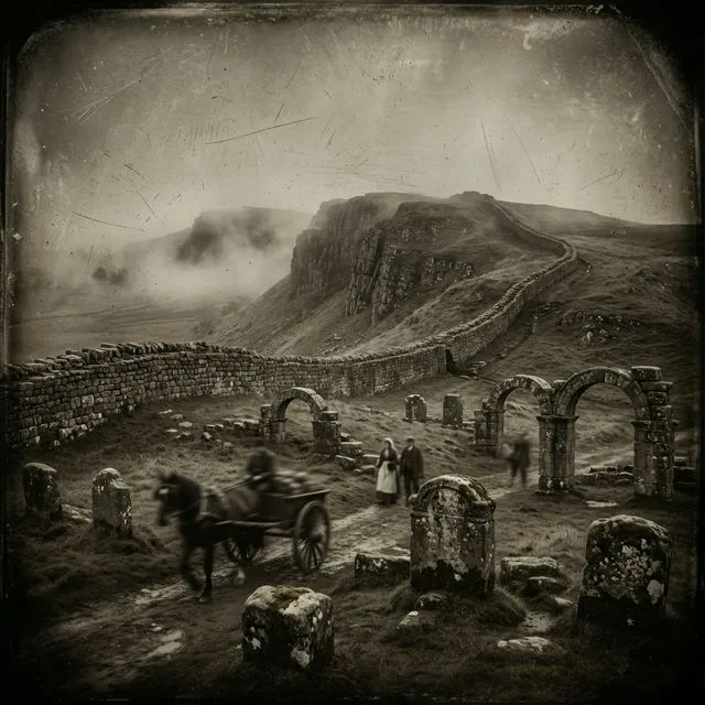
The result was Hadrian’s Wall: 73 miles of stone and turf slashed across the narrowest point of northern England, from Wallsend on the River Tyne to Bowness-on-Solway on the Irish Sea. It remains the largest Roman monument in Britain, and one of the best-preserved frontiers of the entire Roman Empire. In 1987 it was designated a UNESCO World Heritage Site.
Why Did Hadrian Build the Wall?
The wall was not built because Rome was losing. It was built because Hadrian had decided that endless expansion was not sustainable.
His predecessor Trajan had pushed the empire to its greatest geographical extent – Mesopotamia, Dacia, Arabia. But each new province required garrisons, roads, administrators, and money. Hadrian, who spent much of his reign travelling the empire’s frontiers, took a different view. He wanted defined, defensible borders, not open-ended commitments in hostile territory.
Britain presented a particular problem. The legions had been pushing into Caledonia (modern Scotland) for decades, suffering punishing guerrilla warfare from the Pictish tribes with little territorial gain to show for it. Gnaeus Julius Agricola had reached the Highlands in the 80s AD; by Hadrian’s time, Rome had retreated to roughly the Tyne–Solway line anyway. The wall would simply make that reality permanent and defensible.
The ancient sources record Hadrian’s instruction: to build a wall “to separate the Romans from the barbarians.” The phrase is telling. It describes the wall as a boundary between two worlds, not merely a military fortification.
Construction: Who Built It and How Long Did It Take?
Construction began around AD 122 and took roughly six years to complete. The workforce was the Roman army itself – three legions stationed in Britain carried out the work: the Legio II Augusta based at Caerleon, the Legio VI Victrix at York, and the Legio XX Valeria Victrix at Chester. Each century (a unit of around 80 men) was responsible for a specific stretch; some distance slabs marking their work survive to this day.
The original plan called for a wall ten Roman feet wide and perhaps fifteen feet high, built of dressed stone. In practice, the specification was revised downward during construction – the western sections were narrowed to eight feet, and a substantial length in the west was built in turf rather than stone, later replaced with stone after the garrison was established.
The total volume of stone quarried and moved was extraordinary. Contemporary estimates put it at around one million cubic metres of material. Everything was cut locally: the distinctive Cumbrian red sandstone in the west, the harder carboniferous limestone and whinstone of the central section along the Whin Sill escarpment, where the crags provided natural defensive advantage and some of the wall’s most dramatic scenery.
The Structure: More Than a Wall
Hadrian’s Wall was not simply a barrier. It was an integrated military and administrative system.
The Wall Itself
At its maximum, the stone wall stood approximately 15–20 Roman feet high (roughly 4.5–6 metres), topped with a parapet walk and crenellations. The core was rubble and clay; the faces were dressed stone. In the central section, the wall was built directly onto the Whin Sill – a dramatic volcanic outcrop whose northern face drops sheer for dozens of feet, making the wall here almost redundant as a defensive barrier and wholly spectacular as a statement of power.
Milecastles
Every Roman mile along the wall stood a milecastle: a small fortlet roughly 50 by 60 feet, housing a garrison of between eight and thirty-two soldiers. There were 80 milecastles in total. Their primary function was to control passage through the wall – each had a gate on the north face through which people, animals, and trade goods could pass under inspection. They also served as barracks, signalling posts, and supply points.
Turrets
Between each pair of milecastles stood two turrets, placed at intervals of roughly a third of a Roman mile. These were observation towers, roughly 14 feet square, projecting from the north face of the wall. A soldier on watch could signal along the wall to the nearest milecastle or fort using fire or smoke.
The Forts
Sixteen full-scale auxiliary forts were built directly onto or just behind the wall, each housing a garrison of 500 to 1,000 soldiers. Among the most important were:
- Housesteads (Vercovicium) – the most complete Roman fort visible in Britain, perched on the Whin Sill with sweeping views north
- Chesters (Cilurnum) – a cavalry fort beside the River North Tyne, with the best-preserved Roman bathhouse in Britain
- Vindolanda (Chesterholm) – slightly south of the wall, pre-dating it, and the source of the famous Vindolanda writing tablets
- Birdoswald (Banna) – the best-preserved fort on the western section, guarding a key crossing of the Irthing gorge
- South Shields (Arbeia) – the eastern supply base at the mouth of the Tyne
The Vallum
South of the wall, running roughly parallel to it for most of its length, was a feature unique to Hadrian’s frontier: the Vallum. This was a flat-bottomed ditch roughly ten feet deep and twenty feet wide, with earthen mounds thrown up on both sides. It defined the southern boundary of the military zone – a kind of restricted area extending between the two features.
The Vallum’s purpose has been debated for centuries. The most persuasive explanation is administrative: it prevented civilians, merchants, and locals from approaching the wall from behind, ensuring that all contact with the north happened through officially controlled crossing points.
Who Garrisoned the Wall?
The wall was never garrisoned by Roman citizens or Italian legionaries. It was held by auxiliary units – soldiers recruited from across the empire, who served 25 years and received Roman citizenship on discharge.
The inscriptions and documents from wall forts record a remarkable diversity: Tungrians from what is now Belgium, Batavians from the Rhine delta, Dacians from Romania, Hamian archers from Syria, Asturians from northern Spain. Some units were cavalry, some infantry. Many had been garrisoning the wall for generations, their families settled in the civilian settlements (vici) that grew up around each fort.
The Vindolanda tablets – thin slivers of wood used as writing paper, preserved for 1,900 years in the anaerobic soil of the fort’s rubbish heap – give an extraordinary glimpse of life on the wall in the early second century. Among them: a soldier’s complaint about a shortage of beer, a birthday party invitation from one officer’s wife to another, a request for more socks (“I have sent you… pairs of socks”), a report noting that the local Britons, contemptuously called Brittunculi (“little Britons”), had no cavalry and fought without armour.
The Wall After Rome
The Roman army withdrew from Britain in stages during the early fifth century, and the wall’s organised military use ended around AD 410. What followed was not sudden abandonment but slow dissolution.
The forts became the nuclei of early medieval communities. The walls were quarried for centuries – medieval churches, farmhouses, and field boundaries along the wall’s length are built with dressed Roman stone. The market town of Hexham grew up around an abbey founded on the site of the Roman supply base; its crypt is built from Roman stones still bearing inscriptions.
The most systematic destruction came in the eighteenth century, when General George Wade constructed a military road after the 1745 Jacobite uprising, using the wall as its foundation. Several miles of the best-preserved eastern section were simply buried or demolished for road metal.
How to Visit Hadrian’s Wall Today
The wall runs for 73 miles from Wallsend (now a suburb of Newcastle) west to Bowness-on-Solway in Cumbria. The Hadrian’s Wall Path National Trail follows the full length and can be walked in five to nine days.
Key sites open to the public:
Housesteads Roman Fort (near Bardon Mill, Northumberland) – the most complete fort on the wall, run by English Heritage. The setting on the Whin Sill is dramatic; the remains include the barracks, headquarters building, commanding officer’s house, and the famous latrina (communal latrine). Nearby, the wall stretches east and west in some of its most intact and photographed stretches, including the section above Crag Lough where the Sycamore Gap tree stood until its destruction in 2023.
Vindolanda (near Bardon Mill) – independently run by the Vindolanda Trust, the fort continues to produce extraordinary finds. Active excavations run each season. The on-site museum holds the tablets alongside armour, shoes, tools, and the personal belongings of the soldiers and civilians who lived here.
Chesters Roman Fort (near Chollerford) – the best-preserved cavalry fort on the wall, with a museum holding one of the finest collections of Roman inscriptions in Britain. The bathhouse beside the North Tyne is exceptional.
Birdoswald Roman Fort (near Brampton, Cumbria) – the western anchor of the dramatic central section. English Heritage runs the site; the granaries are among the most substantial Roman structures surviving above ground in Britain.
The Roman Army Museum (Greenhead) – purpose-built museum with immersive displays on life in the auxiliary army, adjacent to the wall at Walltown Crags.
The wall is most dramatic in the central section between Chollerford and Greenhead, where it follows the Whin Sill and the landscape is wild and largely unchanged since Roman times. Much of the eastern section through the Newcastle suburbs is buried or fragmentary, though significant stretches survive in places including Benwell and Wallsend, where Segedunum fort has been substantially excavated and interpreted.
Key Facts
- Built: AD 122–128
- Length: 73 miles (80 Roman miles, 117 km)
- Builders: Legio II Augusta, Legio VI Victrix, Legio XX Valeria Victrix
- Eastern terminus: Wallsend (Segedunum), Tyne and Wear
- Western terminus: Bowness-on-Solway, Cumbria
- Forts: 16 full auxiliary forts
- Milecastles: 80
- Turrets: approximately 160
- Garrison at peak: estimated 9,000–10,000 auxiliary soldiers
- UNESCO designation: 1987 (as part of Frontiers of the Roman Empire)
References & Further Reading
- Breeze, David J. Hadrian’s Wall (English Heritage, 2006)
- Bidwell, Paul (ed.) Hadrian’s Wall 1989–1999 (Cumberland and Westmorland Antiquarian and Archaeological Society, 1999)
- Birley, Robin. Vindolanda: Everyday Life on Rome’s Northern Frontier (2009)
- English Heritage: english-heritage.org.uk/hadrianswall
- Hadrian’s Wall Path National Trail: nationaltrail.co.uk/en_GB/trails/hadrians-wall-path/