Wykeham in the Domesday Book (1086)
Wykeham appears in the Domesday Book of 1086, entered under the hundred of Dic in Yorkshire.
Other Settlements in Dic
- Aislaby
- Allerston
- Appleton [le Moors]
- Aschelesmersc
- Aschilesmares
- Barton [le Street]
- Baschebi
- Baschesbi
- Brompton
- Burniston
- Burton [Dale]
- Cawthorn
- Cayton
- Chigogemers
The Meaning of the Name
The name Wykeham is of Anglo-Saxon origin. Its final element derives from the Old English word hām, a homestead or village. The first element is most likely a personal name or an early descriptive term, now difficult to recover with certainty. Taken together the name probably meant something close to ‘a homestead’.
Remarkably, the name has changed little since 1086, when the Domesday scribes wrote it as Wykeham.
Listed Buildings Near Wykeham
Historic England records 40 listed buildings within about a mile of Wykeham. Listing protects structures of special architectural or historic interest, graded I (exceptional), II* (particularly important) and II.
Grade II*
- All Saints Church - 0.15 km
Grade II
- North House and Attached Outbuildings - 0.03 km
- Icehouse Approximately 15 Metres North of All Saints Church - 0.14 km
- School and Attached School House - 0.17 km
- Church Lychgate - 0.19 km
- Hill Farmhouse - 0.19 km
- Bridge - 0.2 km
- 40 and 41, Wykeham Village - 0.21 km
- The Downe Arms - 0.22 km
- Lora Cottages - 0.28 km
- 23 and 24, Wykeham Village - 0.4 km
- Gates, Railings and Four Gate Piers - 0.61 km
- West End Farmhouse - 0.64 km
- Yew Grange and Attached Outbuilding - 0.65 km
- Abbots Meadow - 0.68 km
- 52, Ruston Village - 0.69 km
- Butterfield Cottages and Attached Outbuilding - 0.7 km
- West Hill and Attached Outbuilding - 0.75 km
- Lora Terrace - 0.77 km
- Martin Garth - 0.78 km
- Ruston Lodge - 0.81 km
- Number 46 and Attached Outbuilding - 0.82 km
- Number 65 and Attached Outbuildings - 0.85 km
- Manor Farmhouse and Manor Farm Cottage - 0.85 km
…and 16 more listed structures in the area.
Wykeham Today
Today Wykeham lies within the administrative area of Scarborough, and the settlement recorded a population of 269 at the 2021 census. Nine and a half centuries separate that figure from the small rural community the Domesday survey recorded here in 1086.
Read more about modern Wykeham on Wikipedia .
Nearby Domesday Settlements
Other places recorded in the 1086 survey within a few miles:
- Ruston - 1.0 km W
- Martin Garth - 1.0 km N
- Hutton Buscel - 1.4 km NE
- Preston Hill - 1.4 km NE
- Newton - 2.2 km NE
- West Ayton - 2.2 km NE
Heritage Around Wykeham
Photographs of churches, listed buildings and monuments in the vicinity, contributed by volunteers to the Geograph project and reused here under a Creative Commons licence.
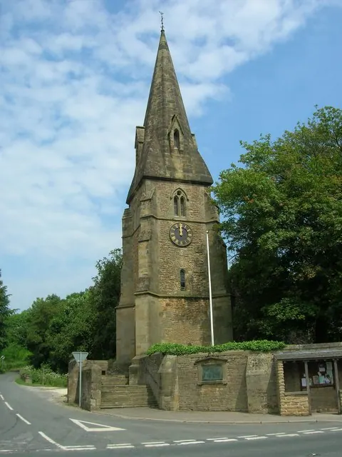
© JThomas · Geograph · CC BY-SA 2.0
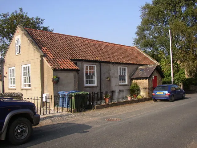
© Humphrey Bolton · Geograph · CC BY-SA 2.0
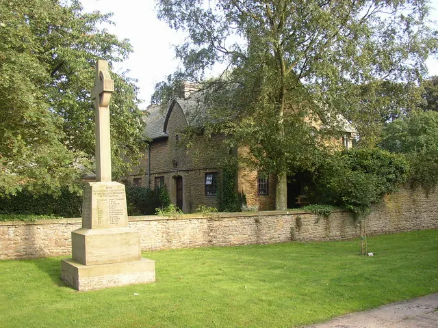
© Humphrey Bolton · Geograph · CC BY-SA 2.0
Images © their respective photographers, licensed under CC BY-SA 2.0 and reused here with attribution. Photographs depict listed buildings, churches and monuments near this settlement and may show neighbouring villages.
Data derived from the Open Domesday project (opendomesday.org), based on the Domesday Book dataset compiled by Professor J.J.N. Palmer and team. The Domesday Book (1086) is in the public domain.
Found an inaccuracy? [email protected]