Wold Newton in the Domesday Book (1086)
Wold Newton is named in the Domesday Book, compiled by Norman commissioners in 1086, entered under the hundred of Torbar in Yorkshire. The survey assessed Wold Newton at 8 carucates of taxable land.
At the time of the survey, Wold Newton supported a recorded population of 6 villagers, 1 smallholder, working 6 ploughs between them.
Something went badly wrong here between the two surveys. Before 1066, Wold Newton was worth 6 shillings; by 1086 that had dropped to 5.11 shillings – a fall of 14%. Most Yorkshire villages that lost value on this scale were swept up in the Harrying of the North – William’s scorched-earth campaign of 1069–70.
Resources Recorded at Wold Newton (1086)
- Meadow: 6 ploughs
- Woodland: 100 pigs
Other Settlements in Torbar
- Argam
- Brigham
- Burton [Fleming]
- Elestolf
- Elmswell
- Estolf
- Folkton
- Fordon
- Foston [on the Wolds]
- Garton [on the Wolds]
- Gembling
- Hunmanby
- Ledemare
- Muston
The Meaning of the Name
The name Wold Newton is of Anglo-Saxon origin. Its final element derives from the Old English word tūn, a farmstead or village, while the first element appears to represent the new. Taken together the name probably meant something close to ’the new farmstead’.
Remarkably, the name has changed little since 1086, when the Domesday scribes wrote it as Wold Newton.
Listed Buildings Near Wold Newton
Historic England records 10 listed buildings within about a mile of Wold Newton. Listing protects structures of special architectural or historic interest, graded I (exceptional), II* (particularly important) and II.
Grade II*
- Church of All Saints - 0.35 km
Grade II
- Old Hall Farmhouse - 0.24 km
- Wesleyan Chapel - 0.28 km
- The Old Vicarage - 0.39 km
- The Hollies - 0.41 km
- Wold Newton Hall - 0.43 km
- Pear Tree Farmhouse - 0.5 km
- The Anvil Arms Public House and Cottage Adjoining to Left - 0.54 km
- K6 Telephone Kiosk - 0.55 km
- The Wold Cottage - 1.24 km
Scheduled Monuments Near Wold Newton
Scheduled monuments are nationally important archaeological sites given legal protection. 3 lie within roughly a mile of Wold Newton:
- Bowl barrow and archery butt 230m south of Wold Newton church - 0.58 km
- Bowl barrow and archery butt 231m south-west of Wold Newton Church - 0.6 km
- Bowl barrow 130m south-east of Bridge Farm - 0.89 km
Wold Newton Today
Today Wold Newton lies within the administrative area of East Riding of Yorkshire, and the settlement recorded a population of 317 at the 2021 census. Nine and a half centuries separate that figure from the small rural community the Domesday survey recorded here in 1086.
Read more about modern Wold Newton on Wikipedia .
Nearby Domesday Settlements
Other places recorded in the 1086 survey within a few miles:
Heritage Around [Wold] Newton
Photographs of churches, listed buildings and monuments in the vicinity, contributed by volunteers to the Geograph project and reused here under a Creative Commons licence.
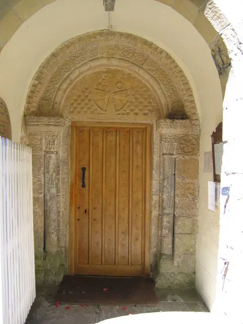
© Stephen Horncastle · Geograph · CC BY-SA 2.0
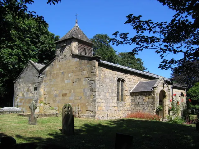
© Stephen Horncastle · Geograph · CC BY-SA 2.0
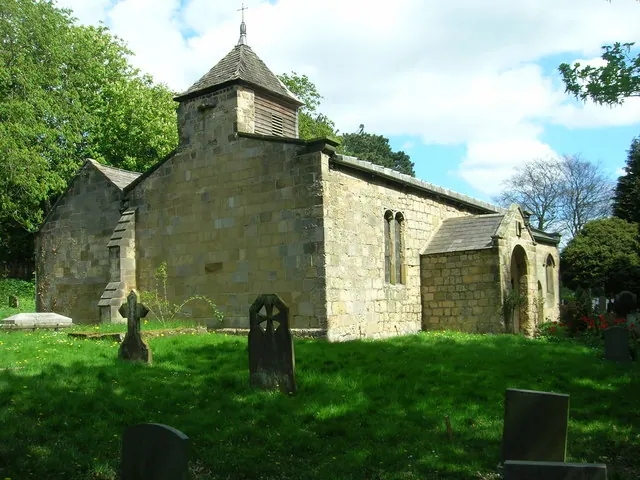
© JThomas · Geograph · CC BY-SA 2.0
Images © their respective photographers, licensed under CC BY-SA 2.0 and reused here with attribution. Photographs depict listed buildings, churches and monuments near this settlement and may show neighbouring villages.
Data derived from the Open Domesday project (opendomesday.org), based on the Domesday Book dataset compiled by Professor J.J.N. Palmer and team. The Domesday Book (1086) is in the public domain.
Found an inaccuracy? [email protected]