Winestead in the Domesday Book (1086)
The settlement of Winestead is recorded in William I’s Domesday survey of 1086, entered under the hundred of Holderness [South Hundred] in Yorkshire.
Other Settlements in Holderness [South Hundred]
- Andrebi
- Burstwick
- Camerton [Hall]
- Dimlington
- Easington
- Grimston
- Halsham
- Hilston
- Hollym
- Holmpton
- Keyingham
- Kilnsea
- Monkwith
- Newton [Garth]
The Meaning of the Name
The name Winestead is of Anglo-Saxon origin. Its final element derives from the Old English word stede, a place or site. The first element is most likely a personal name or an early descriptive term, now difficult to recover with certainty. Taken together the name probably meant something close to ‘a site’.
Remarkably, the name has changed little since 1086, when the Domesday scribes wrote it as Winestead.
Listed Buildings Near Winestead
Historic England records 11 listed buildings within about a mile of Winestead. Listing protects structures of special architectural or historic interest, graded I (exceptional), II* (particularly important) and II.
Grade I
- Church of St Germain - 0.37 km
Grade II*
- The White Hall - 0.47 km
Grade II
- Column-base Approximately 2 Metres South of Chancel of Church of St Germain - 0.36 km
- Enholmes Brick and Tile Works - 0.38 km
- Stable/coach House Range at the White Hall - 0.51 km
- Urn Approximately 40 Metres West of the Old Rectory - 0.72 km
- The Old Rectory and Coach-house Adjoining to East - 0.75 km
- Pair of Urns Flanking Path Approximately 40 Metres North of the Old Rectory - 0.8 km
- Urn Approximately 40 Metres North of the Old Rectory - 0.81 km
- Winestead Grange Farmhouse - 0.83 km
- Milestone Approximately 30 Metres North West of Junction With Winestead Ings Lane - 0.88 km
Scheduled Monuments Near Winestead
Scheduled monuments are nationally important archaeological sites given legal protection. 1 lies within roughly a mile of Winestead:
- Winestead Manor moated site - 0.32 km
Winestead Today
Today Winestead lies within the administrative area of Patrington.
Read more about modern Winestead on Wikipedia .
Nearby Domesday Settlements
Other places recorded in the 1086 survey within a few miles:
- Patrington - 2.2 km SE
- Ottringham - 3.2 km W
- Great and Little Newsome - 3.2 km N
- Thorpe Hill - 3.6 km SE
- Halsham - 3.6 km NW
- Hollym - 5.4 km E
Heritage Around Winestead
Photographs of churches, listed buildings and monuments in the vicinity, contributed by volunteers to the Geograph project and reused here under a Creative Commons licence.
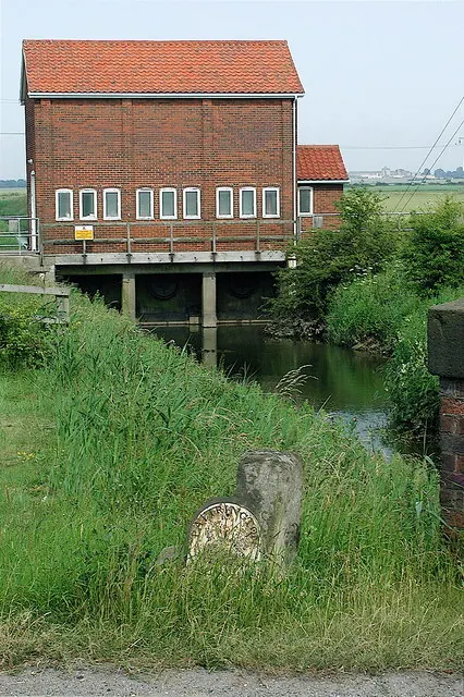
© Paul Glazzard · Geograph · CC BY-SA 2.0
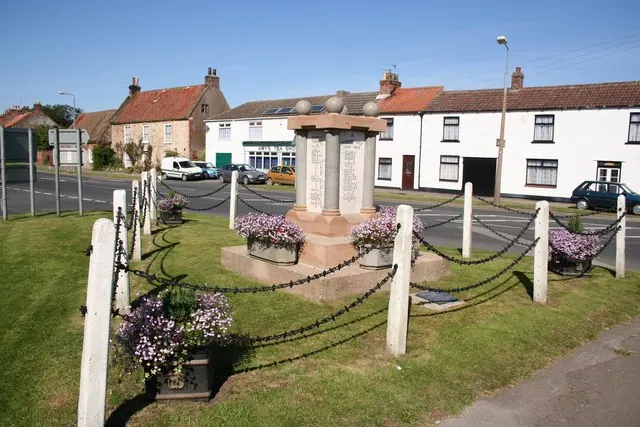
© Richard Croft · Geograph · CC BY-SA 2.0
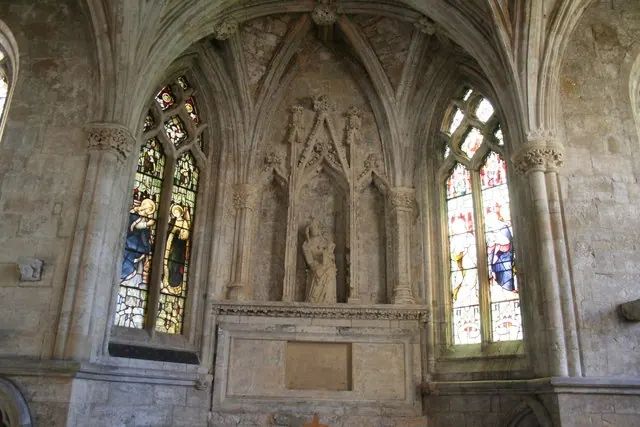
© Richard Croft · Geograph · CC BY-SA 2.0
Images © their respective photographers, licensed under CC BY-SA 2.0 and reused here with attribution. Photographs depict listed buildings, churches and monuments near this settlement and may show neighbouring villages.
Location
53.6916°N, -0.0386°W · Holderness [South Hundred] hundred, Yorkshire
View larger map on OpenStreetMap →Data derived from the Open Domesday project (opendomesday.org), based on the Domesday Book dataset compiled by Professor J.J.N. Palmer and team. The Domesday Book (1086) is in the public domain.
Found an inaccuracy? [email protected]