Whorlton in the Domesday Book (1086)
Whorlton appears in the Domesday Book of 1086, entered under the hundred of Langbaurgh in Yorkshire.
Other Settlements in Langbaurgh
- Acklam
- Airy [Holme]
- Aislaby
- Arnodestorp
- Baldebi
- Barnaby
- Barwick
- Battersby
- Bergolbi
- Berguluesbi
- Blaten [Carr]
- Borrowby
- Breck
- Brotton
The Meaning of the Name
The name Whorlton is of Anglo-Saxon origin. Its final element derives from the Old English word tūn, a farmstead or village. The first element is most likely a personal name or an early descriptive term, now difficult to recover with certainty. Taken together the name probably meant something close to ‘a farmstead’.
Remarkably, the name has changed little since 1086, when the Domesday scribes wrote it as Whorlton.
Listed Buildings Near Whorlton
Historic England records 16 listed buildings within about a mile of Whorlton. Listing protects structures of special architectural or historic interest, graded I (exceptional), II* (particularly important) and II.
Grade I
- Old Church of Holy Rood - 0.28 km
- Whorlton Castle Gatehouse - 0.48 km
Grade II*
- Ruins of Whorlton Castle Undercrofts - 0.51 km
Grade II
- Former Whorlton Memorial School and Schoolmaster’s House - 0.88 km
- Church Farmhouse - 0.89 km
- Church of Holy Cross - 0.94 km
- Middle Bridge - 0.97 km
- 118, High Street - 0.98 km
- Rivington - 1.0 km
- Pinfold to South of Maynard Bridge - 1.0 km
- Gates, Piers and Overthrow to South of Church of St Mary Magdalene - 1.08 km
- Church of St Mary Magdalene - 1.09 km
- Gate and Piers to South East of Church of St Mary Magdalene - 1.1 km
- Meadowfield Attached Outhouse - 1.22 km
- Fir Tree House and Attached Stable - 1.22 km
- Faceby House - 1.23 km
Scheduled Monuments Near Whorlton
Scheduled monuments are nationally important archaeological sites given legal protection. 2 lie within roughly a mile of Whorlton:
- Whorlton Castle: a motte and bailey and tower house with associated garden, earthworks, ponds, park pale, field system, deserted village and church - 0.32 km
- Promontory fort on Live Moor - 1.57 km
Whorlton Today
Today Whorlton lies within the administrative area of Hambleton, and the settlement recorded a population of 562 at the 2021 census. Nine and a half centuries separate that figure from the small rural community the Domesday survey recorded here in 1086.
Read more about modern Whorlton on Wikipedia .
Nearby Domesday Settlements
Other places recorded in the 1086 survey within a few miles:
- Faceby - 1.4 km NE
- Goulton Grange - 2.2 km NW
- Carlton - 2.8 km NE
- Little Busby - 3.6 km NE
- Arncliffe Hall - 3.6 km SW
- Rudby - 4.1 km N
Heritage Around Whorlton
Photographs of churches, listed buildings and monuments in the vicinity, contributed by volunteers to the Geograph project and reused here under a Creative Commons licence.
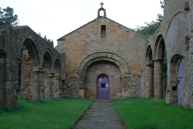
© Mick Garratt · Geograph · CC BY-SA 2.0
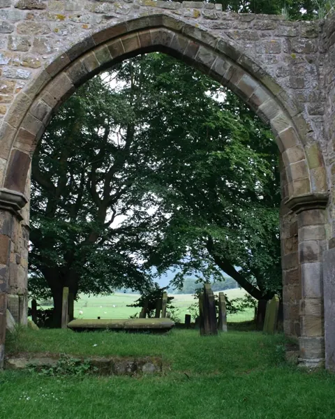
© Mick Garratt · Geograph · CC BY-SA 2.0
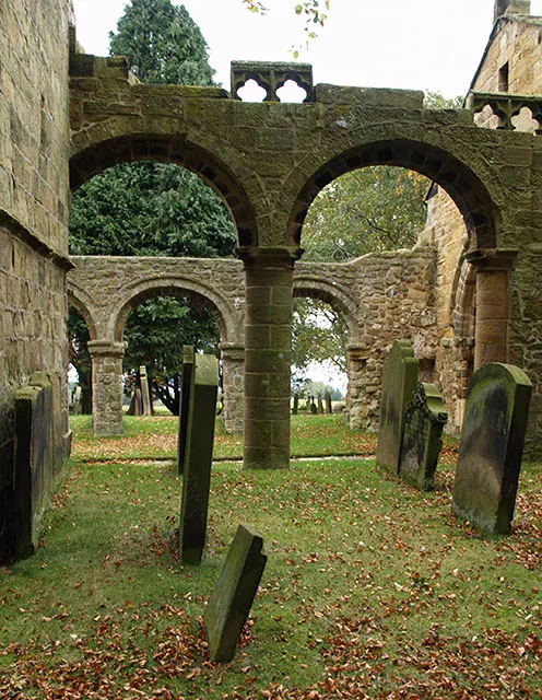
© Stephen McCulloch · Geograph · CC BY-SA 2.0
Images © their respective photographers, licensed under CC BY-SA 2.0 and reused here with attribution. Photographs depict listed buildings, churches and monuments near this settlement and may show neighbouring villages.
Data derived from the Open Domesday project (opendomesday.org), based on the Domesday Book dataset compiled by Professor J.J.N. Palmer and team. The Domesday Book (1086) is in the public domain.
Found an inaccuracy? [email protected]