Whiston in the Domesday Book (1086)
The 1086 Domesday survey records the settlement of Whiston, entered under the hundred of Strafforth in Yorkshire.
Other Settlements in Strafforth
- Adwick [le Street]
- Adwick [upon Dearne]
- Armthorpe
- Aston
- Attercliffe
- Auckley
- Aughton [Hall]
- Austerfield
- Balby
- Barnbrough
- Barnby [Dun]
- Bentley
- Bilham [House]
- Billingley
The Meaning of the Name
The name Whiston is of Anglo-Saxon origin. Its final element derives from the Old English word tūn, a farmstead or village. The first element is most likely a personal name or an early descriptive term, now difficult to recover with certainty. Taken together the name probably meant something close to ‘a farmstead’.
Remarkably, the name has changed little since 1086, when the Domesday scribes wrote it as Whiston.
Listed Buildings Near Whiston
Historic England records 11 listed buildings within about a mile of Whiston. Listing protects structures of special architectural or historic interest, graded I (exceptional), II* (particularly important) and II.
Grade II*
- Whiston Hall Barn - 0.43 km
- Church of St Mary Magdalene - 0.67 km
Grade II
- Newman School - 0.15 km
- Milepost in Front of no 229 - 0.33 km
- Whiston Hall - 0.39 km
- Stable and Granary Immediately to South of Whiston Hall - 0.4 km
- Milepost Approximately 125 Metres South-west of Junction With Moorgate Road - 0.46 km
- Village Stocks Approximately 15 Metres to West of Tower of Church of St Mary Magdalene - 0.65 km
- Headstone to Rebekah Cutt Approximately 11 Metres to West of Tower of Church of St Mary Magdalene* - 0.66 km
- Swinden House - 0.75 km
- Oakwood Hall Including Balustraded Retaining Wall Attached to Portico - 1.09 km
Scheduled Monuments Near Whiston
Scheduled monuments are nationally important archaeological sites given legal protection. 2 lie within roughly a mile of Whiston:
- Blue Man’s Bower moated site, Whiston - 1.15 km
- Canklow Hill earthworks - 1.23 km
Whiston Today
Today Whiston lies within the administrative area of Rotherham, and the settlement recorded a population of 4,858 at the 2021 census. Nine and a half centuries separate that figure from the small rural community the Domesday survey recorded here in 1086.
Read more about modern Whiston on Wikipedia .
Nearby Domesday Settlements
Other places recorded in the 1086 survey within a few miles:
- Rotherham - 2.2 km NW
- Wickersley - 3.2 km E
- Brinsworth - 3.2 km W
- Treeton - 3.2 km S
- Ulley - 3.6 km SE
- Tinsley - 4.0 km W
Heritage Around Whiston
Photographs of churches, listed buildings and monuments in the vicinity, contributed by volunteers to the Geograph project and reused here under a Creative Commons licence.
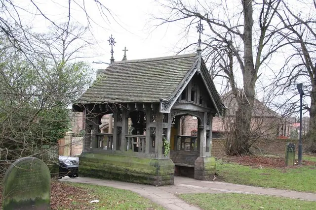
© Richard Croft · Geograph · CC BY-SA 2.0
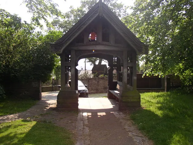
© Dave Thackery · Geograph · CC BY-SA 2.0
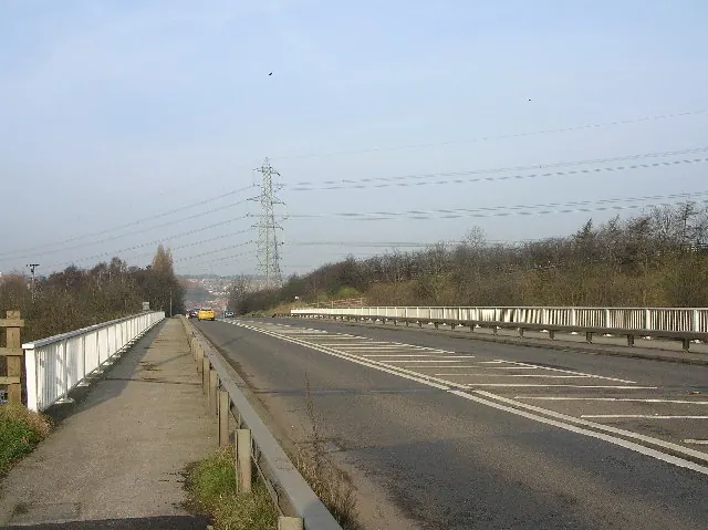
© Andrew Loughran · Geograph · CC BY-SA 2.0
Images © their respective photographers, licensed under CC BY-SA 2.0 and reused here with attribution. Photographs depict listed buildings, churches and monuments near this settlement and may show neighbouring villages.
Data derived from the Open Domesday project (opendomesday.org), based on the Domesday Book dataset compiled by Professor J.J.N. Palmer and team. The Domesday Book (1086) is in the public domain.
Found an inaccuracy? [email protected]