Whipley Hall in the Domesday Book (1086)
The settlement of Whipley Hall is recorded in William I’s Domesday survey of 1086, entered under the hundred of Burghshire in Yorkshire.
Other Settlements in Burghshire
- Addlethorpe
- Aismunderby
- Aldfield
- Allerton [Mauleverer]
- Arkendale
- Askwith
- Azerley
- Barrowby [Grange]
- Beckwith [House]
- Besthaim
- Bestham
- Bewerley
- Bilton
- Birstwith
The Meaning of the Name
The name Whipley Hall is of Anglo-Saxon origin. Its final element derives from the Old English word lēah, a woodland clearing or glade. The first element is most likely a personal name or an early descriptive term, now difficult to recover with certainty. Taken together the name probably meant something close to ‘a clearing’.
Remarkably, the name has changed little since 1086, when the Domesday scribes wrote it as Whipley Hall.
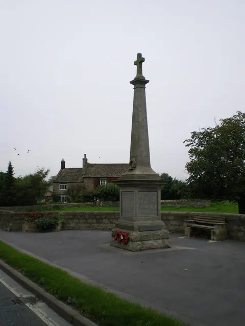
Listed Buildings Near Whipley Hall
Historic England records 6 listed buildings within about a mile of Whipley Hall. Listing protects structures of special architectural or historic interest, graded I (exceptional), II* (particularly important) and II.
Grade II
- Whipley Hall - 0.51 km
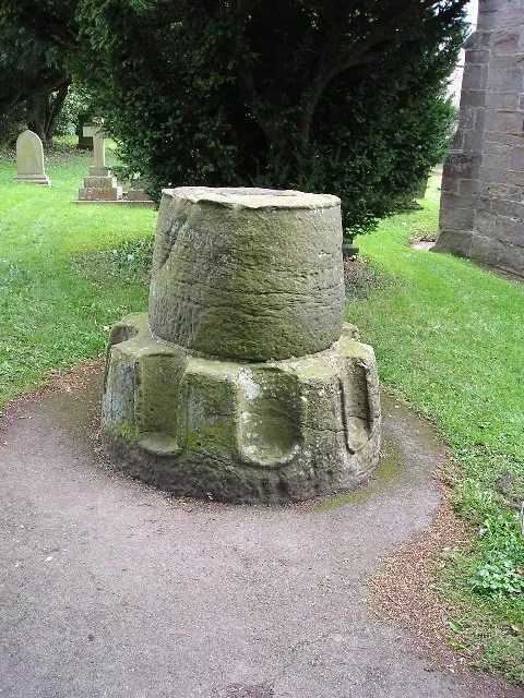
- Medieval Cross Base and Shaft Approximately 200 Metres South East of High Rails Farmhouse - 0.56 km
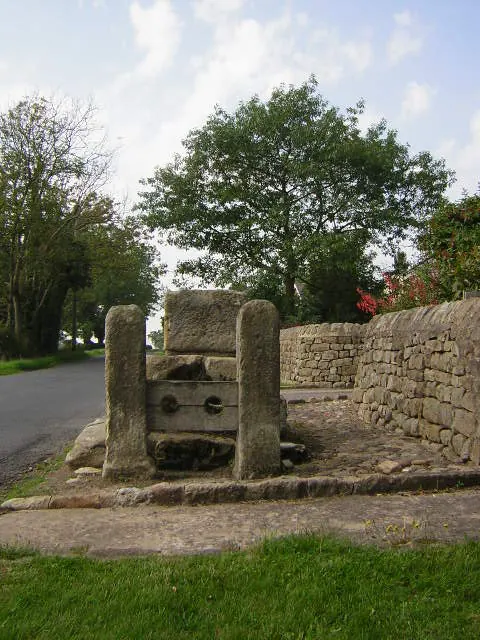
- Cross Base and Stocks - 0.83 km
- Rose Cottage - 1.06 km
- Deer Shed Approximately 400 Metres West of Ripley Lake Outlet - 1.17 km
- Rose Lea Farmhouse and Attached Barn - 1.24 km
Scheduled Monuments Near Whipley Hall
Scheduled monuments are nationally important archaeological sites given legal protection. 1 lies within roughly a mile of Whipley Hall:
- Ripley Park cross - 0.56 km
Nearby Domesday Settlements
Other places recorded in the 1086 survey within a few miles:
- Ripley - 2.0 km E
- Killinghall - 2.8 km SE
- Bishop Thornton - 3.0 km N
- Birstwith - 3.2 km W
- Rowden - 3.2 km S
- Nidd - 4.0 km E
Heritage Around Whipley [Hall]
Photographs of churches, listed buildings and monuments in the vicinity, contributed by volunteers to the Geograph project and reused here under a Creative Commons licence.
© Richard Swales · Geograph · CC BY-SA 2.0
© Richard Law · Geograph · CC BY-SA 2.0
© manonabike · Geograph · CC BY-SA 2.0
Images © their respective photographers, licensed under CC BY-SA 2.0 and reused here with attribution. Photographs depict listed buildings, churches and monuments near this settlement and may show neighbouring villages.
Data derived from the Open Domesday project (opendomesday.org), based on the Domesday Book dataset compiled by Professor J.J.N. Palmer and team. The Domesday Book (1086) is in the public domain.
Found an inaccuracy? [email protected]