Whalley in the Domesday Book (1086)
Whalley is named in the Domesday Book, compiled by Norman commissioners in 1086, entered under the hundred of Blackburn in Cheshire.
Other Settlements in Blackburn
- Bardwell
- Barnham
- Barningham
- Blackburn
- Coney Weston
- Culford
- Elmswell
- Euston
- Hepworth
- Hinderclay
- Honington
- Hopton
- Huncoat
- Hunston
The Meaning of the Name
The name Whalley is of Anglo-Saxon origin. Its final element derives from the Old English word lēah, a woodland clearing or glade. The first element is most likely a personal name or an early descriptive term, now difficult to recover with certainty. Taken together the name probably meant something close to ‘a clearing’.
Remarkably, the name has changed little since 1086, when the Domesday scribes wrote it as Whalley.
Listed Buildings Near Whalley
Historic England records 30 listed buildings within about a mile of Whalley. Listing protects structures of special architectural or historic interest, graded I (exceptional), II* (particularly important) and II.
Grade I
- Church of St Mary and All Saints - 0.45 km
- Whalley Abbey - 0.59 km
Grade II*
- Sands Cottage - 0.67 km
Grade II
- War Memorial - 0.25 km
- 82, King Street - 0.26 km
- Old Grammar School - 0.26 km
- Swan Hotel - 0.38 km
- Former Whalley Arms - 0.41 km
- Sundial East of Church of St Mary and All Saints - 0.43 km
- 10-13, Church Lane - 0.44 km
- 14 and 15, Church Lane - 0.45 km
- 16, Church Lane - 0.46 km
- 33 and 35, King Street - 0.47 km
- Poole House - 0.48 km
- 1, 2 and 3, Poole End - 0.48 km
- 2, 3 and 4, The Square, Whalley - 0.49 km
- 20 and 22, King Street - 0.51 km
- Abbey Corn Mill - 0.56 km
- Pair of Gatepiers at Entrance to Whalley Abbey Grounds Adjacent to No. 1A - 0.59 km
- Lodge at Entrance to Whalley Abbey Grounds - 0.6 km
- Abbey Presbytery - 0.67 km
- Calder Cottage the Marjorie - 0.69 km
- 10-18, Terrace Row - 0.7 km
- 1, 2 and 3 Abbeycroft - 0.74 km
…and 6 more listed structures in the area.
Scheduled Monuments Near Whalley
Scheduled monuments are nationally important archaeological sites given legal protection. 4 lie within roughly a mile of Whalley:
- Three high crosses in St Mary’s churchyard - 0.46 km
- Whalley Bridge - 0.65 km
- Whalley Cistercian abbey - 0.65 km
- Portfield hillfort - 1.37 km
Whalley Today
Today Whalley lies within the administrative area of Ribble Valley, and the settlement recorded a population of 4,052 at the 2021 census. Nine and a half centuries separate that figure from the small rural community the Domesday survey recorded here in 1086.
Read more about modern Whalley on Wikipedia .
Nearby Domesday Settlements
Other places recorded in the 1086 survey within a few miles:
- Great Mitton - 2.8 km NW
- Pendleton - 3.6 km NE
- Bashall Eaves - 6.3 km N
- Aighton - 6.7 km NW
- Waddington - 7.1 km N
- Huncoat - 7.2 km SE
Heritage Around Whalley
Photographs of churches, listed buildings and monuments in the vicinity, contributed by volunteers to the Geograph project and reused here under a Creative Commons licence.
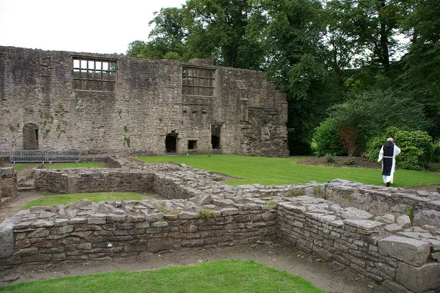
© Alexander P Kapp · Geograph · CC BY-SA 2.0
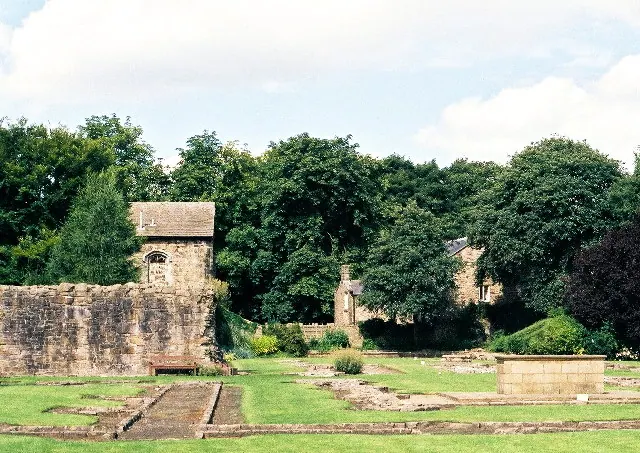
© Mike and Kirsty Grundy · Geograph · CC BY-SA 2.0
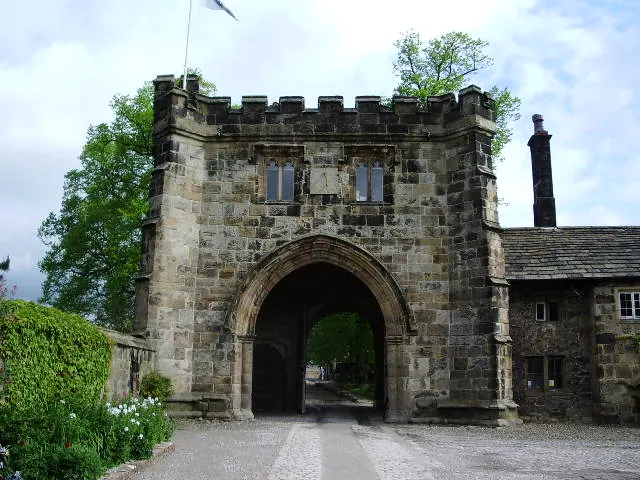
© Alexander P Kapp · Geograph · CC BY-SA 2.0
Images © their respective photographers, licensed under CC BY-SA 2.0 and reused here with attribution. Photographs depict listed buildings, churches and monuments near this settlement and may show neighbouring villages.
Data derived from the Open Domesday project (opendomesday.org), based on the Domesday Book dataset compiled by Professor J.J.N. Palmer and team. The Domesday Book (1086) is in the public domain.
Found an inaccuracy? [email protected]