Weston in the Domesday Book (1086)
Weston appears in the Domesday Book of 1086, entered under the hundred of Burghshire in Yorkshire.
Other Settlements in Burghshire
- Addlethorpe
- Aismunderby
- Aldfield
- Allerton [Mauleverer]
- Arkendale
- Askwith
- Azerley
- Barrowby [Grange]
- Beckwith [House]
- Besthaim
- Bestham
- Bewerley
- Bilton
- Birstwith
The Meaning of the Name
The name Weston is of Anglo-Saxon origin. Its final element derives from the Old English word tūn, a farmstead or village, while the first element appears to represent the western. Taken together the name probably meant something close to ’the western farmstead’.
Remarkably, the name has changed little since 1086, when the Domesday scribes wrote it as Weston.
Listed Buildings Near Weston
Historic England records 26 listed buildings within about a mile of Weston. Listing protects structures of special architectural or historic interest, graded I (exceptional), II* (particularly important) and II.
Grade I
- Banqueting House Approximately 50 Metres East of Weston Hall - 0.78 km
- Weston Hall - 0.79 km
- Church of All Saints - 0.86 km
Grade II*
Grade II
- Hall Farmhouse and Attached Outbuildings - 0.5 km
- Barn Opposite Hall Farmhouse - 0.53 km
- Weston Grange - 0.57 km
- Old Vicarage - 0.7 km
- Ice House Approximately 50 Metres North of Weston Hall - 0.72 km
- Quaker Cottage - 0.73 km
- Outbuildings Approximately 5 Metres North of Weston Hall, and Linking Wall - 0.77 km
- Ibbotson Farmhouse and Attached Barn - 0.81 km
- Table Tomb Approximately 5 Metres South of Church of All Saints - 0.87 km
- Sundial Approximately 5 Metres South of Church of All Saints - 0.87 km
- Group of 3 Table Tombs Approximately 5 Metres East of Church of All Saints - 0.87 km
- Manor House - 1.13 km
- Corn Mill - 1.19 km
- Garden wall to north of Burley Hall - 1.2 km
- Corn Mill Cottage - 1.22 km
- Burley Hall - 1.24 km
- Former Corn Mill Cottage Barn abutting cottage on south side - 1.24 km
- Piers and Gates of entrance to Burley Hall from Corn Mill Lane - 1.26 km
- Former orchard walls to south of Burley Hall - 1.28 km
- Sundial Farmhouse and Attached Barn - 1.28 km
…and 2 more listed structures in the area.
Weston Today
Today Weston lies within the administrative area of Harrogate, and the settlement recorded a population of 193 at the 2021 census. Nine and a half centuries separate that figure from the small rural community the Domesday survey recorded here in 1086.
Read more about modern Weston on Wikipedia .
Nearby Domesday Settlements
Other places recorded in the 1086 survey within a few miles:
Heritage Around Weston
Photographs of churches, listed buildings and monuments in the vicinity, contributed by volunteers to the Geograph project and reused here under a Creative Commons licence.
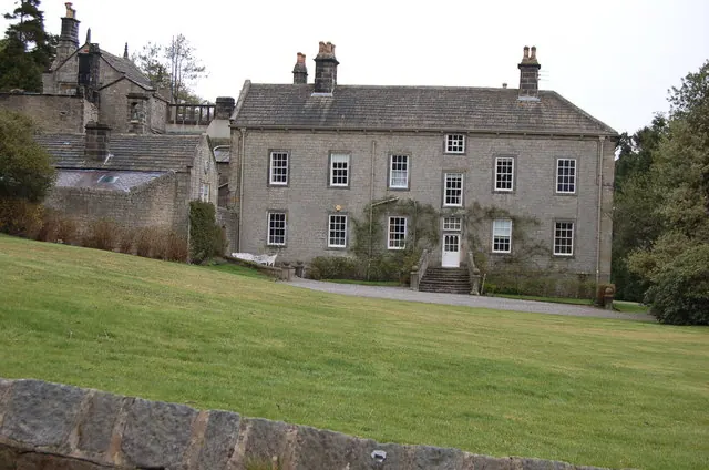
© John Sparshatt · Geograph · CC BY-SA 2.0
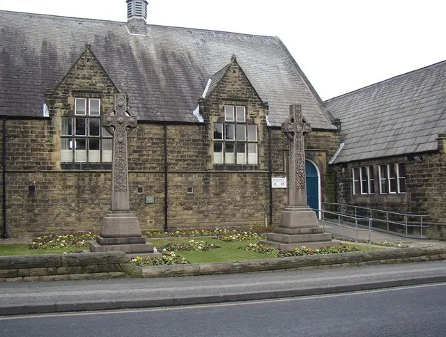
© Humphrey Bolton · Geograph · CC BY-SA 2.0
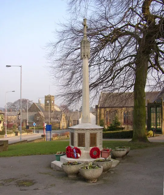
© Humphrey Bolton · Geograph · CC BY-SA 2.0
Images © their respective photographers, licensed under CC BY-SA 2.0 and reused here with attribution. Photographs depict listed buildings, churches and monuments near this settlement and may show neighbouring villages.
Data derived from the Open Domesday project (opendomesday.org), based on the Domesday Book dataset compiled by Professor J.J.N. Palmer and team. The Domesday Book (1086) is in the public domain.
Found an inaccuracy? [email protected]