West Tanfield in the Domesday Book (1086)
West Tanfield is named in the Domesday Book, compiled by Norman commissioners in 1086, entered under the hundred of Land of Count Alan in Yorkshire.
Other Settlements in Land of Count Alan
- Achebi
- Agglethorpe
- Ainderby [Mires]
- Ainderby [Quernhow]
- Aiskew
- Aldbrough
- Allerthorpe [Hall]
- Ascam
- Ascham
- Asebi
- Aske [Hall]
- Askrigg
- Aysgarth
- Baldersby
The Meaning of the Name
The name West Tanfield is of Anglo-Saxon origin. Its final element derives from the Old English word feld, open country. The first element is most likely a personal name or an early descriptive term, now difficult to recover with certainty. Taken together the name probably meant something close to ‘a open land’.
Remarkably, the name has changed little since 1086, when the Domesday scribes wrote it as West Tanfield.
Listed Buildings Near West Tanfield
Historic England records 19 listed buildings within about a mile of West Tanfield. Listing protects structures of special architectural or historic interest, graded I (exceptional), II* (particularly important) and II.
Grade I
- Church of St Nicholas - 0.76 km
- The Marmion Tower - 0.78 km
Grade II
- Old Wesleyan Chapel - 0.47 km
- Stables to the Bruce Arms Inn - 0.65 km
- The Bruce Arms Inn - 0.67 km
- Briar and Jasmine Cottages - 0.7 km
- Sunnyside and Orchard Cottage - 0.7 km
- The Estate House - 0.73 km
- 1-8, Long Row - 0.76 km
- Chantry House and Chantry House Cottage - 0.78 km
- 2, Church Street - 0.78 km
- Chantry Cottage - 0.78 km
- 3, 4 and 5, Church Street - 0.78 km
- The Bull Inn - 0.78 km
- The Chantry and The Little Chantry - 0.78 km
- Tanfield Bridge - 0.83 km
- Tanfield Bridge - 0.84 km
- Prospect House - 0.9 km
- Low Haw Leas - 1.19 km
Scheduled Monuments Near West Tanfield
Scheduled monuments are nationally important archaeological sites given legal protection. 3 lie within roughly a mile of West Tanfield:
- Marmion Tower (former gatehouse of Tanfield Castle fortified manor) - 0.78 km
- Tanfield Bridge - 0.83 km
- Round barrow known as Binsoe Hill, south of Binsoe Hill Farm - 1.58 km
West Tanfield Today
Today West Tanfield lies within the administrative area of Hambleton, and the settlement recorded a population of 576 at the 2021 census. Nine and a half centuries separate that figure from the small rural community the Domesday survey recorded here in 1086.
Read more about modern West Tanfield on Wikipedia .
Nearby Domesday Settlements
Other places recorded in the 1086 survey within a few miles:
- Sleningford - 2.2 km SE
- East Stainley - 2.8 km SE
- East Tanfield - 2.8 km SE
- North Stainley - 2.8 km SE
- Well - 3.0 km N
- Upsland - 4.0 km E
Heritage Around [West] Tanfield
Photographs of churches, listed buildings and monuments in the vicinity, contributed by volunteers to the Geograph project and reused here under a Creative Commons licence.
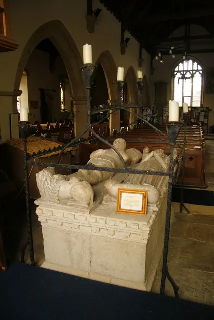
© David Rogers · Geograph · CC BY-SA 2.0
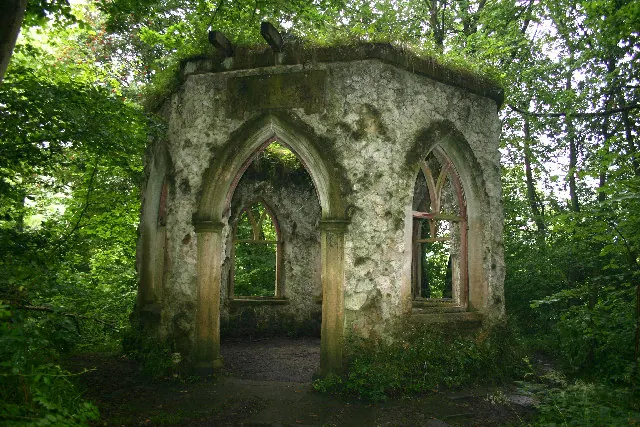
© Uncredited · Geograph · CC BY-SA 2.0
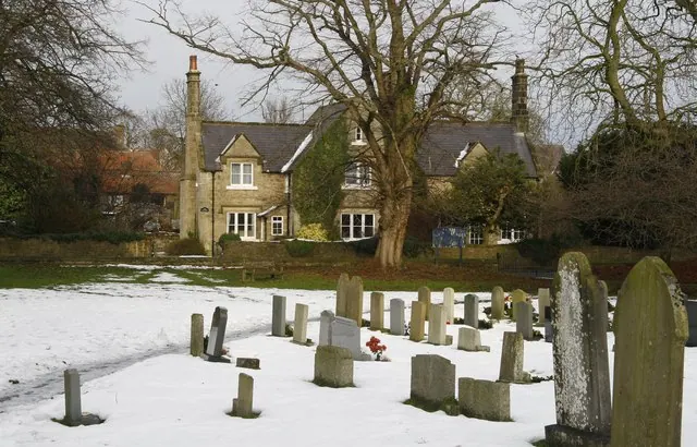
© David Rogers · Geograph · CC BY-SA 2.0
Images © their respective photographers, licensed under CC BY-SA 2.0 and reused here with attribution. Photographs depict listed buildings, churches and monuments near this settlement and may show neighbouring villages.
Location
54.2104°N, -1.5936°W · Land of Count Alan hundred, Yorkshire
View larger map on OpenStreetMap →Data derived from the Open Domesday project (opendomesday.org), based on the Domesday Book dataset compiled by Professor J.J.N. Palmer and team. The Domesday Book (1086) is in the public domain.
Found an inaccuracy? [email protected]