West Burton in the Domesday Book (1086)
West Burton appears in the Domesday Book of 1086, entered under the hundred of Land of Count Alan in Yorkshire. The survey assessed West Burton at 6.6 carucates of taxable land.
At the time of the survey, West Burton supported a recorded population of 10 villagers, 6 smallholders, 2 freemanmen, working 4 ploughs between them.
The survey records West Burton’s value at 4 shillings in 1086. No pre-Conquest figure survives – not unusual in the North, where records were disrupted by the Harrying and by the patchy coverage of the survey.
Resources Recorded at West Burton (1086)
- Meadow: 40 acres
- Woodland: 6 * 1 furlongs
Other Settlements in Land of Count Alan
- Achebi
- Agglethorpe
- Ainderby [Mires]
- Ainderby [Quernhow]
- Aiskew
- Aldbrough
- Allerthorpe [Hall]
- Ascam
- Ascham
- Asebi
- Aske [Hall]
- Askrigg
- Aysgarth
- Baldersby
The Meaning of the Name
The name West Burton is of Anglo-Saxon origin. Its final element derives from the Old English word tūn, a farmstead or village. The first element is most likely a personal name or an early descriptive term, now difficult to recover with certainty. Taken together the name probably meant something close to ‘a farmstead’.
Remarkably, the name has changed little since 1086, when the Domesday scribes wrote it as West Burton.
Listed Buildings Near West Burton
Historic England records 16 listed buildings within about a mile of West Burton. Listing protects structures of special architectural or historic interest, graded I (exceptional), II* (particularly important) and II.
Grade II
- Old Hall Stables - 0.07 km
- Wensleydale Cottage and Attached Outbuilding - 0.14 km
- 1 and 2 Black Bull Cottages - 0.17 km
- Obelisk - 0.2 km
- Stocks - 0.21 km
- West End Cottage and Inglenook Cottage - 0.28 km
- Galloway House - 0.33 km
- Ryder’s Farmhouse - 0.41 km
- The Grange - 0.53 km
- The Coach House and Stable Cottage to the North East of the Grange - 0.59 km
- Burton Bridge - 0.67 km
- Grange Farm Cottage - 0.68 km
- Flanders Hall - 0.76 km
- Stables at Flanders Hall - 0.76 km
- Wall, Railings, Gates and Gate Piers Approximately 10 Metres East of Flanders Hall - 0.78 km
- Chimney and Flue Approximately 150 Metres South-south-west of Cote Farmhouse - 1.11 km
Scheduled Monuments Near West Burton
Scheduled monuments are nationally important archaeological sites given legal protection. 1 lies within roughly a mile of West Burton:
- Settlement on Burton Moor - 1.58 km
West Burton Today
Today West Burton lies within the administrative area of Burton-cum-Walden, and the settlement recorded a population of 303 at recent figures. Nine and a half centuries separate that figure from the small rural community the Domesday survey recorded here in 1086.
Read more about modern West Burton on Wikipedia .
Nearby Domesday Settlements
Other places recorded in the 1086 survey within a few miles:
- Thoralby - 1.0 km W
- Eshingtons - 1.0 km N
- Aysgarth - 2.2 km NW
- Crooksby Barn - 3.2 km W
- Carperby - 3.2 km N
- West Bolton - 4.1 km N
Heritage Around [West] Burton
Photographs of churches, listed buildings and monuments in the vicinity, contributed by volunteers to the Geograph project and reused here under a Creative Commons licence.
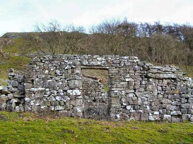
© Arnold Price · Geograph · CC BY-SA 2.0
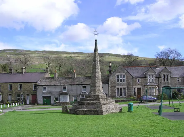
© Arnold Price · Geograph · CC BY-SA 2.0
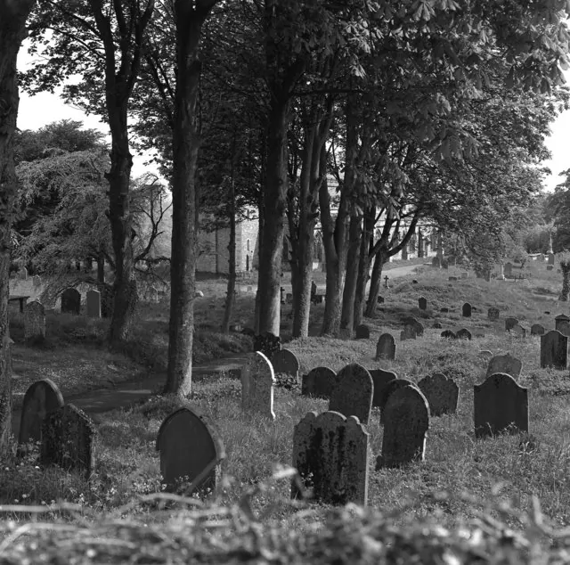
© Dr Neil Clifton · Geograph · CC BY-SA 2.0
Images © their respective photographers, licensed under CC BY-SA 2.0 and reused here with attribution. Photographs depict listed buildings, churches and monuments near this settlement and may show neighbouring villages.
Location
54.2740°N, -1.9770°W · Land of Count Alan hundred, Yorkshire
View larger map on OpenStreetMap →Data derived from the Open Domesday project (opendomesday.org), based on the Domesday Book dataset compiled by Professor J.J.N. Palmer and team. The Domesday Book (1086) is in the public domain.
Found an inaccuracy? [email protected]