Welburn in the Domesday Book (1086)
The settlement of Welburn is recorded in William I’s Domesday survey of 1086, entered under the hundred of Bulford in Yorkshire. The survey assessed Welburn at 1 carucate of taxable land.
At the time of the survey, Welburn supported a recorded population of 7 villagers, 4 smallholders, 2 slaves, working 3 ploughs between them.
The survey records Welburn’s value at 1 shilling in 1086. No pre-Conquest figure survives – not unusual in the North, where records were disrupted by the Harrying and by the patchy coverage of the survey.
Resources Recorded at Welburn (1086)
- Sheep: 30
- Meadow: 3 acres
- Woodland: 10 acres
Other Settlements in Bulford
- Aldwark
- Alne
- Barnby [House]
- Barton [le Willows]
- Beningbrough
- Bossall
- Brafferton
- Brandsby
- Bulmer
- Buttercrambe
- Carlton [Farm]
- Claxton
- Coneysthorpe
- Corburn
The Meaning of the Name
The origin of the name Welburn is not securely established from its modern form alone; like many settlement names in the North it likely combines an Old English or Old Norse personal name with a landscape term.
Remarkably, the name has changed little since 1086, when the Domesday scribes wrote it as Welburn.
Listed Buildings Near Welburn
Historic England records 24 listed buildings within about a mile of Welburn. Listing protects structures of special architectural or historic interest, graded I (exceptional), II* (particularly important) and II.
Grade I
- Carrmire Gates Wall and End Turrets - 0.38 km
- The Pyramid and Surrounding Piers - 0.78 km
- Pyramid Gatehouse and Flanking Wings - 1.13 km
Grade II*
Grade II
- Holly Bank - 0.51 km
- Woodview - 0.59 km
- Elm Tree House and Pigeon Cote Farmhouse - 0.6 km
- K6 Telephone Kiosk Opposite Pigeoncote Farm - 0.61 km
- Rose Cottage - 0.62 km
- Pitcairn - 0.63 km
- Temperance Inn Farmhouse - 0.63 km
- The Crown and Cushion - 0.64 km
- Chapel Garth - 0.64 km
- Pear Tree House and Attached Outbuilding - 0.68 km
- Cherry Tree House - 0.68 km
- Rosedale House - 0.71 km
- Reading Room - 0.71 km
- Yew Tree House and Attached Railings and Gates to Front - 0.72 km
- Manor House and Attached Flight of Steps to Front - 0.75 km
- Chanting Hill Farmhouse - 0.76 km
- The Grange - 0.8 km
- Church of St John - 0.89 km
- The Aviaries - 0.92 km
- White Gate - 1.07 km
Scheduled Monuments Near Welburn
Scheduled monuments are nationally important archaeological sites given legal protection. 2 lie within roughly a mile of Welburn:
- Round barrow 300m east of Carrmire Gate - 0.07 km
- Round barrow 400m SSW of Low Gaterley Cottages - 1.4 km
Welburn Today
Today Welburn lies within the administrative area of Ryedale, and the settlement recorded a population of 504 at the 2021 census. Nine and a half centuries separate that figure from the small rural community the Domesday survey recorded here in 1086.
Read more about modern Welburn-on-Derwent on Wikipedia .
Nearby Domesday Settlements
Other places recorded in the 1086 survey within a few miles:
- Henderskelfe - 2.0 km N
- Bulmer - 2.2 km SW
- Kirkham - 2.8 km SE
- Coneysthorpe - 3.0 km N
- Low Mowthorpe Farm - 3.2 km W
- Whitwell on the Hill - 3.2 km S
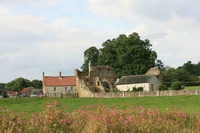
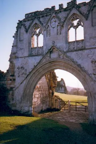
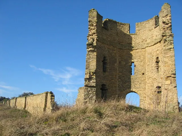
Heritage Around Welburn
Photographs of churches, listed buildings and monuments in the vicinity, contributed by volunteers to the Geograph project and reused here under a Creative Commons licence.
© Peter Church · Geograph · CC BY-SA 2.0
© Gordon Hatton · Geograph · CC BY-SA 2.0
© Chris McLean · Geograph · CC BY-SA 2.0
Images © their respective photographers, licensed under CC BY-SA 2.0 and reused here with attribution. Photographs depict listed buildings, churches and monuments near this settlement and may show neighbouring villages.
Data derived from the Open Domesday project (opendomesday.org), based on the Domesday Book dataset compiled by Professor J.J.N. Palmer and team. The Domesday Book (1086) is in the public domain.
Found an inaccuracy? [email protected]