Wavertree in the Domesday Book (1086)
The settlement of Wavertree is recorded in William I’s Domesday survey of 1086, entered under the hundred of [West] Derby in Cheshire. The survey assessed Wavertree at 5 carucates of taxable land.
At the time of the survey, Wavertree supported a recorded population of 9 villagers, 2 smallholders, 4 slaves, working 4 ploughs between them.
The valuation dropped between 1066 and 1086. Before 1066, Wavertree was worth 2 shillings; by 1086 that had dropped to 1.5 shillings – a fall of 25%. Most Yorkshire villages that lost value on this scale were swept up in the Harrying of the North – William’s scorched-earth campaign of 1069–70.
Resources Recorded at Wavertree (1086)
- Mills: 1 mill (valued at 4d)
Other Settlements in [West] Derby
- Ainsdale
- Allerton
- Argarmeles
- Aughton
- Barton
- Bootle
- Childwall
- Dalton
- Downholland
- Formby
- Halsall
- Hurlston
- Huyton
- Ince [Blundell]
The Meaning of the Name
The origin of the name Wavertree is not securely established from its modern form alone; like many settlement names in the North it likely combines an Old English or Old Norse personal name with a landscape term.
Remarkably, the name has changed little since 1086, when the Domesday scribes wrote it as Wavertree.
Listed Buildings Near Wavertree
Historic England records 75 listed buildings within about a mile of Wavertree. Listing protects structures of special architectural or historic interest, graded I (exceptional), II* (particularly important) and II.
Grade II*
Grade II
- Mossfield - 0.06 km
- 8 and 10, Childwall Road, Liverpool - 0.14 km
- 6, Childwall Road - 0.15 km
- Lock Up - 0.29 km
- Olive Mount Children’s Hospital (Original House Only) - 0.3 km
- Newstead - 0.32 km
- Former Abbey Cinema - 0.33 km
- Monk’s Well at Corner of North Drive - 0.34 km
- Wall and Gate Piers to Number 14 - 0.34 km
- Clock Tower, and 4 Iron Lamps - 0.38 km
- Lamb Hotel - 0.42 km
- 28A and 28, Church Road North - 0.45 km
- 37 and 39, North Drive - 0.48 km
- 35, North Drive - 0.51 km
- Wavertree Town Hall - 0.51 km
- 18 and 20, North Drive - 0.53 km
- Cross and Passion Convent - 0.53 km
- 27-35, Prince Alfred Road - 0.54 km
- Sandy Knowe - 0.54 km
- 15 and 17, Prince Alfred Road - 0.55 km
- 19-25, Prince Alfred Road - 0.55 km
- 9,11,13, Prince Alfred Road - 0.55 km
- 29 and 31, North Drive - 0.56 km
…and 51 more listed structures in the area.
Wavertree Today
Today Wavertree lies within the administrative area of Liverpool, and the settlement recorded a population of 14,772 at recent figures. Nine and a half centuries separate that figure from the small rural community the Domesday survey recorded here in 1086.
Read more about modern Wavertree on Wikipedia .
Nearby Domesday Settlements
Other places recorded in the 1086 survey within a few miles:
- Allerton - 2.8 km SE
- Childwall - 3.0 km E
- Smithdown - 3.2 km W
- Wibaldeslei - 3.6 km SE
- Toxteth - 4.1 km W
- Much Woolton - 4.2 km SE
Heritage Around Wavertree
Photographs of churches, listed buildings and monuments in the vicinity, contributed by volunteers to the Geograph project and reused here under a Creative Commons licence.
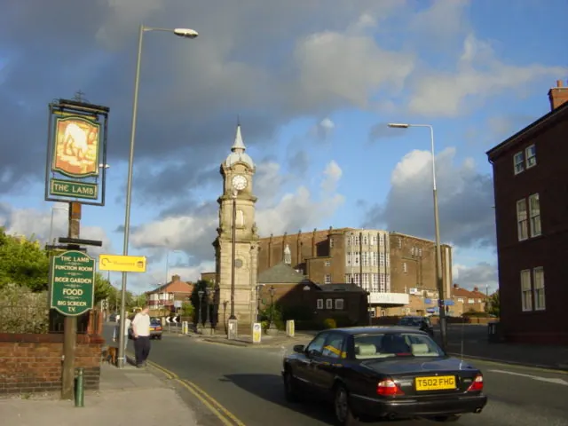
© Sue Adair · Geograph · CC BY-SA 2.0
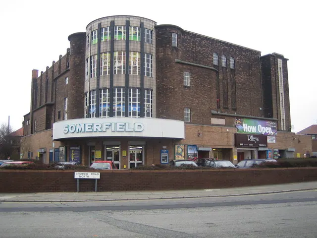
© Nigel Cox · Geograph · CC BY-SA 2.0
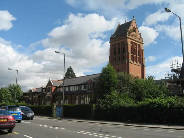
© Sue Adair · Geograph · CC BY-SA 2.0
Images © their respective photographers, licensed under CC BY-SA 2.0 and reused here with attribution. Photographs depict listed buildings, churches and monuments near this settlement and may show neighbouring villages.
Data derived from the Open Domesday project (opendomesday.org), based on the Domesday Book dataset compiled by Professor J.J.N. Palmer and team. The Domesday Book (1086) is in the public domain.
Found an inaccuracy? [email protected]