Watton in the Domesday Book (1086)
Watton is named in the Domesday Book, compiled by Norman commissioners in 1086, entered under the hundred of Sneculfcros in Yorkshire. The survey assessed Watton at 1.8 carucates of taxable land.
At the time of the survey, Watton supported a recorded population of 3 villagers, 4 smallholders, 6 slaves, working 3 ploughs between them.
By 1086 Watton was worth 2.1 shillings, up from 1.06 shillings before the Conquest – in contrast to many Yorkshire neighbours whose valuations collapsed.
The survey lists 3 manors at Watton under different lords. Splitting a single settlement between multiple tenants was common across the North – Saxon estates broken up and handed to William’s followers after 1066.
Resources Recorded at Watton (1086)
- Woodland: 10 None
Other Settlements in Sneculfcros
- Aike
- Beswick
- Beverley
- Bracken
- Dunnington
- Etton
- Gardham
- Grimston
- Holme [on the Wolds]
- Ianulfestorp
- Kilnwick
- Leconfield
- Lockington
- Middleton [on the Wolds]
The Meaning of the Name
The name Watton is of Anglo-Saxon origin. Its final element derives from the Old English word tūn, a farmstead or village. The first element is most likely a personal name or an early descriptive term, now difficult to recover with certainty. Taken together the name probably meant something close to ‘a farmstead’.
Remarkably, the name has changed little since 1086, when the Domesday scribes wrote it as Watton.
Listed Buildings Near Watton
Historic England records 3 listed buildings within about a mile of Watton. Listing protects structures of special architectural or historic interest, graded I (exceptional), II* (particularly important) and II.
Grade I
- Watton Abbey - 0.42 km
- Church of St Mary - 0.49 km
Grade II*
- Outbuildings to Watton Abbey - 0.52 km
Scheduled Monuments Near Watton
Scheduled monuments are nationally important archaeological sites given legal protection. 1 lies within roughly a mile of Watton:
- Site of Watton Gilbertine priory, two possible medieval archery butts and Civil War earthworks - 0.56 km
Watton Today
Today Watton lies within the administrative area of East Riding of Yorkshire, and the settlement recorded a population of 219 at the 2021 census. Nine and a half centuries separate that figure from the small rural community the Domesday survey recorded here in 1086.
Read more about modern Watton on Wikipedia .
Nearby Domesday Settlements
Other places recorded in the 1086 survey within a few miles:
- Beswick - 1.4 km SW
- Kilnwick - 3.0 km W
- Cranswick - 3.0 km N
- Lockington - 3.6 km SW
- Hutton Cranswick - 4.0 km N
- Bracken - 4.1 km W
Heritage Around Watton
Photographs of churches, listed buildings and monuments in the vicinity, contributed by volunteers to the Geograph project and reused here under a Creative Commons licence.
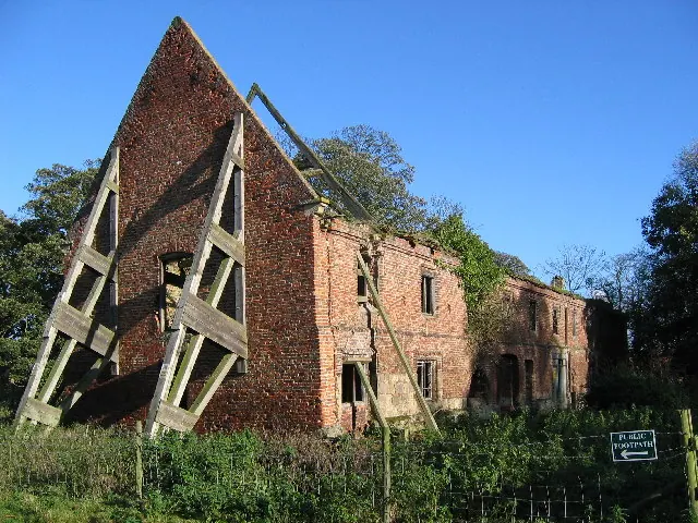
© Stephen Horncastle · Geograph · CC BY-SA 2.0
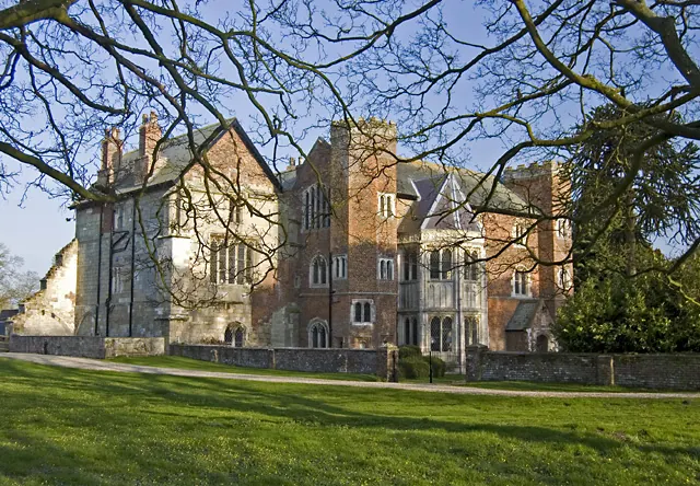
© Paul Harrop · Geograph · CC BY-SA 2.0
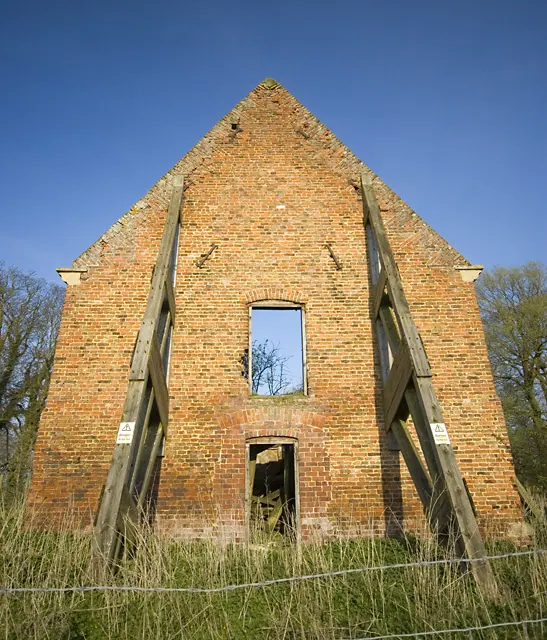
© Paul Harrop · Geograph · CC BY-SA 2.0
Images © their respective photographers, licensed under CC BY-SA 2.0 and reused here with attribution. Photographs depict listed buildings, churches and monuments near this settlement and may show neighbouring villages.
Data derived from the Open Domesday project (opendomesday.org), based on the Domesday Book dataset compiled by Professor J.J.N. Palmer and team. The Domesday Book (1086) is in the public domain.
Found an inaccuracy? [email protected]