Water Fulford in the Domesday Book (1086)
Water Fulford is named in the Domesday Book, compiled by Norman commissioners in 1086, entered under the hundred of Warter in Yorkshire.
Other Settlements in Warter
- Grimthorpe [Manor]
- Hawold
- Heslington
- Huggate
- Kilnwick [Percy]
- Langwith [Lodge]
- Meltonby
- Millington
- Naburn
- Warter
- Wetwang
- Yapham
- [Great] Givendale
- [Little] Givendale
The Meaning of the Name
The name Water Fulford is of Anglo-Saxon origin. Its final element derives from the Old English word ford, a river crossing. The first element is most likely a personal name or an early descriptive term, now difficult to recover with certainty. Taken together the name probably meant something close to ‘a ford’.
Remarkably, the name has changed little since 1086, when the Domesday scribes wrote it as Water Fulford.
Listed Buildings Near Water Fulford
Historic England records 40 listed buildings within about a mile of Water Fulford. Listing protects structures of special architectural or historic interest, graded I (exceptional), II* (particularly important) and II.
Grade I
- Bishopthorpe Palace and Chapel - 1.1 km
Grade II*
- Middlethorpe Hall - 0.78 km
Grade II
- Fulford Hall - 0.14 km
- Stables to Fulford Hall Approximately 20 Metres to South-west - 0.18 km
- Cart house and stables and wall adjoining to Fulford Hall - 0.21 km
- Gates and Piers to Fulford Hall - 0.24 km
- Dovecote to Garden House - 0.27 km
- Middlethorpe Manor - 0.56 km
- Dovecote Approximately 50 Metres South East of Middlethorpe Hall - 0.71 km
- Delwood Croft - 0.74 km
- 30 and 32, York Road - 0.85 km
- K6 Telephone Kiosk Next to Number 53 - 0.89 km
- Fulford House - 0.93 km
- Holly House the Old Manor House - 0.95 km
- The White House, White House North and White House South - 0.96 km
- 6 and 8, York Road - 1.0 km
- 19, York Road - 1.01 km
- The Old House - 1.01 km
- 17, York Road - 1.02 km
- Folly in Grounds of Bishopthorpe Palace - 1.04 km
- Sundial Approximately 10 Metres South-east of Bishopthorpe Palace - 1.09 km
- Ruined Church of St Andrew - 1.1 km
- Wall and archway adjoining Bishopthorpe Palace to right - 1.11 km
- Church of Saint Oswald - 1.12 km
…and 16 more listed structures in the area.
Water Fulford Today
Today Water Fulford lies within the administrative area of City of York, and the settlement recorded a population of 3,082 at the 2021 census. Nine and a half centuries separate that figure from the small rural community the Domesday survey recorded here in 1086.
Read more about modern Fulford on Wikipedia .
Nearby Domesday Settlements
Other places recorded in the 1086 survey within a few miles:
- Bithen - 1.0 km W
- Middlethorpe - 1.0 km W
- Gate Fulford - 1.0 km N
- Bishopthorpe - 1.4 km SW
- Mulede - 1.4 km SW
- Mulehale - 1.4 km SW
Heritage Around [Water] Fulford
Photographs of churches, listed buildings and monuments in the vicinity, contributed by volunteers to the Geograph project and reused here under a Creative Commons licence.
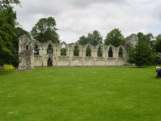
© Lyall Duffus · Geograph · CC BY-SA 2.0
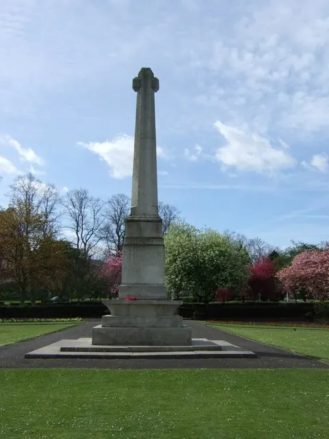
© Stanley Howe · Geograph · CC BY-SA 2.0
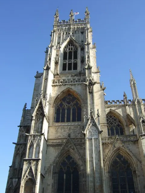
© Stanley Howe · Geograph · CC BY-SA 2.0
Images © their respective photographers, licensed under CC BY-SA 2.0 and reused here with attribution. Photographs depict listed buildings, churches and monuments near this settlement and may show neighbouring villages.
Data derived from the Open Domesday project (opendomesday.org), based on the Domesday Book dataset compiled by Professor J.J.N. Palmer and team. The Domesday Book (1086) is in the public domain.
Found an inaccuracy? [email protected]