Warburton in the Domesday Book (1086)
Warburton appears in the Domesday Book of 1086, entered under the hundred of Bucklow in Cheshire. The survey assessed Warburton at 0.2 carucates of taxable land.
At the time of the survey, Warburton supported a recorded population of 4 villagers, 1 smallholder, 1 slave, working 3 ploughs between them.
The survey records Warburton’s value at 15d in 1086. No pre-Conquest figure survives – not unusual in the North, where records were disrupted by the Harrying and by the patchy coverage of the survey.
Resources Recorded at Warburton (1086)
- Pigs: 10
- Sheep: 40
- Woodland: 8 acres
Other Settlements in Bucklow
- Appleton
- Ashley
- Aston [by Budworth]
- Aston [by Sutton]
- Bartington
- Clifton
- Dunham [Massey]
- Eanley
- Grappenhall
- Lymm
- Mobberley
- Northenden
- Norton
- Ollerton
The Meaning of the Name
The name Warburton is of Anglo-Saxon origin. Its final element derives from the Old English word tūn, a farmstead or village. The first element is most likely a personal name or an early descriptive term, now difficult to recover with certainty. Taken together the name probably meant something close to ‘a farmstead’.
Remarkably, the name has changed little since 1086, when the Domesday scribes wrote it as Warburton.
Listed Buildings Near Warburton
Historic England records 22 listed buildings within about a mile of Warburton. Listing protects structures of special architectural or historic interest, graded I (exceptional), II* (particularly important) and II.
Grade I
- Old Church of Saint Werburg - 0.9 km
Grade II
- Church House - 0.3 km
- Barn to South West of Overtown Farmhouse - 0.3 km
- Church of Saint Werburg - 0.34 km
- The Bent Farmhouse - 0.35 km
- Onion Farm - 0.35 km
- War memorial in St Werburg’s churchyard - 0.35 km
- Post Office House - 0.39 km
- Barn to South West of the Bent Farmhouse - 0.4 km
- Paddocklake Farmhouse - 0.43 km
- Wigsey Farmhouse - 0.53 km
- Shippon to West of Wigsey Farmhouse - 0.56 km
- The School - 0.57 km
- Stocks Stocks South of Junction With Wigsey Lane - 0.7 km
- Cross Base Cross Base South of Junction With Wigsey Lane - 0.71 km
- Stone Flag Wall Around Old Stocks and Cross - 0.71 km
- Timber Framed Farm Building, South Side of Warburton Park Farmyard - 0.86 km
- Lychgate, Old Church of Saint Werburg - 0.87 km
- Heathlands Farmhouse - 0.9 km
- Sundial to South West of Old Church of Saint Werburg - 0.91 km
- Barn North East of Heathlands Farmhouse - 0.91 km
- The Manor House - 1.07 km
Nearby Domesday Settlements
Other places recorded in the 1086 survey within a few miles:
- Sinderland - 3.2 km E
- Dunham Massey - 4.1 km E
- Lymm - 4.2 km SW
- High Legh - 5.1 km S
- Millington - 5.4 km S
- Bowdon - 5.8 km SE
Heritage Around Warburton
Photographs of churches, listed buildings and monuments in the vicinity, contributed by volunteers to the Geograph project and reused here under a Creative Commons licence.
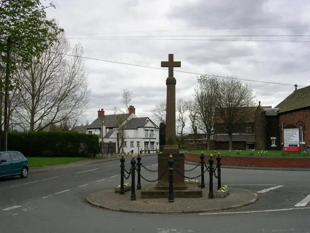
© Keith Williamson · Geograph · CC BY-SA 2.0
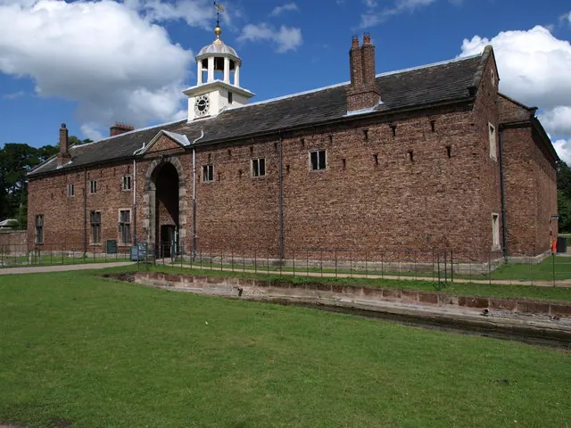
© Tim Marshall · Geograph · CC BY-SA 2.0
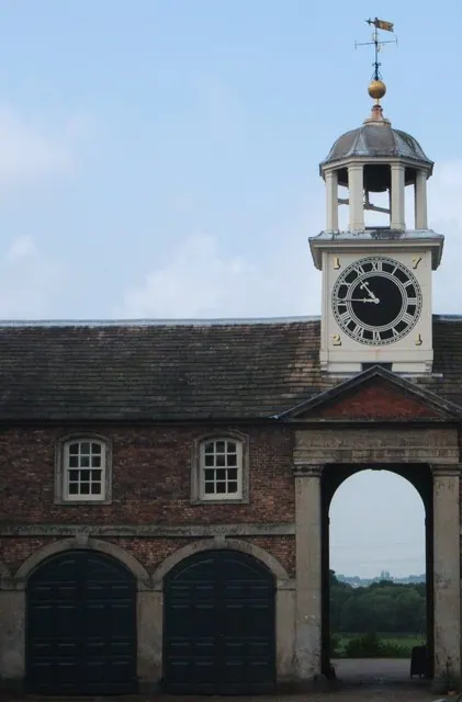
© Peter Barr · Geograph · CC BY-SA 2.0
Images © their respective photographers, licensed under CC BY-SA 2.0 and reused here with attribution. Photographs depict listed buildings, churches and monuments near this settlement and may show neighbouring villages.
Data derived from the Open Domesday project (opendomesday.org), based on the Domesday Book dataset compiled by Professor J.J.N. Palmer and team. The Domesday Book (1086) is in the public domain.
Found an inaccuracy? [email protected]