Walton on the Hill in the Domesday Book (1086)
Walton on the Hill is named in the Domesday Book, compiled by Norman commissioners in 1086, entered under the hundred of [West] Derby in Cheshire.
At the time of the survey, Walton on the Hill supported a recorded population of 6 villagers, working 1 plough between them.
Resources Recorded at Walton on the Hill (1086)
- Churches: 1
- Woodland: 0.5 league * 20 perches mixed measures
Other Settlements in [West] Derby
- Ainsdale
- Allerton
- Argarmeles
- Aughton
- Barton
- Bootle
- Childwall
- Dalton
- Downholland
- Formby
- Halsall
- Hurlston
- Huyton
- Ince [Blundell]
The Meaning of the Name
The name Walton on the Hill is of Anglo-Saxon origin. Its final element derives from the Old English word tūn, a farmstead or village. The first element is most likely a personal name or an early descriptive term, now difficult to recover with certainty. Taken together the name probably meant something close to ‘a farmstead’.
Remarkably, the name has changed little since 1086, when the Domesday scribes wrote it as Walton on the Hill.
Listed Buildings Near Walton on the Hill
Historic England records 20 listed buildings within about a mile of Walton on the Hill. Listing protects structures of special architectural or historic interest, graded I (exceptional), II* (particularly important) and II.
Grade II
- Prince Arthur - 0.72 km
- 32-54, HORNBY ROAD (See details for further address information) - 0.82 km
- 2, HORNBY PLACE (See details for further address information) - 0.82 km
- Walton Hospital (Original Building Only) - 0.87 km
- Entrance to Everton Cemetery Entrance to Long Lane - 0.88 km
- Lodge to Everton Cemetery Long Lane Lodge - 0.9 km
- The Old Rectory (Now Part of High School) - 0.91 km
- Mortuary to Right of Entrance to Churchyard - 0.93 km
- Hearse House to Right of Entrance to Churchyard - 0.93 km
- Church of St Mary - 0.95 km
- Sundial in Churchyard 10 Metres South of South Porch of St Mary’s Church - 0.97 km
- South Chapel - 0.98 km
- Sandstone Wall All Round Churchyard, With One Entrance on County Road, One at the Junction of County Road and Church Lane, and One on Walton Village. - 1.0 km
- Dining Hall, at Hartley’s Factory - 1.0 km
- Old School House - 1.01 km
- Engine House and Chimney at Hartley’s Factory - 1.03 km
- Entrance Gateway and Pavilions - 1.05 km
- Chapel and Administration Block - 1.06 km
- Barclays Bank - 1.09 km
- Glebe Hotel - 1.18 km
Walton on the Hill Today
Today Walton on the Hill lies within the administrative area of Liverpool.
Read more about modern Walton on Wikipedia .
Nearby Domesday Settlements
Other places recorded in the 1086 survey within a few miles:
- Kirkdale - 1.4 km SW
- Bootle - 2.2 km SW
- West Derby - 3.2 km E
- Down Litherland - 3.6 km NW
- Smithdown - 5.0 km S
- Wallasey - 5.8 km SW
Heritage Around Walton [on the Hill]
Photographs of churches, listed buildings and monuments in the vicinity, contributed by volunteers to the Geograph project and reused here under a Creative Commons licence.
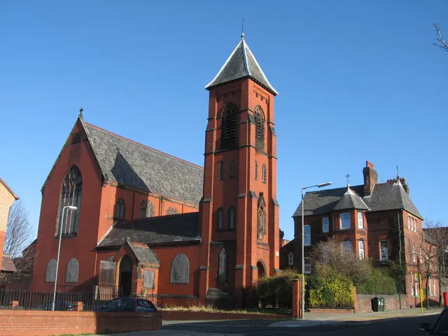
© Sue Adair · Geograph · CC BY-SA 2.0
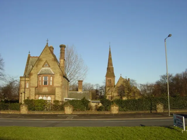
© Sue Adair · Geograph · CC BY-SA 2.0
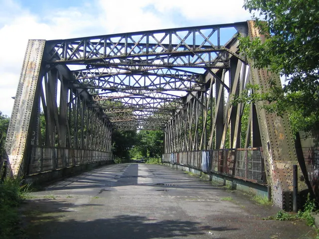
© Nigel Cox · Geograph · CC BY-SA 2.0
Images © their respective photographers, licensed under CC BY-SA 2.0 and reused here with attribution. Photographs depict listed buildings, churches and monuments near this settlement and may show neighbouring villages.
Data derived from the Open Domesday project (opendomesday.org), based on the Domesday Book dataset compiled by Professor J.J.N. Palmer and team. The Domesday Book (1086) is in the public domain.
Found an inaccuracy? [email protected]