Upleatham in the Domesday Book (1086)
The settlement of Upleatham is recorded in William I’s Domesday survey of 1086, entered under the hundred of Langbaurgh in Yorkshire.
Other Settlements in Langbaurgh
- Acklam
- Airy [Holme]
- Aislaby
- Arnodestorp
- Baldebi
- Barnaby
- Barwick
- Battersby
- Bergolbi
- Berguluesbi
- Blaten [Carr]
- Borrowby
- Breck
- Brotton
The Meaning of the Name
The name Upleatham is of Anglo-Saxon origin. Its final element derives from the Old English word hām, a homestead or village. The first element is most likely a personal name or an early descriptive term, now difficult to recover with certainty. Taken together the name probably meant something close to ‘a homestead’.
Remarkably, the name has changed little since 1086, when the Domesday scribes wrote it as Upleatham.
Listed Buildings Near Upleatham
Historic England records 17 listed buildings within about a mile of Upleatham. Listing protects structures of special architectural or historic interest, graded I (exceptional), II* (particularly important) and II.
Grade II*
- Old Church of St Andrew - 0.16 km
Grade II
- Upleatham Post Office - 0.32 km
- K6 Telephone Kiosk, on West Side of Number 13 (Upleatham Post Office) - 0.33 km
- 14 and 15 - 0.34 km
- Church of St Andrew - 0.36 km
- Boundary Walls, Gates and Gatepiers to South of Church of St Andrew - 0.37 km
- Village Hall - 0.37 km
- Stone Shaft, 2 Metres South West of Tower of Church of St Andrew - 0.38 km
- Number 16 and West Extension - 0.38 km
- Boundary Garden Walls to Numbers 14 to 20 - 0.4 km
- 17 and 18 - 0.4 km
- Methodist Chapel - 0.42 km
- Number 19 and Outbuildings Adjoining Rear (South) Elevation - 0.43 km
- Number 20 and Outbuilding Adjoining East Side - 0.44 km
- War Memorial, Upleatham - 0.49 km
- Barn, Cart Shed and Stable Circa 15 Metres North of Barns Farmhouse - 1.3 km
- Farm Cottages East of Barns Farmhouse - 1.3 km
Scheduled Monuments Near Upleatham
Scheduled monuments are nationally important archaeological sites given legal protection. 1 lies within roughly a mile of Upleatham:
- Two round barrows on Patterson’s Bank - 1.54 km
Upleatham Today
Today Upleatham lies within the administrative area of Guisborough.
Read more about modern Upleatham on Wikipedia .
Nearby Domesday Settlements
Other places recorded in the 1086 survey within a few miles:
- Thornton Fields - 2.2 km SW
- Skelton - 2.2 km SE
- Tocketts Farm - 2.8 km SW
- Marske by the Sea - 3.0 km N
- Rawcliff Banks - 3.0 km S
- Guisborough - 3.6 km SW
Heritage Around Upleatham
Photographs of churches, listed buildings and monuments in the vicinity, contributed by volunteers to the Geograph project and reused here under a Creative Commons licence.
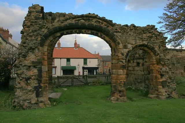
© Mick Garratt · Geograph · CC BY-SA 2.0
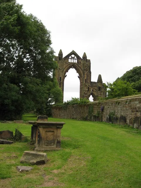
© Carol Walker · Geograph · CC BY-SA 2.0
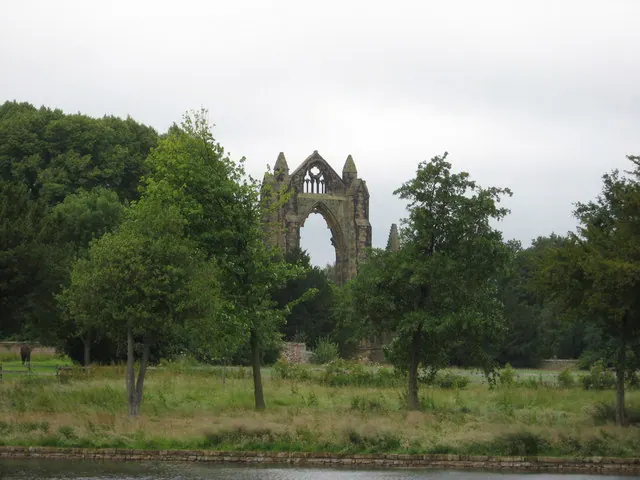
© Carol Walker · Geograph · CC BY-SA 2.0
Images © their respective photographers, licensed under CC BY-SA 2.0 and reused here with attribution. Photographs depict listed buildings, churches and monuments near this settlement and may show neighbouring villages.
Data derived from the Open Domesday project (opendomesday.org), based on the Domesday Book dataset compiled by Professor J.J.N. Palmer and team. The Domesday Book (1086) is in the public domain.
Found an inaccuracy? [email protected]