Ufton in the Domesday Book (1086)
Ufton appears in the Domesday Book of 1086, entered under the hundred of Scarsdale in Derbyshire.
Other Settlements in Scarsdale
- Alfreton
- Ashover
- Barlborough
- Barlow
- Beighton
- Blingsby
- Bolsover
- Boythorpe
- Bramley [Vale]
- Brimington
- Calow
- Chesterfield
- Clowne
- Dore
The Meaning of the Name
The name Ufton is of Anglo-Saxon origin. Its final element derives from the Old English word tūn, a farmstead or village. The first element is most likely a personal name or an early descriptive term, now difficult to recover with certainty. Taken together the name probably meant something close to ‘a farmstead’.
Remarkably, the name has changed little since 1086, when the Domesday scribes wrote it as Ufton.
Listed Buildings Near Ufton
Historic England records 19 listed buildings within about a mile of Ufton. Listing protects structures of special architectural or historic interest, graded I (exceptional), II* (particularly important) and II.
Grade II*
- Church of St Martin - 1.27 km
Grade II
- Furnace House - 0.74 km
- Former Friends Meeting House and School, Toadhole Furnace - 0.84 km
- Amber House and Attached Mill - 0.85 km
- Outbuilding to North of Amber House - 0.88 km
- The Peacock Hotel and Attached Cottage - 0.88 km
- Alfreton Stream Bridge (SPC8 60) - 0.9 km
- Railway Bridge to the South East of Dale Bridge - 0.94 km
- Amber Mill Bridge (SPC8 61) - 0.94 km
- Dale Bridge - 0.95 km
- Amber Hill Bridge - 0.97 km
- Amber Farmhouse - 1.08 km
- Outbuilding to North of Amber Farmhouse - 1.11 km
- Gateway and Attached Wall to North of Amber Farmhouse - 1.11 km
- Barn to north of Amber Farmhouse - 1.13 km
- Alfreton Hall - 1.23 km
- Former stableblock to Alfreton Hall - 1.25 km
- Sundial 15 metres south east of porch to St Martin’s Church - 1.28 km
- Chest Tomb 1 Metre to North of Chancel of St Martin’s Church - 1.28 km
Nearby Domesday Settlements
Other places recorded in the 1086 survey within a few miles:
- Shirland - 2.0 km N
- South? Wingfield - 2.2 km SW
- Alfreton - 2.2 km SE
- Wessington - 2.2 km NW
- Ogston - 3.2 km N
- Morton - 4.1 km N
Heritage Around Ufton
Photographs of churches, listed buildings and monuments in the vicinity, contributed by volunteers to the Geograph project and reused here under a Creative Commons licence.
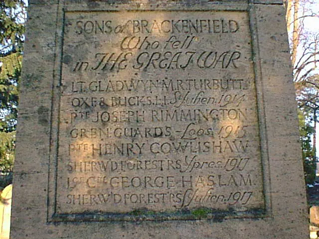
© Alan Heardman · Geograph · CC BY-SA 2.0
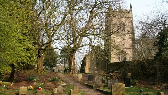
© Alan Walker · Geograph · CC BY-SA 2.0
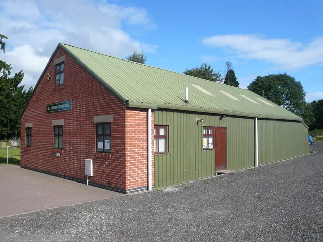
© Alan Heardman · Geograph · CC BY-SA 2.0
Images © their respective photographers, licensed under CC BY-SA 2.0 and reused here with attribution. Photographs depict listed buildings, churches and monuments near this settlement and may show neighbouring villages.
Data derived from the Open Domesday project (opendomesday.org), based on the Domesday Book dataset compiled by Professor J.J.N. Palmer and team. The Domesday Book (1086) is in the public domain.
Found an inaccuracy? [email protected]