Treales in the Domesday Book (1086)
The 1086 Domesday survey records the settlement of Treales, entered under the hundred of Amounderness in Yorkshire.
Other Settlements in Amounderness
- Aighton
- Aldcliffe
- Aldingham
- Arkholme
- Aschebi
- Ashton [Hall]
- Ashton [on Ribble]
- Austwick
- Barbon
- Bardsea
- Bare
- Barnoldswick
- Barton
- Beetham
The Meaning of the Name
The origin of the name Treales is not securely established from its modern form alone; like many settlement names in the North it likely combines an Old English or Old Norse personal name with a landscape term.
Remarkably, the name has changed little since 1086, when the Domesday scribes wrote it as Treales.
Listed Buildings Near Treales
Historic England records 18 listed buildings within about a mile of Treales. Listing protects structures of special architectural or historic interest, graded I (exceptional), II* (particularly important) and II.
Grade II*
- Church of St Michael - 0.89 km
Grade II
- Derby Arms Inn - 0.77 km
- Tomb of Edward and Elizabeth Birley in Churchyard Circa 50 Metres South East of the Porch of the Church of St Michael - 0.85 km
- Tomb of William Birley and Others in Churchyard Circa 50 Metres South East of the Porch of the Church of St Michael - 0.85 km
- Tomb of Edward and Dorothy King in Churchyard Circa 50 Metres South East of the Porch of the Church of St Michael - 0.86 km
- Hillside and attached wings - 0.86 km
- Sundial in Churchyard Circa 20 Metres South of the South Porch of the Church of St Michael - 0.89 km
- 4, Church Steet - 0.92 km
- Ash Tree House - 0.93 km
- 14, Preston Street - 0.94 km
- Fishstones and Lamp - 0.96 km
- 4 and 6, Freckleton Street - 0.98 km
- K6 Telephone Kiosk Opposite Post Office - 1.01 km
- 32, Poulton Street - 1.07 km
- Trustee Savings Bank - 1.14 km
- Treales Windmill - 1.15 km
- Kirkham United Reformed Church - 1.21 km
- Jubilee Lamp - 1.23 km
Treales Today
Today Treales lies within the administrative area of Treales, Roseacre and Wharles.
Read more about modern Treales on Wikipedia .
Nearby Domesday Settlements
Other places recorded in the 1086 survey within a few miles:
- Kirkham - 1.0 km W
- Newton - 2.2 km SE
- Salwick Hall - 3.0 km E
- Ribby - 3.2 km W
- Freckleton - 3.2 km S
- Clifton - 3.6 km SE
Heritage Around Treales
Photographs of churches, listed buildings and monuments in the vicinity, contributed by volunteers to the Geograph project and reused here under a Creative Commons licence.
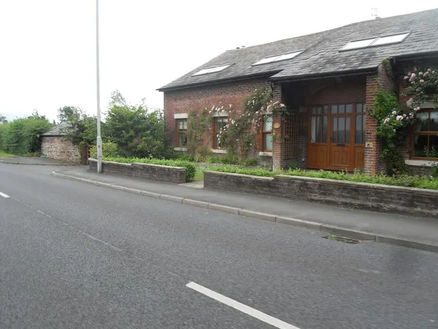
© Anthony Parkes · Geograph · CC BY-SA 2.0
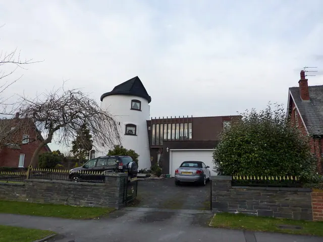
© Alexander P Kapp · Geograph · CC BY-SA 2.0
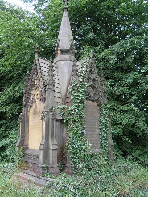
© Richard Paxman · Geograph · CC BY-SA 2.0
Images © their respective photographers, licensed under CC BY-SA 2.0 and reused here with attribution. Photographs depict listed buildings, churches and monuments near this settlement and may show neighbouring villages.
Data derived from the Open Domesday project (opendomesday.org), based on the Domesday Book dataset compiled by Professor J.J.N. Palmer and team. The Domesday Book (1086) is in the public domain.
Found an inaccuracy? [email protected]