Trangesbi in the Domesday Book (1086)
Trangesbi is named in the Domesday Book, compiled by Norman commissioners in 1086, entered under the hundred of Goscote in LEC. The survey assessed Trangesbi at 106.7 carucates of taxable land.
At the time of the survey, Trangesbi supported a recorded population of 36 villagers, 31 smallholders, 4 slaves, 100 freemanmen, working 57 ploughs between them.
The survey records Trangesbi’s value at 25 shillings in 1086. No pre-Conquest figure survives – not unusual in the North, where records were disrupted by the Harrying and by the patchy coverage of the survey.
The survey lists 3 manors at Trangesbi under different lords. Splitting a single settlement between multiple tenants was common across the North – Saxon estates broken up and handed to William’s followers after 1066.
Resources Recorded at Trangesbi (1086)
- Mills: 2 mills (valued at 1.25 shillings)
- Meadow: 104 acres
- Woodland: 1 * 1 furlongs
Other Settlements in Goscote
- Allexton
- Alton
- Anstey
- Appleby
- Appleby [Parva]
- Asfordby
- Ashby [-de-la-Zouch]
- Ashby [Folville]
- Barkby
- Barrow [-upon-Soar]
- Barsby
- Beeby
- Belgrave
- Birstall
The Meaning of the Name
The origin of the name Trangesbi is not securely established from its modern form alone; like many settlement names in the North it likely combines an Old English or Old Norse personal name with a landscape term.
Remarkably, the name has changed little since 1086, when the Domesday scribes wrote it as Trangesbi.
Listed Buildings Near Trangesbi
Historic England records 13 listed buildings within about a mile of Trangesbi. Listing protects structures of special architectural or historic interest, graded I (exceptional), II* (particularly important) and II.
Grade II
- Tomb of Charles Booth, Approx.12m. North of Nave of the Church of St Andrew - 0.06 km
- Church of St Andrew - 0.07 km
- The Gables - 0.19 km
- 25, the Green - 0.26 km
- The Old Manor House - 0.39 km
- Stable and Granary With Dovecote, to Rear of Lily Bank Farmhouse - 0.45 km
- Lily Bank Farmhouse - 0.46 km
- Former Engine House, Calcutta Pit - 0.79 km
- Milepost at Os Sk 432182 - 0.96 km
- Church of St George - 1.09 km
- Grace Dieu Manor Preparatory School - 1.24 km
- Manor Farmhouse - 1.28 km
- Ruins of Grace Dieu Priory - 1.29 km
Scheduled Monuments Near Trangesbi
Scheduled monuments are nationally important archaeological sites given legal protection. 1 lies within roughly a mile of Trangesbi:
Trangesbi Today
Today Trangesbi lies within the administrative area of North West Leicestershire, and the settlement recorded a population of 2,891 at the 2021 census. Nine and a half centuries separate that figure from the small rural community the Domesday survey recorded here in 1086.
Read more about modern Thringstone on Wikipedia .
Nearby Domesday Settlements
Other places recorded in the 1086 survey within a few miles:
Heritage Around Trangesbi
Photographs of churches, listed buildings and monuments in the vicinity, contributed by volunteers to the Geograph project and reused here under a Creative Commons licence.
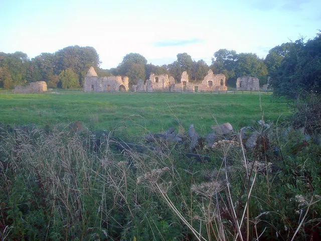
© Trevor Rickard · Geograph · CC BY-SA 2.0
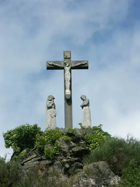
© Jerry Evans · Geograph · CC BY-SA 2.0
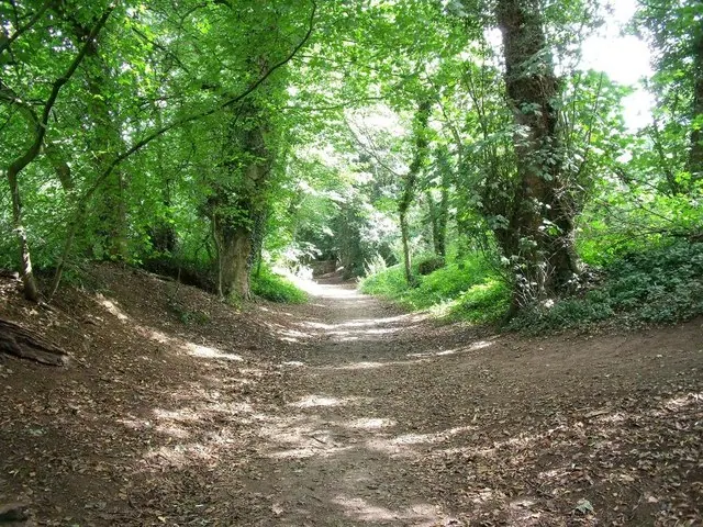
© Ian Calderwood · Geograph · CC BY-SA 2.0
Images © their respective photographers, licensed under CC BY-SA 2.0 and reused here with attribution. Photographs depict listed buildings, churches and monuments near this settlement and may show neighbouring villages.
Data derived from the Open Domesday project (opendomesday.org), based on the Domesday Book dataset compiled by Professor J.J.N. Palmer and team. The Domesday Book (1086) is in the public domain.
Found an inaccuracy? [email protected]