Towton in the Domesday Book (1086)
The settlement of Towton is recorded in William I’s Domesday survey of 1086, entered under the hundred of Barkston in Yorkshire. The survey assessed Towton at 1.9 carucates of taxable land.
At the time of the survey, Towton supported a recorded population of 4 smallholders, 7 freemanmen, working 3 ploughs between them.
By 1086 Towton was worth 2.54 shillings, up from 1.04 shillings before the Conquest – a sign this community came through the Conquest without being ruined.
The survey lists 5 manors at Towton under different lords. Splitting a single settlement between multiple tenants was common across the North – Saxon estates broken up and handed to William’s followers after 1066.
Resources Recorded at Towton (1086)
- Mills: 0 mills
- Churches: 1
- Cattle: 1
- Pigs: 9
- Sheep: 30
- Horses (cobs): 1
- Meadow: 4 acres
Other Settlements in Barkston
- Barkston
- Barlow
- Birkin
- Bramham
- Brayton
- Burton [Hall]
- Camblesforth
- Carlton
- Clifford
- Drax
- Fairburn
- Grimston [Grange]
- Hambleton
- Hazelwood [Castle]
The Meaning of the Name
The name Towton is of Anglo-Saxon origin. Its final element derives from the Old English word tūn, a farmstead or village. The first element is most likely a personal name or an early descriptive term, now difficult to recover with certainty. Taken together the name probably meant something close to ‘a farmstead’.
Remarkably, the name has changed little since 1086, when the Domesday scribes wrote it as Towton.
Listed Buildings Near Towton
Historic England records 5 listed buildings within about a mile of Towton. Listing protects structures of special architectural or historic interest, graded I (exceptional), II* (particularly important) and II.
Grade II
- Greystones - 0.08 km
- K6 Telephone Kiosk to South of Greystones - 0.08 km
- Milestone Approximately 20 Metres North of Junction With Old London Road - 0.35 km
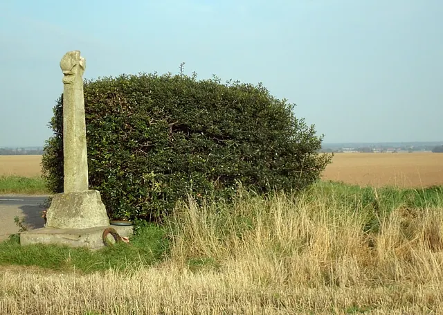
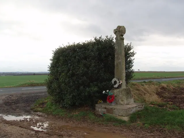
- Cross, Sometimes Known As Lord Dacres Cross - 1.14 km
- Milestone Approximately 100 Metres North of Junction With Scarthingwell Lane - 1.25 km
Scheduled Monuments Near Towton
Scheduled monuments are nationally important archaeological sites given legal protection. 1 lies within roughly a mile of Towton:
- Lord Dacre’s Cross or Towton Cross on the west side of the B1217, 1km south west of Towton - 1.17 km
Towton Today
Today Towton lies within the administrative area of North Yorkshire, and the settlement recorded a population of 214 at the 2021 census. Nine and a half centuries separate that figure from the small rural community the Domesday survey recorded here in 1086.
Read more about modern Towton on Wikipedia .
Nearby Domesday Settlements
Other places recorded in the 1086 survey within a few miles:
- North Milford Hall - 2.0 km E
- Grimston Grange - 2.0 km N
- Stutton - 2.2 km NW
- Kirkby Wharfe - 2.8 km NE
- Neuhuse - 3.2 km E
- Niuuehusum - 3.2 km E
Heritage Around Towton
Photographs of churches, listed buildings and monuments in the vicinity, contributed by volunteers to the Geograph project and reused here under a Creative Commons licence.

© I Love Colour · Geograph · CC BY-SA 2.0
© David Pickersgill · Geograph · CC BY-SA 2.0
© Robert Neilson · Geograph · CC BY-SA 2.0
Images © their respective photographers, licensed under CC BY-SA 2.0 and reused here with attribution. Photographs depict listed buildings, churches and monuments near this settlement and may show neighbouring villages.
Data derived from the Open Domesday project (opendomesday.org), based on the Domesday Book dataset compiled by Professor J.J.N. Palmer and team. The Domesday Book (1086) is in the public domain.
Found an inaccuracy? [email protected]