Topcliffe in the Domesday Book (1086)
The settlement of Topcliffe is recorded in William I’s Domesday survey of 1086, entered under the hundred of Yarlestre in Yorkshire.
Other Settlements in Yarlestre
- Arden [Hall]
- Asenby
- Bagby
- Baxby
- Bergebi
- Berghebi
- Bernebi
- Boltby
- Breckenbrough
- Carlton [Husthwaite]
- Carlton [Miniott]
- Catton
- Coxwold
- Crakehill
The Meaning of the Name
The name Topcliffe is of Anglo-Saxon origin. Its final element derives from the Old English word clif, a cliff or steep slope. The first element is most likely a personal name or an early descriptive term, now difficult to recover with certainty. Taken together the name probably meant something close to ‘a slope’.
Remarkably, the name has changed little since 1086, when the Domesday scribes wrote it as Topcliffe.
Listed Buildings Near Topcliffe
Historic England records 19 listed buildings within about a mile of Topcliffe. Listing protects structures of special architectural or historic interest, graded I (exceptional), II* (particularly important) and II.
Grade II*
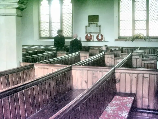
- Church of St Columba - 0.77 km
Grade II
- Mile-post Approximately 100 Metres to South of Kibber Hall - 0.52 km
- The Old Vicarage - 0.6 km
- Dovecote 35 Metres East of Hall Farmhouse - 0.61 km
- Hall Farmhouse - 0.64 km
- Ye Old Golden Lion Cottage - 0.66 km
- Jasmine Cottage - 0.66 km
- Duart and House to Right - 0.67 km
- The Old Post House - 0.68 km
- The Mount - 0.7 km
- Walkers Ground - 0.71 km
- The Old Tolbooth - 0.71 km
- The Old School to North of Church in Churchyard - 0.76 km
- Medieval Cross Base Outside Post Office - 0.77 km
- Wesleyan Chapel - 0.78 km
- Topcliffe Mill House - 0.94 km
- Topcliffe Mill - 0.95 km
- Highfield House - 1.14 km
- Roecliffe House - 1.16 km
Scheduled Monuments Near Topcliffe
Scheduled monuments are nationally important archaeological sites given legal protection. 2 lie within roughly a mile of Topcliffe:
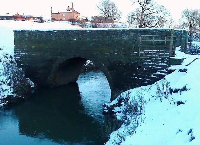
- Topcliffe Bridge - 0.95 km
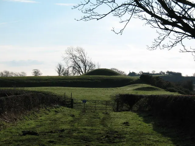
- Maiden Bower and Cock Lodge: a motte and bailey castle, moated site, windmill mound and associated linear outwork - 1.31 km
Topcliffe Today
Today Topcliffe lies within the administrative area of Hambleton, and the settlement recorded a population of 1,237 at the 2021 census. Nine and a half centuries separate that figure from the small rural community the Domesday survey recorded here in 1086.
Read more about modern Topcliffe on Wikipedia .
Nearby Domesday Settlements
Other places recorded in the 1086 survey within a few miles:
- Bergebi - 0.0 km N
- Berghebi - 0.0 km N
- Asenby - 1.4 km SW
- Horebodebi - 2.2 km SE
- Horenbodebi - 2.2 km SE
- Leckby Palace - 2.2 km SE
Heritage Around Topcliffe
Photographs of churches, listed buildings and monuments in the vicinity, contributed by volunteers to the Geograph project and reused here under a Creative Commons licence.
© Bill Lovelock · Geograph · CC BY-SA 2.0
© Matthew Hatton · Geograph · CC BY-SA 2.0
© Gordon Hatton · Geograph · CC BY-SA 2.0
Images © their respective photographers, licensed under CC BY-SA 2.0 and reused here with attribution. Photographs depict listed buildings, churches and monuments near this settlement and may show neighbouring villages.
Data derived from the Open Domesday project (opendomesday.org), based on the Domesday Book dataset compiled by Professor J.J.N. Palmer and team. The Domesday Book (1086) is in the public domain.
Found an inaccuracy? [email protected]