Tissington in the Domesday Book (1086)
The 1086 Domesday survey records the settlement of Tissington, entered under the hundred of Hamston in Derbyshire.
Other Settlements in Hamston
- Alsop [-en-le-Dale]
- Ashbourne
- Atlow
- Ballidon
- Bonsall
- Bradbourne
- Brassington
- Broadlowash
- Callow
- Carsington
- Cowley
- Cromford
- Elton
- Hanson [Grange]
The Meaning of the Name
The name Tissington is of Anglo-Saxon origin. Its final element derives from the Old English word tūn, a farmstead or village. The first element is most likely a personal name or an early descriptive term, now difficult to recover with certainty. Taken together the name probably meant something close to ‘a farmstead’.
Remarkably, the name has changed little since 1086, when the Domesday scribes wrote it as Tissington.
Listed Buildings Near Tissington
Historic England records 37 listed buildings within about a mile of Tissington. Listing protects structures of special architectural or historic interest, graded I (exceptional), II* (particularly important) and II.
Grade II*
- Tissington Hall - 0.18 km
- Church of St Mary - 0.19 km
Grade II
- Hall Cottages - 0.14 km
- Gate Piers, Walls and Entrance Gateway and Gates to Hall - 0.15 km
- Hall Well - 0.15 km
- Highway Close - 0.15 km
- Hands Well - 0.17 km
- Overfield Farmhouse - 0.19 km
- Stableblock to Tissington Hall - 0.19 km
- Garden Terraces, Walls and Piers at Tissington Hall - 0.2 km
- Barn North East of Old Vicarage - 0.2 km
- Staff Quarters and Outbuilding at Tissington Hall - 0.21 km
- Old Vicarage and Garden Wall - 0.24 km
- Rose Cottage - 0.24 km
- Church House and garden wall - 0.25 km
- Slaughter House - 0.25 km
- Darfield House and Garden Wall - 0.25 km
- 1-3, the Green - 0.25 km
- Wibbern Hill Farmhouse and Garden Wall - 0.26 km
- Dilcroft and Garden Wall - 0.26 km
- House and Outbuilding South of Slaughter House - 0.26 km
- Yew Tree Well - 0.26 km
- Town Head Farmhouse, Garden Wall and Railings - 0.26 km
- Fern Cottage Jasmine Cottage - 0.27 km
…and 13 more listed structures in the area.
Scheduled Monuments Near Tissington
Scheduled monuments are nationally important archaeological sites given legal protection. 5 lie within roughly a mile of Tissington:
- Civil War redoubt 150m east of Tissington Hall - 0.13 km
- Boars Low bowl barrow - 0.68 km
- Bassett Wood bowl barrow - 1.36 km
- Gorsey Low bowl barrow - 1.39 km
- Sharp Low bowl barrow - 1.52 km
Tissington Today
Today Tissington lies within the administrative area of Tissington and Lea Hall, and the settlement recorded a population of 169 at the 2001 census. Nine and a half centuries separate that figure from the small rural community the Domesday survey recorded here in 1086.
Read more about modern Tissington on Wikipedia .
Nearby Domesday Settlements
Other places recorded in the 1086 survey within a few miles:
- Newton Grange - 1.4 km NW
- Fenny Bentley - 2.0 km S
- Parwich - 2.2 km NE
- Broadlowash - 2.8 km SW
- Thorpe - 2.8 km SW
- Bradbourne - 3.0 km E
Heritage Around Tissington
Photographs of churches, listed buildings and monuments in the vicinity, contributed by volunteers to the Geograph project and reused here under a Creative Commons licence.
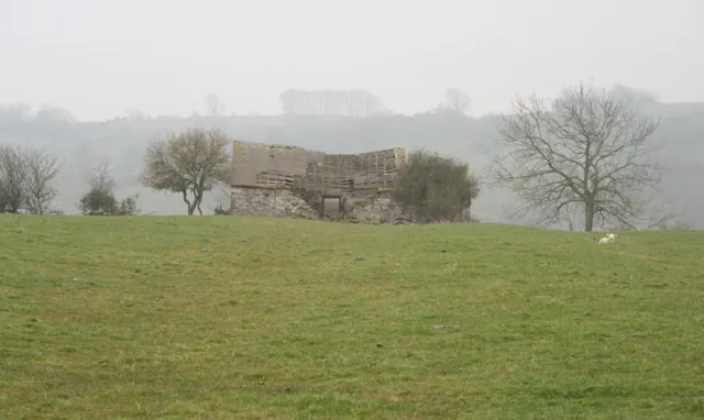
© David Lally · Geograph · CC BY-SA 2.0
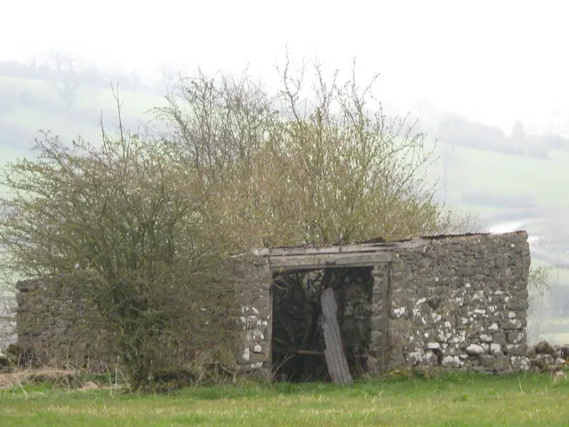
© Anonymous · Geograph · CC BY-SA 2.0
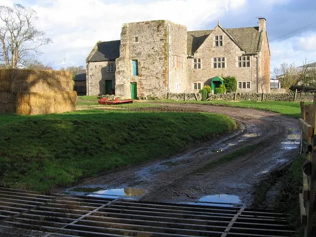
© Nikki Mahadevan · Geograph · CC BY-SA 2.0
Images © their respective photographers, licensed under CC BY-SA 2.0 and reused here with attribution. Photographs depict listed buildings, churches and monuments near this settlement and may show neighbouring villages.
Data derived from the Open Domesday project (opendomesday.org), based on the Domesday Book dataset compiled by Professor J.J.N. Palmer and team. The Domesday Book (1086) is in the public domain.
Found an inaccuracy? [email protected]