Tilston in the Domesday Book (1086)
Tilston appears in the Domesday Book of 1086, entered under the hundred of Duddeston in Cheshire.
Other Settlements in Duddeston
- Bettisfield
- Bickerton
- Bickley
- Boughton
- Broxton
- Burwardestone
- Burwardsley and [Higher] Burwardsley
- Caldecott
- Calvintone
- Cheaveley
- Cholmondeley
- Chowley
- Christleton
- Clutton
The Meaning of the Name
The name Tilston is of Anglo-Saxon origin. Its final element derives from the Old English word tūn, a farmstead or village. The first element is most likely a personal name or an early descriptive term, now difficult to recover with certainty. Taken together the name probably meant something close to ‘a farmstead’.
Remarkably, the name has changed little since 1086, when the Domesday scribes wrote it as Tilston.
Listed Buildings Near Tilston
Historic England records 14 listed buildings within about a mile of Tilston. Listing protects structures of special architectural or historic interest, graded I (exceptional), II* (particularly important) and II.
Grade I
- Lower Carden Hall - 0.88 km
Grade II*
- Church of St Mary - 0.89 km
Grade II
- The Close - 0.29 km
- Carden Arms - 0.3 km
- Stocks - 0.33 km
- Garage/workshop to North of no 21 - 0.4 km
- Tilston Cottage - 0.4 km
- Ivy Dene - 0.52 km
- Old Rectory - 0.79 km
- Gatepiers, Gates and Churchyard Walls to West of Church of St Mary - 0.88 km
- Stone House Farmhouse - 0.96 km
- Carden Bank - 1.15 km
- Well House Antiques - 1.19 km
- House Adjacent to Well House Antiques - 1.2 km
Scheduled Monuments Near Tilston
Scheduled monuments are nationally important archaeological sites given legal protection. 2 lie within roughly a mile of Tilston:
- Grafton deserted medieval village and ornamental moat - 0.75 km
- Standing cross in St Mary’s churchyard - 0.91 km
Nearby Domesday Settlements
Other places recorded in the 1086 survey within a few miles:
Heritage Around Tilston
Photographs of churches, listed buildings and monuments in the vicinity, contributed by volunteers to the Geograph project and reused here under a Creative Commons licence.
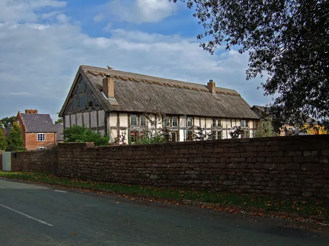
© Mike Searle · Geograph · CC BY-SA 2.0
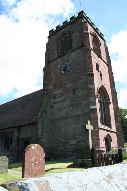
© Geoff Evans · Geograph · CC BY-SA 2.0
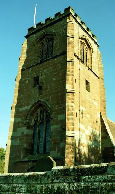
© Jeff Buck · Geograph · CC BY-SA 2.0
Images © their respective photographers, licensed under CC BY-SA 2.0 and reused here with attribution. Photographs depict listed buildings, churches and monuments near this settlement and may show neighbouring villages.
Data derived from the Open Domesday project (opendomesday.org), based on the Domesday Book dataset compiled by Professor J.J.N. Palmer and team. The Domesday Book (1086) is in the public domain.
Found an inaccuracy? [email protected]