Thorpe Salvin in the Domesday Book (1086)
Thorpe Salvin is named in the Domesday Book, compiled by Norman commissioners in 1086, entered under the hundred of Strafforth in Yorkshire.
Other Settlements in Strafforth
- Adwick [le Street]
- Adwick [upon Dearne]
- Armthorpe
- Aston
- Attercliffe
- Auckley
- Aughton [Hall]
- Austerfield
- Balby
- Barnbrough
- Barnby [Dun]
- Bentley
- Bilham [House]
- Billingley
The Meaning of the Name
The origin of the name Thorpe Salvin is not securely established from its modern form alone; like many settlement names in the North it likely combines an Old English or Old Norse personal name with a landscape term.
Remarkably, the name has changed little since 1086, when the Domesday scribes wrote it as Thorpe Salvin.
Listed Buildings Near Thorpe Salvin
Historic England records 13 listed buildings within about a mile of Thorpe Salvin. Listing protects structures of special architectural or historic interest, graded I (exceptional), II* (particularly important) and II.
Grade I
- Church of St Peter - 0.64 km
Grade II*
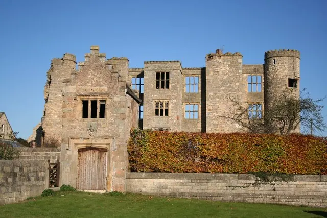
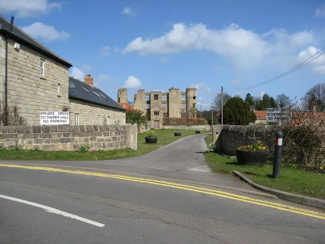
- Ruins of Thorpe Salvin Hall - 0.51 km
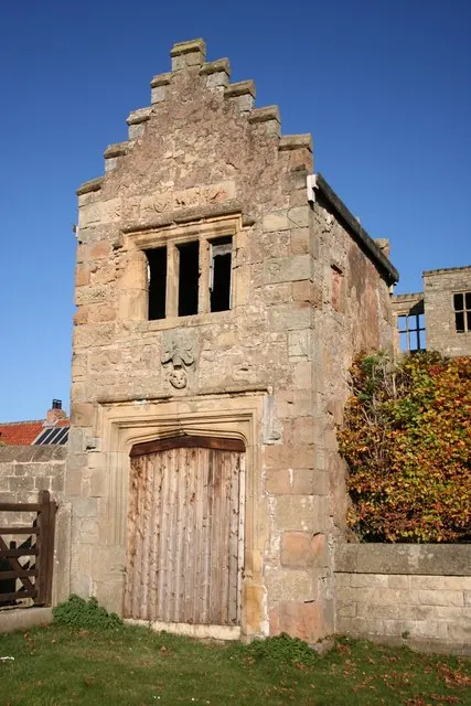
- Gatehouse to Thorpe Salvin Hall - 0.53 km
Grade II
- Chesterfield Canal Pudding Dike Bridge - 0.27 km
- Chesterfield Canal, Canal Milestone Approximately 260 Metres to South East of Devil’s Hole Bridge - 0.35 km
- Chesterfield Canal Devil’s Hole Bridge - 0.6 km
- 5, 7 and 9, Little Wood Lane - 0.62 km
- Sundial Approximately 5 Metres to South East of Porch to Church of St Peter - 0.64 km
- Headstones to John Berry and Thomas Morton Situated Approximately 4 Metres to South East of Porch to Church of St Peter - 0.65 km
- Chesterfield Canal Bridge 35 and Top Treble Lock (To West of Low Spring Wood) - 0.77 km
- Chesterfield Canal Thorpe Bridge - 1.12 km
- Chesterfield Canal, Canal Milestone Immediately to West of Milestone Lock - 1.16 km
- Chesterfield Canal Thorpe Flight of Locks Between Bridge 35 (To West of Low Spring Wood) and Turnerwood Bridge - 1.19 km
Scheduled Monuments Near Thorpe Salvin
Scheduled monuments are nationally important archaeological sites given legal protection. 3 lie within roughly a mile of Thorpe Salvin:
- Thorpe Salvin Old Hall - 0.5 km
- Lob Wells Shelter - 1.23 km
- Netherthorpe moated site - 1.45 km
Thorpe Salvin Today
Today Thorpe Salvin lies within the administrative area of Rotherham, and the settlement recorded a population of 468 at the 2021 census. Nine and a half centuries separate that figure from the small rural community the Domesday survey recorded here in 1086.
Read more about modern Thorpe Salvin on Wikipedia .
Nearby Domesday Settlements
Other places recorded in the 1086 survey within a few miles:
- South Anston - 2.2 km NW
- North Anston - 3.0 km N
- Harthill - 3.2 km W
- Kiveton - 3.6 km NW
- Dinnington - 4.0 km N
- Todwick - 4.2 km NW
Heritage Around Thorpe [Salvin]
Photographs of churches, listed buildings and monuments in the vicinity, contributed by volunteers to the Geograph project and reused here under a Creative Commons licence.
© Richard Croft · Geograph · CC BY-SA 2.0
© Richard Croft · Geograph · CC BY-SA 2.0
© Alan Heardman · Geograph · CC BY-SA 2.0
Images © their respective photographers, licensed under CC BY-SA 2.0 and reused here with attribution. Photographs depict listed buildings, churches and monuments near this settlement and may show neighbouring villages.
Data derived from the Open Domesday project (opendomesday.org), based on the Domesday Book dataset compiled by Professor J.J.N. Palmer and team. The Domesday Book (1086) is in the public domain.
Found an inaccuracy? [email protected]