Thornton Watlass in the Domesday Book (1086)
Thornton Watlass appears in the Domesday Book of 1086, entered under the hundred of Land of Count Alan in Yorkshire. The survey assessed Thornton Watlass at 56.6 carucates of taxable land.
At the time of the survey, Thornton Watlass supported a recorded population of 39 villagers, 3 smallholders, 11 freemanmen, working 22 ploughs between them.
The numbers record a sharp fall. Before 1066, Thornton Watlass was worth 20 shillings; by 1086 that had dropped to 13 shillings – a fall of 35%. Most Yorkshire villages that lost value on this scale were swept up in the Harrying of the North – William’s scorched-earth campaign of 1069–70.
Resources Recorded at Thornton Watlass (1086)
- Mills: 4 mills (valued at 18d)
- Meadow: 1 league * 7 furlongs mixed measures
- Woodland: 4 * 4 furlongs
Other Settlements in Land of Count Alan
- Achebi
- Agglethorpe
- Ainderby [Mires]
- Ainderby [Quernhow]
- Aiskew
- Aldbrough
- Allerthorpe [Hall]
- Ascam
- Ascham
- Asebi
- Aske [Hall]
- Askrigg
- Aysgarth
- Baldersby
The Meaning of the Name
The name Thornton Watlass is of Anglo-Saxon origin. Its final element derives from the Old English word tūn, a farmstead or village, while the first element appears to represent thorn-bushes. Taken together the name probably meant something close to ’the thorn-bushes farmstead’.
Remarkably, the name has changed little since 1086, when the Domesday scribes wrote it as Thornton Watlass.
Listed Buildings Near Thornton Watlass
Historic England records 9 listed buildings within about a mile of Thornton Watlass. Listing protects structures of special architectural or historic interest, graded I (exceptional), II* (particularly important) and II.
Grade I
Grade II
- Longhurst - 0.01 km
- 6 and 7, the Green - 0.17 km
- High Row - 0.17 km
- The Old Rectory - 0.23 km
- Warley Cottage - 0.23 km
- Gateway Approximately 150 Metres to South of Thornton Watlass Hall - 0.33 km
- Church of St Mary - 0.4 km
- Piers Approximately 1,000 Metres to North of Thornton Watlass Hall - 1.18 km
Scheduled Monuments Near Thornton Watlass
Scheduled monuments are nationally important archaeological sites given legal protection. 1 lies within roughly a mile of Thornton Watlass:
Thornton Watlass Today
Today Thornton Watlass lies within the administrative area of Hambleton, and the settlement recorded a population of 199 at the 2021 census. Nine and a half centuries separate that figure from the small rural community the Domesday survey recorded here in 1086.
Read more about modern Thornton Watlass on Wikipedia .
Nearby Domesday Settlements
Other places recorded in the 1086 survey within a few miles:
- Thirn - 2.0 km W
- Burrill - 2.0 km N
- Cowling - 2.0 km N
- Clifton on Ure - 2.2 km SW
- Thorp Perrow - 3.0 km E
- Firby - 3.2 km E
Heritage Around Thornton [Watlass]
Photographs of churches, listed buildings and monuments in the vicinity, contributed by volunteers to the Geograph project and reused here under a Creative Commons licence.
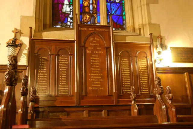
© Nick W · Geograph · CC BY-SA 2.0
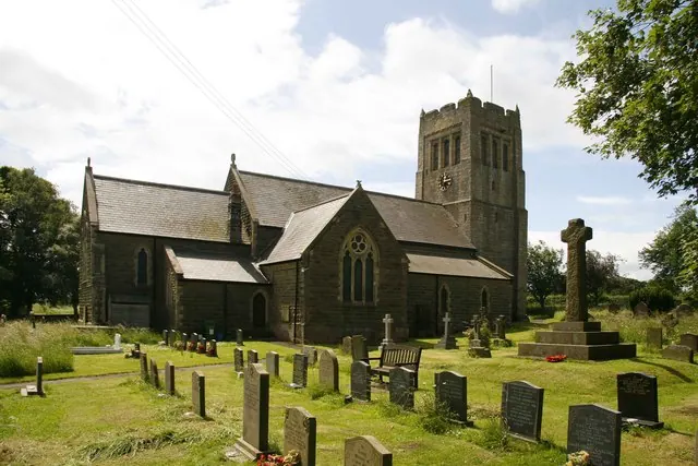
© David Rogers · Geograph · CC BY-SA 2.0
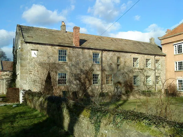
© Matthew Hatton · Geograph · CC BY-SA 2.0
Images © their respective photographers, licensed under CC BY-SA 2.0 and reused here with attribution. Photographs depict listed buildings, churches and monuments near this settlement and may show neighbouring villages.
Location
54.2644°N, -1.6392°W · Land of Count Alan hundred, Yorkshire
View larger map on OpenStreetMap →Data derived from the Open Domesday project (opendomesday.org), based on the Domesday Book dataset compiled by Professor J.J.N. Palmer and team. The Domesday Book (1086) is in the public domain.
Found an inaccuracy? [email protected]