Thornton in the Domesday Book (1086)
The 1086 Domesday survey records the settlement of Thornton, entered under the hundred of Morley in Yorkshire.
Other Settlements in Morley
- Allerton
- Armley
- Batley
- Beeston
- Bolton
- Bowling
- Bradford
- Bramley
- Calverley
- Carlton
- Chellow [Grange]
- Clayton
- Clifton
- Cruttonstall
The Meaning of the Name
The name Thornton is of Anglo-Saxon origin. Its final element derives from the Old English word tūn, a farmstead or village, while the first element appears to represent thorn-bushes. Taken together the name probably meant something close to ’the thorn-bushes farmstead’.
Remarkably, the name has changed little since 1086, when the Domesday scribes wrote it as Thornton.
Listed Buildings Near Thornton
Historic England records 97 listed buildings within about a mile of Thornton. Listing protects structures of special architectural or historic interest, graded I (exceptional), II* (particularly important) and II.
Grade II*
- Thornton Hall - 0.16 km
Grade II
- Stocks to East of Thornton Hall - 0.19 km
- Garden Wall With 4 Bee Boles Inset, to North West of Thornton Hall - 0.19 km
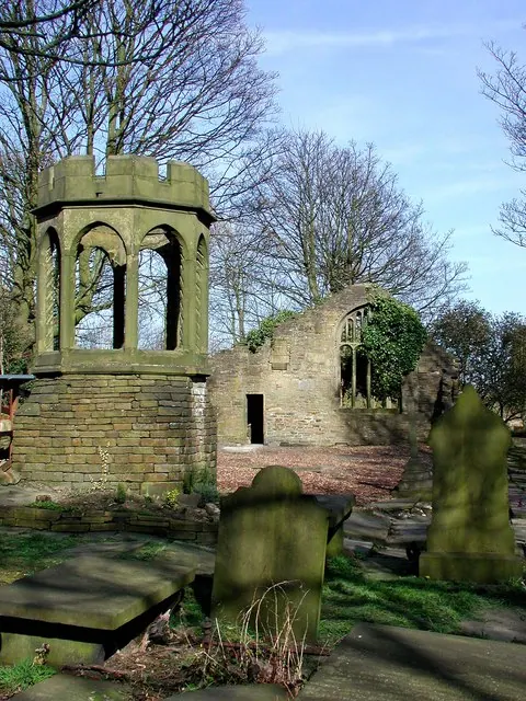
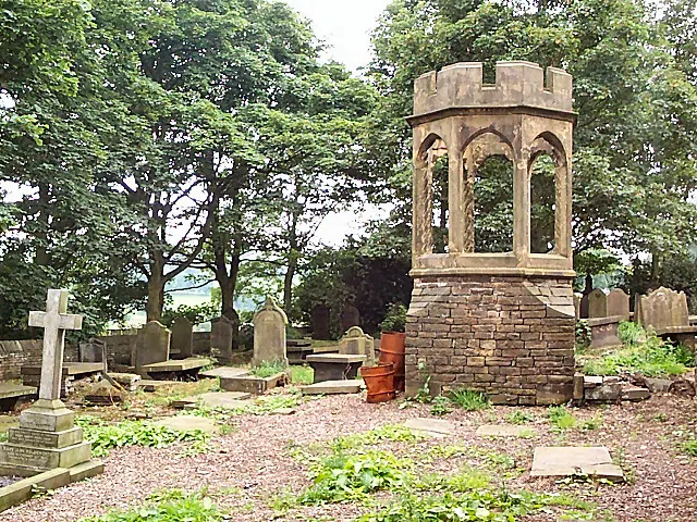
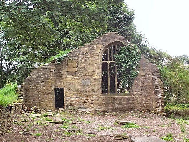
- Ruins of the Chapel of St James, the Old Bell Chapel - 0.21 km
- Church of St James - 0.27 km
- Ashfield House - 0.36 km
- Thorntree Farmhouse and Integral Barn - 0.38 km
- Cresswell Farmhouse and Integral Barn - 0.41 km
- 4-14, Prospect Street Bd13 - 0.42 km
- 283, Thornton Road Bd13 - 0.43 km
- 11-17, Market Street Bd13 - 0.44 km
- Number 19 and Barn - 0.45 km
- 285 and 287, Thornton Road Bd13 - 0.45 km
- Prospect Mill - 0.45 km
- Cloggers Row - 0.46 km
- Oxheys Farmhouse - 0.47 km
- Dye Royd Farmhouse and Adjoining Barn - 0.5 km
- Grandage Gate Farmhouse and Adjoining Barn - 0.51 km
- 1, CORRIE STREET (See details for further address information) - 0.51 km
- 48, 50 and 52, Market Street Bd13 - 0.53 km
- Kipping Independent Chapel - 0.54 km
- 2, 4 and 6, Sapgate Lane Bd13 - 0.54 km
- 15-21, Sapgate Lane Bd13 - 0.55 km
- 54, 56 and 58 (Fern Bank), Market Street - 0.55 km
…and 73 more listed structures in the area.
Thornton Today
Today Thornton lies within the administrative area of Bradford, and the settlement recorded a population of 17,276 at recent figures. Nine and a half centuries separate that figure from the small rural community the Domesday survey recorded here in 1086.
Read more about modern Thornton on Wikipedia .
Nearby Domesday Settlements
Other places recorded in the 1086 survey within a few miles:
- Clayton - 1.0 km E
- Allerton - 1.4 km NE
- Chellow Grange - 3.6 km NE
- Wilsden - 4.1 km N
- Shelf - 4.5 km SE
- Cottingley - 5.1 km N
Heritage Around Thornton
Photographs of churches, listed buildings and monuments in the vicinity, contributed by volunteers to the Geograph project and reused here under a Creative Commons licence.
© Paul Glazzard · Geograph · CC BY-SA 2.0
© David Spencer · Geograph · CC BY-SA 2.0
© David Spencer · Geograph · CC BY-SA 2.0
Images © their respective photographers, licensed under CC BY-SA 2.0 and reused here with attribution. Photographs depict listed buildings, churches and monuments near this settlement and may show neighbouring villages.
Data derived from the Open Domesday project (opendomesday.org), based on the Domesday Book dataset compiled by Professor J.J.N. Palmer and team. The Domesday Book (1086) is in the public domain.
Found an inaccuracy? [email protected]