Thornton Hough in the Domesday Book (1086)
Thornton Hough appears in the Domesday Book of 1086, entered under the hundred of Willaston in Cheshire. The survey assessed Thornton Hough at 2 carucates of taxable land.
Most significantly, Thornton Hough is recorded as waste in 1086 - land rendered uninhabitable and valueless. Before the Conquest, the settlement had been assessed at 13d; by 1086 that value had collapsed entirely. This pattern - prosperity before 1066, devastation by 1086 - is the unmistakable signature of the Harrying of the North , William I’s campaign of systematic destruction across Yorkshire in 1069–70.
Other Settlements in Willaston
The Meaning of the Name
The name Thornton Hough is of Anglo-Saxon origin. Its final element derives from the Old English word tūn, a farmstead or village, while the first element appears to represent thorn-bushes. Taken together the name probably meant something close to ’the thorn-bushes farmstead’.
Remarkably, the name has changed little since 1086, when the Domesday scribes wrote it as Thornton Hough.
Listed Buildings Near Thornton Hough
Historic England records 45 listed buildings within about a mile of Thornton Hough. Listing protects structures of special architectural or historic interest, graded I (exceptional), II* (particularly important) and II.
Grade II
- Nos. 1 to 4 (consec) D’Arcy Cottages - 0.31 km
- 25 and 27, the Folds - 0.34 km
- 17-23, the Folds - 0.34 km
- 4 and 5, Raby Road - 0.34 km
- 3, Raby Road - 0.35 km
- 5-11 the Folds - 0.36 km
- 13 and 15, the Folds - 0.36 km
- 2, Raby Road - 0.37 km
- 1 and 3, the Folds - 0.38 km
- Church of All Saints - 0.42 km
- Vicarage to All Saints Church - 0.46 km
- Thornton House - 0.47 km
- Former School and Masters House - 0.47 km
- Village Post Office and Club - 0.48 km
- 3 and 4, Neston Road - 0.49 km
- 6 and 7, Neston Road - 0.49 km
- 5, Neston Road - 0.49 km
- Stone Shelter to South of St Georges Church - 0.5 km
- 2, Neston Road - 0.5 km
- Smithy - 0.5 km
- Neston Road - 0.5 km
- The Seven Stars Public House - 0.5 km
- Former stables to Thornton House - 0.52 km
- Nos. 1-6 Wilshaw Terrace, Rowan Cottage and the Stores - 0.52 km
…and 21 more listed structures in the area.
Scheduled Monuments Near Thornton Hough
Scheduled monuments are nationally important archaeological sites given legal protection. 1 lies within roughly a mile of Thornton Hough:
- Moated site 400m north east of New Hall - 1.33 km
Thornton Hough Today
Today Thornton Hough lies within the administrative area of Wirral, and the settlement recorded a population of 770 at recent figures. Nine and a half centuries separate that figure from the small rural community the Domesday survey recorded here in 1086.
Read more about modern Thornton Hough on Wikipedia .
Nearby Domesday Settlements
Other places recorded in the 1086 survey within a few miles:
- Raby - 1.4 km SE
- Hargrave - 2.2 km SE
- Leighton - 2.2 km SW
- Little Neston - 3.0 km S
- Poulton Lancelyn - 3.2 km E
- Great Neston - 3.2 km S
Heritage Around Thornton [Hough]
Photographs of churches, listed buildings and monuments in the vicinity, contributed by volunteers to the Geograph project and reused here under a Creative Commons licence.
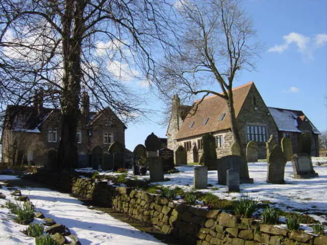
© Sue Adair · Geograph · CC BY-SA 2.0
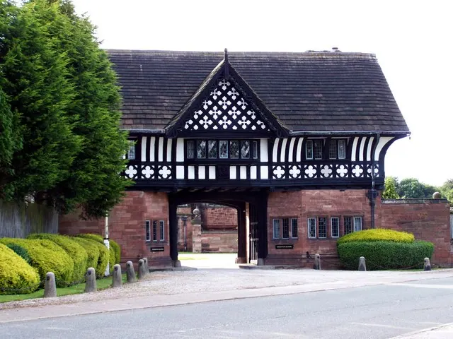
© El Pollock · Geograph · CC BY-SA 2.0
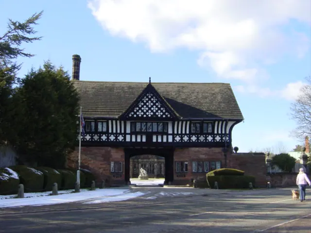
© Sue Adair · Geograph · CC BY-SA 2.0
Images © their respective photographers, licensed under CC BY-SA 2.0 and reused here with attribution. Photographs depict listed buildings, churches and monuments near this settlement and may show neighbouring villages.
Data derived from the Open Domesday project (opendomesday.org), based on the Domesday Book dataset compiled by Professor J.J.N. Palmer and team. The Domesday Book (1086) is in the public domain.
Found an inaccuracy? [email protected]