Thirnby Wood in the Domesday Book (1086)
The settlement of Thirnby Wood is recorded in William I’s Domesday survey of 1086, entered under the hundred of Amounderness in Yorkshire.
Other Settlements in Amounderness
- Aighton
- Aldcliffe
- Aldingham
- Arkholme
- Aschebi
- Ashton [Hall]
- Ashton [on Ribble]
- Austwick
- Barbon
- Bardsea
- Bare
- Barnoldswick
- Barton
- Beetham
The Meaning of the Name
The name Thirnby Wood is of Scandinavian origin. Its final element derives from the Old Norse word bý, a farmstead or village. The first element is most likely a personal name or an early descriptive term, now difficult to recover with certainty. Taken together the name probably meant something close to ‘a farmstead’.
Names of this type are a fingerprint of Scandinavian settlement: they cluster across the old Danelaw, where Norse-speaking settlers renamed or founded villages from the late 9th century onward.
Remarkably, the name has changed little since 1086, when the Domesday scribes wrote it as Thirnby Wood.
Listed Buildings Near Thirnby Wood
Historic England records 50 listed buildings within about a mile of Thirnby Wood. Listing protects structures of special architectural or historic interest, graded I (exceptional), II* (particularly important) and II.
Grade I
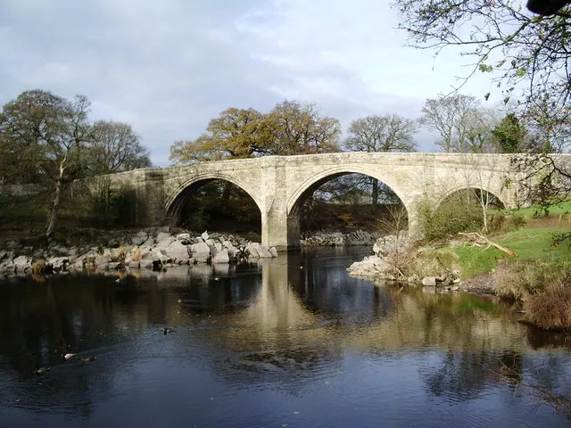
- Devils Bridge - 0.76 km
Grade II
- Summerfield House - 0.33 km
- Lodge to Summerfield House - 0.5 km
- Pair of Piers at Entrance to Drive to Summerfield House - 0.51 km
- County Boundary Stone - 0.51 km
- Boundary Stone - 0.54 km
- Milestone - 0.54 km
- Boundary Stone - 0.56 km
- Milestone - 0.58 km
- Milestone - 0.8 km
- Sellet Mill - 0.89 km
- Summerhouse to South of Green Close - 1.02 km
- Milestone Immediately South East of Town End House - 1.09 km
- Town End House and the Courts - 1.1 km
- Wood End Farmhouse - 1.12 km
- Number 9, Garden Wall and Gatepiers Fronting Road Immediately to North - 1.14 km
- No. 10, MAIN STREET - 1.15 km
- 11 and 13, Main Street - 1.16 km
- 17 and 19, Main Street - 1.17 km
- 16 and 16A, Main Street - 1.17 km
- 18 Main Street - 1.18 km
- 21 and 23, Main Street - 1.18 km
- Jingling End - 1.18 km
- 1, 3, 5, 7, 9, 13 and 15, Market Square - 1.19 km
…and 26 more listed structures in the area.
Scheduled Monuments Near Thirnby Wood
Scheduled monuments are nationally important archaeological sites given legal protection. 4 lie within roughly a mile of Thirnby Wood:
- Devil’s Bridge - 0.76 km
- Sellet Bank prehistoric defended enclosure - 1.09 km
- Roman fort and civil settlement, Over Burrow - 1.5 km
- Cockpit Hill, medieval motte castle - 1.58 km
Nearby Domesday Settlements
Other places recorded in the 1086 survey within a few miles:
- Whittington - 1.4 km SW
- Kirkby Lonsdale - 2.0 km N
- Casterton - 2.2 km NE
- Lower Leck - 3.2 km E
- Newton - 3.6 km SW
- Hutton Roof - 4.1 km W
Heritage Around Thirnby [Wood]
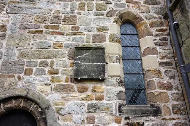
Photographs of churches, listed buildings and monuments in the vicinity, contributed by volunteers to the Geograph project and reused here under a Creative Commons licence.
© Alexander P Kapp · Geograph · CC BY-SA 2.0
© Alexander P Kapp · Geograph · CC BY-SA 2.0
© John Salmon · Geograph · CC BY-SA 2.0
Images © their respective photographers, licensed under CC BY-SA 2.0 and reused here with attribution. Photographs depict listed buildings, churches and monuments near this settlement and may show neighbouring villages.
Data derived from the Open Domesday project (opendomesday.org), based on the Domesday Book dataset compiled by Professor J.J.N. Palmer and team. The Domesday Book (1086) is in the public domain.
Found an inaccuracy? [email protected]