Swine in the Domesday Book (1086)
Swine appears in the Domesday Book of 1086, entered under the hundred of Holderness [Middle Hundred] in Yorkshire.
Other Settlements in Holderness [Middle Hundred]
- Aldbrough
- Benningholme [Hall]
- Bewick [Hall]
- Bilton
- Burton [Constable]
- Burton [Pidsea]
- Conis[ton]
- Danthorpe
- Dowthorpe [Hall]
- Drypool
- Ellerby
- Elstronwick
- Eske
- Etherdwick
The Meaning of the Name
The origin of the name Swine is not securely established from its modern form alone; like many settlement names in the North it likely combines an Old English or Old Norse personal name with a landscape term.
Remarkably, the name has changed little since 1086, when the Domesday scribes wrote it as Swine.
Listed Buildings Near Swine
Historic England records 2 listed buildings within about a mile of Swine. Listing protects structures of special architectural or historic interest, graded I (exceptional), II* (particularly important) and II.
Grade I
- Church of St Mary - 0.39 km
Grade II
- Cross at Grid Ref Ta 138358 - 0.35 km
Scheduled Monuments Near Swine
Scheduled monuments are nationally important archaeological sites given legal protection. 3 lie within roughly a mile of Swine:
- Site of Swine Cistercian nunnery - 0.54 km
- Round barrow 300m south of Castle Hill Farm - 1.37 km
- Swine Castle Hill - 1.55 km
Swine Today
Today Swine lies within the administrative area of East Riding of Yorkshire, and the settlement recorded a population of 136 at the 2021 census. Nine and a half centuries separate that figure from the small rural community the Domesday survey recorded here in 1086.
Read more about modern Swine on Wikipedia .
Nearby Domesday Settlements
Other places recorded in the 1086 survey within a few miles:
- Ganstead - 1.4 km SE
- Coniston - 2.0 km E
- Oubrough - 2.2 km NE
- Ellerby - 3.6 km NE
- Dowthorpe Hall - 3.6 km NE
- Sutton on Hull - 3.6 km SW
Heritage Around Swine
Photographs of churches, listed buildings and monuments in the vicinity, contributed by volunteers to the Geograph project and reused here under a Creative Commons licence.
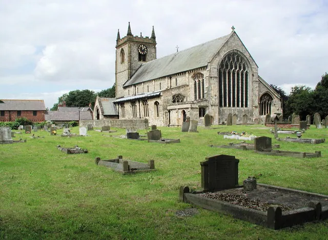
© Paul Glazzard · Geograph · CC BY-SA 2.0
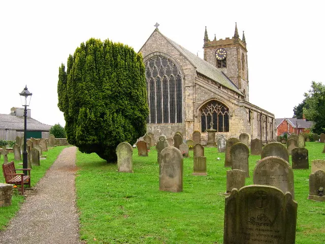
© Stephen Horncastle · Geograph · CC BY-SA 2.0
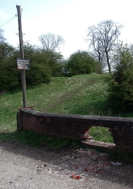
© Paul Glazzard · Geograph · CC BY-SA 2.0
Images © their respective photographers, licensed under CC BY-SA 2.0 and reused here with attribution. Photographs depict listed buildings, churches and monuments near this settlement and may show neighbouring villages.
Location
53.8032°N, -0.2764°W · Holderness [Middle Hundred] hundred, Yorkshire
View larger map on OpenStreetMap →Data derived from the Open Domesday project (opendomesday.org), based on the Domesday Book dataset compiled by Professor J.J.N. Palmer and team. The Domesday Book (1086) is in the public domain.
Found an inaccuracy? [email protected]