Stubham in the Domesday Book (1086)
Stubham is named in the Domesday Book, compiled by Norman commissioners in 1086, entered under the hundred of Skyrack in Yorkshire.
Other Settlements in Skyrack
- Adel
- Allerton [Bywater]
- Alwoodley
- Arthington
- Austhorpe
- Baildon
- Bardsey
- Barwick [in Elmet]
- Bichertun
- Bicherun
- Bingley
- Birkby [Hill]
- Bramhope
- Burden [Head]
The Meaning of the Name
The name Stubham is of Anglo-Saxon origin. Its final element derives from the Old English word hām, a homestead or village. The first element is most likely a personal name or an early descriptive term, now difficult to recover with certainty. Taken together the name probably meant something close to ‘a homestead’.
Remarkably, the name has changed little since 1086, when the Domesday scribes wrote it as Stubham.
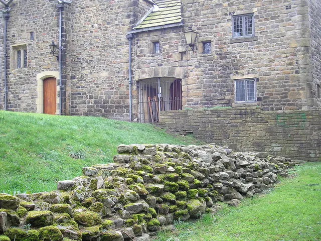
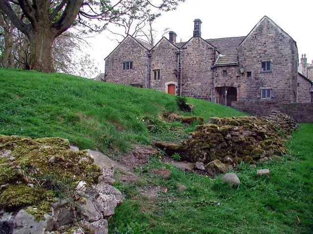
Listed Buildings Near Stubham
Historic England records 54 listed buildings within about a mile of Stubham. Listing protects structures of special architectural or historic interest, graded I (exceptional), II* (particularly important) and II.
Grade I
- Manor House - 0.6 km
- 3 Stone Crosses South of the Church of All Saints - 0.66 km
Grade II*
- Low Hall - 0.11 km
- Parish Church of All Saints - 0.65 km
Grade II
- Post box at junction with Denton Road, on north-east corner - 0.24 km
- Ilkley Lido (Including Cafe and Changing Rooms) - 0.34 km
- Number 14 and Number 16 (Castle House) - 0.6 km
- 14, Church Street - 0.65 km
- 18, Church Street - 0.65 km
- 12, Church Street - 0.65 km
- 16, Church Street - 0.65 km
- 4-6, Church Street - 0.66 km
- 7 Headstones Grouped South West of Church of All Saints - 0.66 km
- All Saints First School - 0.66 km
- 19 and 21, Church Street - 0.68 km
- Church of All Saints Hall - 0.68 km
- Box Tree - 0.69 km
- Northern chapel at Ilkley cemetery - 0.69 km
- Old Grammar School - 0.7 km
- Southern chapel at Ilkley cemetery - 0.7 km
- Lister’s Arms Hotel - 0.71 km
- Crescent Hotel - 0.72 km
- Outbuilding of Crescent Hotel to the East - 0.72 km
- Former Stables of Lister’s Arms Hotel - 0.73 km
…and 30 more listed structures in the area.
Scheduled Monuments Near Stubham
Scheduled monuments are nationally important archaeological sites given legal protection. 4 lie within roughly a mile of Stubham:
- Old Bridge - 0.51 km
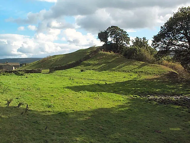
- Site of Roman Fort, Ilkley. - 0.6 km
- Medieval settlement and part of the open field system immediately south of Myddleton Lodge - 0.73 km
- Three carved rocks opposite St Margaret’s Church - 1.19 km
Nearby Domesday Settlements
Other places recorded in the 1086 survey within a few miles:
Heritage Around Stubham
Photographs of churches, listed buildings and monuments in the vicinity, contributed by volunteers to the Geograph project and reused here under a Creative Commons licence.
© David Spencer · Geograph · CC BY-SA 2.0
© John Illingworth · Geograph · CC BY-SA 2.0
© Paul Glazzard · Geograph · CC BY-SA 2.0
Images © their respective photographers, licensed under CC BY-SA 2.0 and reused here with attribution. Photographs depict listed buildings, churches and monuments near this settlement and may show neighbouring villages.
Data derived from the Open Domesday project (opendomesday.org), based on the Domesday Book dataset compiled by Professor J.J.N. Palmer and team. The Domesday Book (1086) is in the public domain.
Found an inaccuracy? [email protected]