Stokesley in the Domesday Book (1086)
Stokesley appears in the Domesday Book of 1086, entered under the hundred of Langbaurgh in Yorkshire.
Other Settlements in Langbaurgh
- Acklam
- Airy [Holme]
- Aislaby
- Arnodestorp
- Baldebi
- Barnaby
- Barwick
- Battersby
- Bergolbi
- Berguluesbi
- Blaten [Carr]
- Borrowby
- Breck
- Brotton
The Meaning of the Name
The name Stokesley is of Anglo-Saxon origin. Its final element derives from the Old English word lēah, a woodland clearing or glade. The first element is most likely a personal name or an early descriptive term, now difficult to recover with certainty. Taken together the name probably meant something close to ‘a clearing’.
Remarkably, the name has changed little since 1086, when the Domesday scribes wrote it as Stokesley.
Listed Buildings Near Stokesley
Historic England records 97 listed buildings within about a mile of Stokesley. Listing protects structures of special architectural or historic interest, graded I (exceptional), II* (particularly important) and II.
Grade II*
- The Old Rectory - 0.09 km
- Manor House and Wall Adjoining - 0.15 km
Grade II
- Garden Wall to North of Number 7 - 0.05 km
- Number 3 Including the Former Number 5 With Garden Wall to North - 0.06 km
- 19, Levenside - 0.08 km
- Church of St Peter and St Paul - 0.08 km
- Wall on North Side of St Peter’s Churchyard - 0.11 km
- The Golden Lion Public House - 0.11 km
- 15, High Street - 0.12 km
- 11, High Street - 0.13 km
- 21 and 23, High Street - 0.13 km
- Martin House and Garden Wall to East - 0.13 km
- 17 and 19, High Street - 0.13 km
- Preston House and Garden Wall to South East - 0.14 km
- Garden Walls and Gate Piers to North, West and South of Manor House - 0.14 km
- Midland Bank - 0.14 km
- 33, High Street - 0.15 km
- The Spread Eagle Public House - 0.16 km
- 35 and 37, High Street - 0.16 km
- 41, High Street - 0.17 km
- The Bay Horse Public House - 0.17 km
- 45 and 45A, High Street - 0.18 km
- The Post Office - 0.19 km
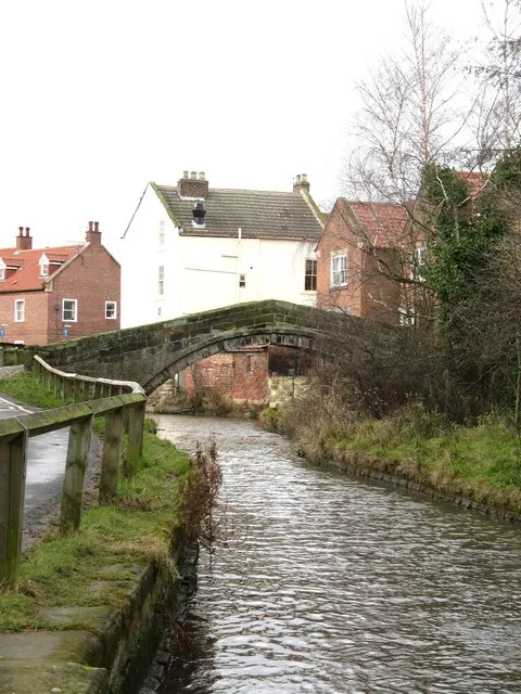
- Packhorse Bridge - 0.19 km
…and 73 more listed structures in the area.
Stokesley Today
Today Stokesley lies within the administrative area of North Yorkshire, and the settlement recorded a population of 4,906 at the 2021 census. Nine and a half centuries separate that figure from the small rural community the Domesday survey recorded here in 1086.
Read more about modern Stokesley on Wikipedia .
Nearby Domesday Settlements
Other places recorded in the 1086 survey within a few miles:
- Tanton - 2.0 km N
- Kirkby - 2.2 km SE
- Great Broughton - 2.8 km SE
- Blaten Carr - 3.0 km S
- Great Busby - 3.0 km S
- Thoraldby Farm - 3.2 km W
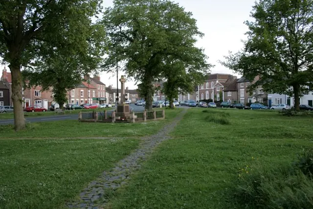
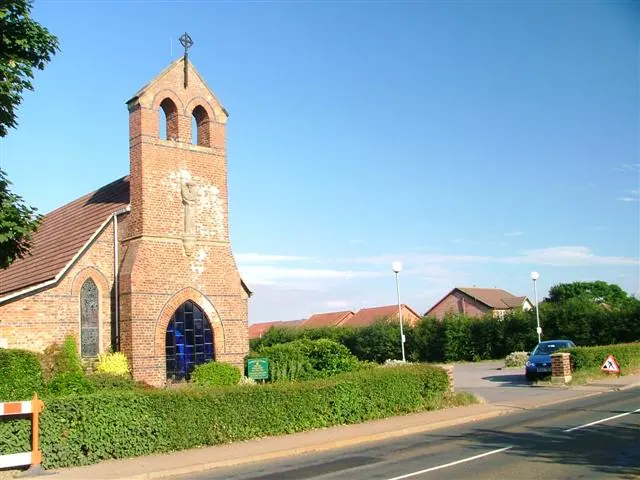
Heritage Around Stokesley
Photographs of churches, listed buildings and monuments in the vicinity, contributed by volunteers to the Geograph project and reused here under a Creative Commons licence.
© Gordon Hatton · Geograph · CC BY-SA 2.0
© Mick Garratt · Geograph · CC BY-SA 2.0
© Mick Garratt · Geograph · CC BY-SA 2.0
Images © their respective photographers, licensed under CC BY-SA 2.0 and reused here with attribution. Photographs depict listed buildings, churches and monuments near this settlement and may show neighbouring villages.
Data derived from the Open Domesday project (opendomesday.org), based on the Domesday Book dataset compiled by Professor J.J.N. Palmer and team. The Domesday Book (1086) is in the public domain.
Found an inaccuracy? [email protected]