Stanley in the Domesday Book (1086)
Stanley appears in the Domesday Book of 1086, entered under the hundred of Morleystone in Derbyshire.
Other Settlements in Morleystone
- Bradley
- Breadsall
- Breaston
- Cellesdene
- Chaddesden
- Codnor
- Crich
- Denby
- Derby
- Draycott
- Duffield
- Hallam
- Heanor
- Herdebi
The Meaning of the Name
The name Stanley is of Anglo-Saxon origin. Its final element derives from the Old English word lēah, a woodland clearing or glade, while the first element appears to represent stone (OE stān). Taken together the name probably meant something close to ’the stone clearing’.
Remarkably, the name has changed little since 1086, when the Domesday scribes wrote it as Stanley.
Listed Buildings Near Stanley
Historic England records 8 listed buildings within about a mile of Stanley. Listing protects structures of special architectural or historic interest, graded I (exceptional), II* (particularly important) and II.
Grade II*
- Church of St Wilfrid - 0.9 km
Grade II
- Church Cottage - 0.67 km
- Church of St Andrew - 0.67 km
- Stanley and Stanley Common Parish War Memorial - 0.71 km
- The Old School - 0.89 km
- Village Hall - 0.97 km
- War Memorial - 0.98 km
- Cinder Cottage Ye Olde Cinder House - 1.15 km
Scheduled Monuments Near Stanley
Scheduled monuments are nationally important archaeological sites given legal protection. 2 lie within roughly a mile of Stanley:
- Medieval iron working remains at Stanley monastic grange - 0.21 km
- Moated site and two fishponds at Moat Wood - 1.27 km
Stanley Today
Today Stanley lies within the administrative area of Stanley and Stanley Common.
Read more about modern Stanley on Wikipedia .
Nearby Domesday Settlements
Other places recorded in the 1086 survey within a few miles:
Heritage Around Stanley
Photographs of churches, listed buildings and monuments in the vicinity, contributed by volunteers to the Geograph project and reused here under a Creative Commons licence.
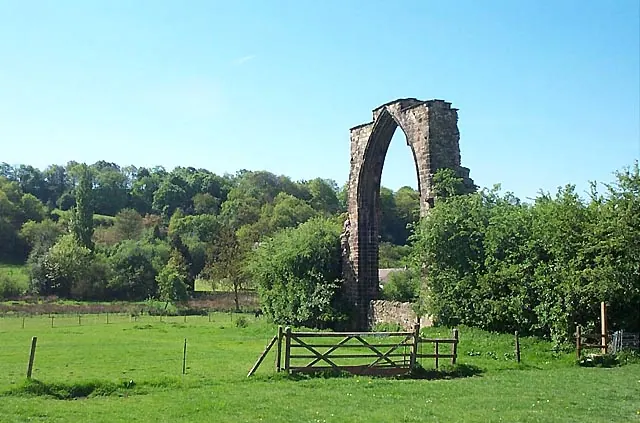
© Garth Newton · Geograph · CC BY-SA 2.0
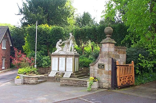
© Garth Newton · Geograph · CC BY-SA 2.0
© Stephen McKay · Geograph · CC BY-SA 2.0
Images © their respective photographers, licensed under CC BY-SA 2.0 and reused here with attribution. Photographs depict listed buildings, churches and monuments near this settlement and may show neighbouring villages.
Data derived from the Open Domesday project (opendomesday.org), based on the Domesday Book dataset compiled by Professor J.J.N. Palmer and team. The Domesday Book (1086) is in the public domain.
Found an inaccuracy? [email protected]