Spofforth in the Domesday Book (1086)
Spofforth is named in the Domesday Book, compiled by Norman commissioners in 1086, entered under the hundred of Burghshire in Yorkshire. The survey assessed Spofforth at 2.0 carucates of taxable land.
At the time of the survey, Spofforth supported a recorded population of 1 villager, 4 smallholders, 24 freemanmen, working 6 ploughs between them.
By 1086 Spofforth was worth 5.51 shillings, up from 2 shillings before the Conquest – in contrast to many Yorkshire neighbours whose valuations collapsed.
The survey lists 2 manors at Spofforth under different lords. Splitting a single settlement between multiple tenants was common across the North – Saxon estates broken up and handed to William’s followers after 1066.
Resources Recorded at Spofforth (1086)
- Churches: 0
- Cattle: 4
- Pigs: 22
- Sheep: 40
- Horses (cobs): 1
- Meadow: 4 acres
Other Settlements in Burghshire
- Addlethorpe
- Aismunderby
- Aldfield
- Allerton [Mauleverer]
- Arkendale
- Askwith
- Azerley
- Barrowby [Grange]
- Beckwith [House]
- Besthaim
- Bestham
- Bewerley
- Bilton
- Birstwith
The Meaning of the Name
The name Spofforth is of Anglo-Saxon origin. Its final element derives from the Old English word ford, a river crossing. The first element is most likely a personal name or an early descriptive term, now difficult to recover with certainty. Taken together the name probably meant something close to ‘a ford’.
Remarkably, the name has changed little since 1086, when the Domesday scribes wrote it as Spofforth.
Listed Buildings Near Spofforth
Historic England records 16 listed buildings within about a mile of Spofforth. Listing protects structures of special architectural or historic interest, graded I (exceptional), II* (particularly important) and II.
Grade II*
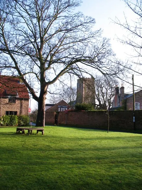
- Church of All Saints - 0.42 km
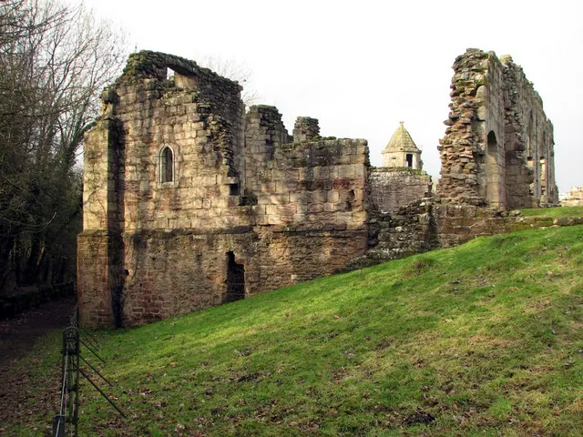
- Spofforth Castle, Ruins - 0.69 km
Grade II
- John Metcalf Memorial Approximately 15 Metres From East End of North Aisle of Church of All Saints - 0.39 km
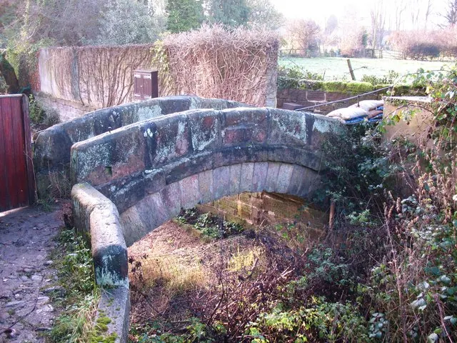
- Packhorse Bridge Approximately 1 Metre to West of Old Corn Mill - 0.39 km
- Mounting Block - 0.41 km
- Archway With Gates and Flanking Walls and Inner, Freestanding Archway to the Old Rectory - 0.42 km
- The Old Rectory - 0.46 km
- Chantry House Massey Garth - 0.5 km
- Brookroyd Cottage - 0.52 km
- Manor House - 0.55 km
- Milepost Against North Corner of Castle Farmhouse - 0.57 km
- 26 and 28, High Street - 0.57 km
- Castle Farmhouse - 0.58 km
- 47, 49, 51 and 53, Castle Street - 0.59 km
- Aketon Close - 1.04 km
- Stables at Aketon Close - 1.07 km
Scheduled Monuments Near Spofforth
Scheduled monuments are nationally important archaeological sites given legal protection. 1 lies within roughly a mile of Spofforth:
- Spofforth Castle magnates’ residence - 0.63 km
Spofforth Today
Today Spofforth lies within the administrative area of Spofforth with Stockeld.
Read more about modern Spofforth on Wikipedia .
Nearby Domesday Settlements
Other places recorded in the 1086 survey within a few miles:
- Caldeuuelle - 0.0 km N
- Cradeuuelle - 0.0 km N
- Newsome Farm - 1.0 km E
- Great Braham - 1.4 km NW
- Little Braham - 1.4 km NW
- Great and Little Ribston - 2.8 km NE
Heritage Around Spofforth
Photographs of churches, listed buildings and monuments in the vicinity, contributed by volunteers to the Geograph project and reused here under a Creative Commons licence.
© Gordon Hatton · Geograph · CC BY-SA 2.0
© John Sutton · Geograph · CC BY-SA 2.0
© Gordon Hatton · Geograph · CC BY-SA 2.0
Images © their respective photographers, licensed under CC BY-SA 2.0 and reused here with attribution. Photographs depict listed buildings, churches and monuments near this settlement and may show neighbouring villages.
Data derived from the Open Domesday project (opendomesday.org), based on the Domesday Book dataset compiled by Professor J.J.N. Palmer and team. The Domesday Book (1086) is in the public domain.
Found an inaccuracy? [email protected]