South? Wingfield in the Domesday Book (1086)
South? Wingfield appears in the Domesday Book of 1086, entered under the hundred of Scarsdale in Derbyshire.
Other Settlements in Scarsdale
- Alfreton
- Ashover
- Barlborough
- Barlow
- Beighton
- Blingsby
- Bolsover
- Boythorpe
- Bramley [Vale]
- Brimington
- Calow
- Chesterfield
- Clowne
- Dore
The Meaning of the Name
The name South? Wingfield is of Anglo-Saxon origin. Its final element derives from the Old English word feld, open country. The first element is most likely a personal name or an early descriptive term, now difficult to recover with certainty. Taken together the name probably meant something close to ‘a open land’.
Remarkably, the name has changed little since 1086, when the Domesday scribes wrote it as South? Wingfield.
Listed Buildings Near South? Wingfield
Historic England records 28 listed buildings within about a mile of South? Wingfield. Listing protects structures of special architectural or historic interest, graded I (exceptional), II* (particularly important) and II.
Grade I
Grade II*
- Church of All Saints - 0.79 km
Grade II
- Boundary Wall and Two Pairs of Gate Piers at Wingfield House - 0.01 km
- Wingfield House - 0.03 km
- Stables and Coach House to Wingfield House - 0.03 km
- Outbuilding to the West of Wingfield House - 0.05 km
- Zion Cottage - 0.06 km
- Outbuilding to the South of Malthouse Farmhouse - 0.1 km
- Malthouse Farmhouse and Boundary Wall to East - 0.11 km
- The Manor - 0.19 km
- Park Cottage - 0.2 km
- Manor Cottage - 0.27 km
- Outbuilding to the south of Windy Gap Farm - 0.29 km
- Prospect House - 0.29 km
- Outbuildings to the South of Manor Cottage - 0.29 km
- Wingfield Hall - 0.42 km
- Stable Block at Wingfield Hall - 0.43 km
- Garden Walls to West of Farm Outbuilding, to the West of the Stables to Wingfield Hall - 0.43 km
- Hovel to the south of the stables to Wingfield Hall - 0.45 km
- Outbuilding to the West of the Stables to Wingfield Hall - 0.45 km
- Road Bridge to the South West of St Matthews Church - 0.71 km
- South Wingfield Footpath Bridge (SPC8 56) - 0.81 km
- Railway bridge south of South Wingfield Stationmaster’s House - 0.88 km
- Wall Between Wingfield Station From End of the Front Boundary to the Stationmaster’s House - 0.93 km
…and 4 more listed structures in the area.
Scheduled Monuments Near South? Wingfield
Scheduled monuments are nationally important archaeological sites given legal protection. 1 lies within roughly a mile of South? Wingfield:
- Wingfield Manor: a medieval great house - 0.75 km
South? Wingfield Today
Today South? Wingfield lies within the administrative area of Amber Valley, and the settlement recorded a population of 1,535 at the 2021 census. Nine and a half centuries separate that figure from the small rural community the Domesday survey recorded here in 1086.
Read more about modern South Wingfield on Wikipedia .
Nearby Domesday Settlements
Other places recorded in the 1086 survey within a few miles:
- Wessington - 2.0 km N
- Ufton - 2.2 km NE
- Crich - 2.2 km SW
- Pentrich - 3.2 km S
- Shuckstone - 3.6 km NW
- Shirland - 3.6 km NE
Heritage Around [South?] Wingfield
Photographs of churches, listed buildings and monuments in the vicinity, contributed by volunteers to the Geograph project and reused here under a Creative Commons licence.
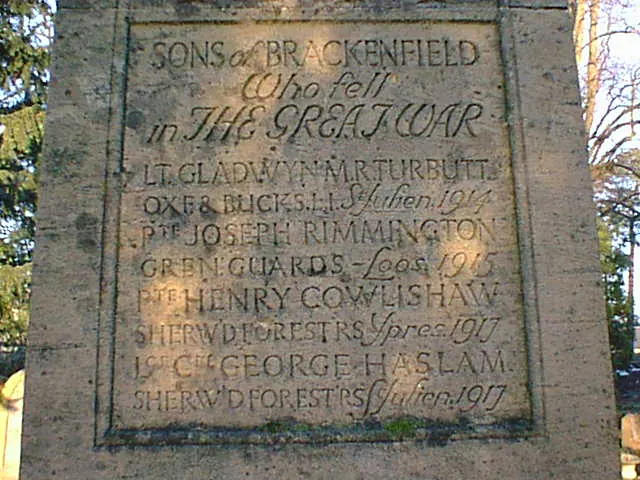
© Alan Heardman · Geograph · CC BY-SA 2.0
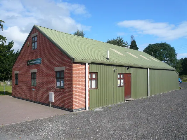
© Alan Heardman · Geograph · CC BY-SA 2.0
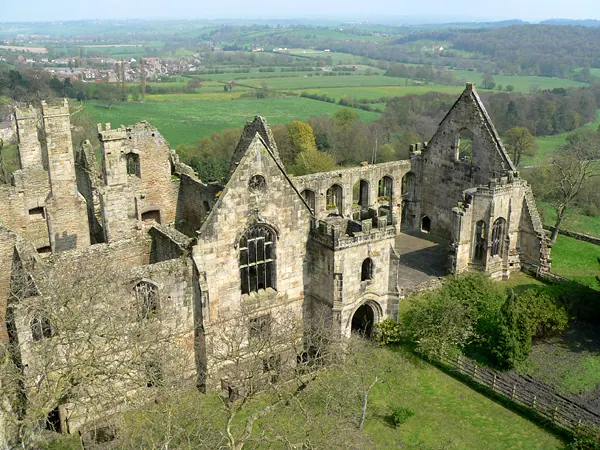
© Sam Styles · Geograph · CC BY-SA 2.0
Images © their respective photographers, licensed under CC BY-SA 2.0 and reused here with attribution. Photographs depict listed buildings, churches and monuments near this settlement and may show neighbouring villages.
Data derived from the Open Domesday project (opendomesday.org), based on the Domesday Book dataset compiled by Professor J.J.N. Palmer and team. The Domesday Book (1086) is in the public domain.
Found an inaccuracy? [email protected]