Slingsby in the Domesday Book (1086)
The settlement of Slingsby is recorded in William I’s Domesday survey of 1086, entered under the hundred of Maneshou in Yorkshire.
Other Settlements in Maneshou
- Amotherby
- Ampleforth
- Appleton [le Street]
- Beadlam
- Brawby
- Broughton
- Cawton
- Coulton
- Fadmoor
- Fryton
- Gillamoor
- Gilling [East]
- Griff [Farm]
- Grimston
The Meaning of the Name
The name Slingsby is of Scandinavian origin. Its final element derives from the Old Norse word bý, a farmstead or village. The first element is most likely a personal name or an early descriptive term, now difficult to recover with certainty. Taken together the name probably meant something close to ‘a farmstead’.
Names of this type are a fingerprint of Scandinavian settlement: they cluster across the old Danelaw, where Norse-speaking settlers renamed or founded villages from the late 9th century onward.
Remarkably, the name has changed little since 1086, when the Domesday scribes wrote it as Slingsby.
Listed Buildings Near Slingsby
Historic England records 35 listed buildings within about a mile of Slingsby. Listing protects structures of special architectural or historic interest, graded I (exceptional), II* (particularly important) and II.
Grade II*
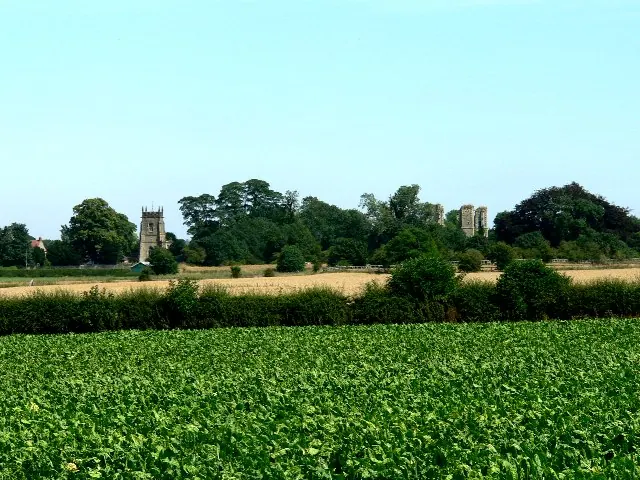
- Church of All Saints, Slingsby - 0.51 km
Grade II
- Slingsby Heights and Gates and Railings to Front - 0.08 km
- West Flatts Farmhouse - 0.1 km
- Heights Farmhouse - 0.2 km
- Mile Post at Southern End of Balkside - 0.25 km
- Grey Gables - 0.26 km
- Castle Farmhouse - 0.26 km
- Bransdale - 0.32 km
- Bag End - 0.32 km
- Ivy Cottage and Castle House - 0.34 km
- Glebe Cottage - 0.35 km
- Dossers House - 0.36 km
- Lindon House and Gate and Railings to Front - 0.37 km
- Porch Farmhouse and Cottage - 0.39 km
- Schoolroom and School House - 0.41 km
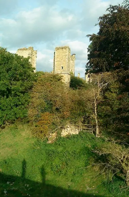
- Ruins of Slingsby Castle - 0.42 km
- Wesleyan Chapel and Hall - 0.42 km
- The Reading Room - 0.42 km
- The Green - 0.44 km
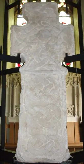
- Tomb Chest Commemorating Members of the Markinfield Family Approximately 3 Metres to South of Porch of All Saints Church - 0.5 km
- Wyville Hall and Wyville Cottage - 0.51 km
- Wheatlands Farmhouse - 0.51 km
- House Immediately to the North of Cooperative Stores - 0.57 km
- The Old Rectory - 0.57 km
…and 11 more listed structures in the area.
Scheduled Monuments Near Slingsby
Scheduled monuments are nationally important archaeological sites given legal protection. 7 lie within roughly a mile of Slingsby:
- Slingsby Castle - 0.4 km
- Iron Age barrow cemetery - 0.75 km
- Round barrow 800m north east of High Baxtonhowe - 1.21 km
- Linear dyke extending for 2.1km from Fryton West Wood to Slingsby Banks Wood - 1.21 km
- Round barrow 750m ENE of High Baxtonhowe - 1.53 km
- Round barrow 230m ENE of Hall Moor Plantation - 1.55 km
- Round barrow 570m ENE of High Baxtonhowe - 1.55 km
Slingsby Today
Today Slingsby lies within the administrative area of Ryedale, and the settlement recorded a population of 593 at the 2021 census. Nine and a half centuries separate that figure from the small rural community the Domesday survey recorded here in 1086.
Read more about modern Slingsby on Wikipedia .
Nearby Domesday Settlements
Other places recorded in the 1086 survey within a few miles:
- Fryton - 1.4 km NW
- Hawade - 2.2 km NW
- Wath - 2.2 km NW
- Howthorpe Farm - 2.8 km SW
- Barton le Street - 3.0 km E
- Hovingham - 3.2 km W
Heritage Around Slingsby
Photographs of churches, listed buildings and monuments in the vicinity, contributed by volunteers to the Geograph project and reused here under a Creative Commons licence.
© Roger Gilbertson · Geograph · CC BY-SA 2.0
© Matthew Hatton · Geograph · CC BY-SA 2.0
© Matthew Hatton · Geograph · CC BY-SA 2.0
Images © their respective photographers, licensed under CC BY-SA 2.0 and reused here with attribution. Photographs depict listed buildings, churches and monuments near this settlement and may show neighbouring villages.
Data derived from the Open Domesday project (opendomesday.org), based on the Domesday Book dataset compiled by Professor J.J.N. Palmer and team. The Domesday Book (1086) is in the public domain.
Found an inaccuracy? [email protected]