Sherburn in the Domesday Book (1086)
The 1086 Domesday survey records the settlement of Sherburn, entered under the hundred of Toreshou in Yorkshire.
Other Settlements in Toreshou
- Cottam
- Cowlam
- Croom [House]
- Helperthorpe
- Kirby [Grindalythe]
- Knapton
- Newton
- Sledmere
- Thirkleby [Manor]
- Turodebi
- Ulchiltorp
- Weaverthorpe
- [East and West] Lutton
- [East] Heslerton
The Meaning of the Name
The origin of the name Sherburn is not securely established from its modern form alone; like many settlement names in the North it likely combines an Old English or Old Norse personal name with a landscape term.
Remarkably, the name has changed little since 1086, when the Domesday scribes wrote it as Sherburn.
Listed Buildings Near Sherburn
Historic England records 11 listed buildings within about a mile of Sherburn. Listing protects structures of special architectural or historic interest, graded I (exceptional), II* (particularly important) and II.
Grade II*
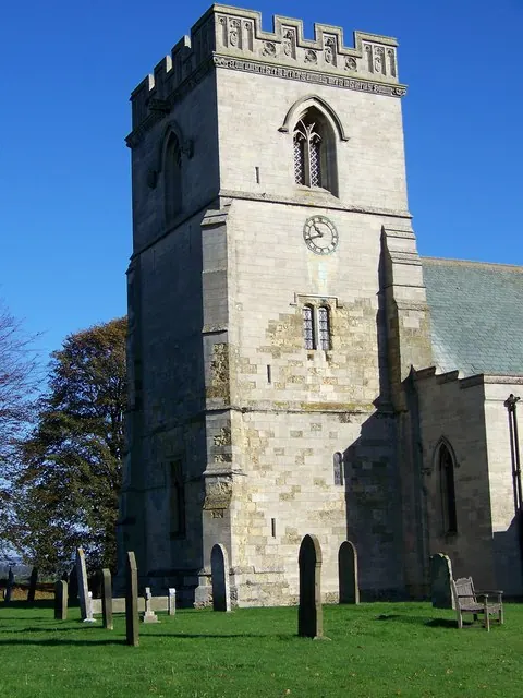
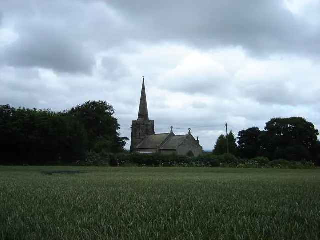
- Church of St Hilda - 1.01 km
Grade II
- Brewery House - 0.25 km
- Old Pigeon Pie Court - 0.35 km
- Pasture House Farmhouse - 0.36 km
- Corner Farmhouse - 0.39 km
- Range of Farmbuildings at Rear of Corner Farmhouse - 0.41 km
- 9, St Hilda’s Street - 0.43 km
- 13, St Hilda’s Street - 0.44 km
- Milepost Approximately 200 Metres East of Sherburn Lodge - 0.69 km
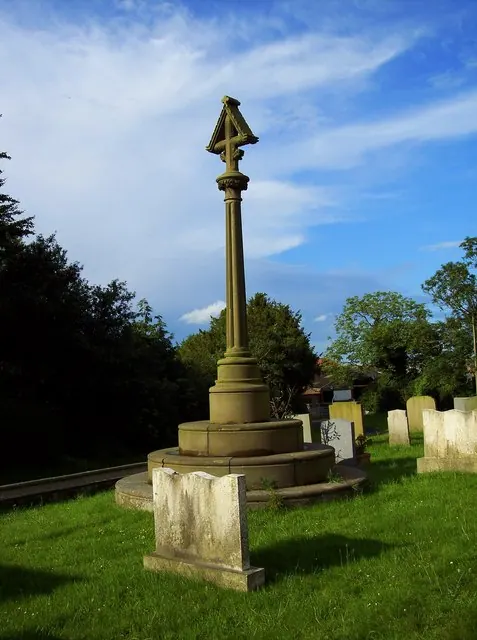
- Village Cross - 0.88 km
- Lychgate and Attached Churchyard Wall, Approximately 50 Metres South-west of Church of St Hilda - 0.98 km
Scheduled Monuments Near Sherburn
Scheduled monuments are nationally important archaeological sites given legal protection. 1 lies within roughly a mile of Sherburn:
- Round barrow NE of Lawson’s Wold Barn - 1.32 km
Sherburn Today
Today Sherburn lies within the administrative area of Ryedale, and the settlement recorded a population of 870 at the 2021 census. Nine and a half centuries separate that figure from the small rural community the Domesday survey recorded here in 1086.
Read more about modern Sherburn on Wikipedia .
Nearby Domesday Settlements
Other places recorded in the 1086 survey within a few miles:
- Potter Brompton - 2.0 km E
- East Heslerton - 3.0 km W
- Ganton - 4.1 km E
- West Heslerton - 4.1 km W
- Binnington - 4.5 km NE
- Weaverthorpe - 5.1 km S
Heritage Around Sherburn
Photographs of churches, listed buildings and monuments in the vicinity, contributed by volunteers to the Geograph project and reused here under a Creative Commons licence.
© Maigheach-gheal · Geograph · CC BY-SA 2.0
© Maigheach-gheal · Geograph · CC BY-SA 2.0
© Martin Dawes · Geograph · CC BY-SA 2.0
Images © their respective photographers, licensed under CC BY-SA 2.0 and reused here with attribution. Photographs depict listed buildings, churches and monuments near this settlement and may show neighbouring villages.
Data derived from the Open Domesday project (opendomesday.org), based on the Domesday Book dataset compiled by Professor J.J.N. Palmer and team. The Domesday Book (1086) is in the public domain.
Found an inaccuracy? [email protected]