Shadwell in the Domesday Book (1086)
Shadwell is named in the Domesday Book, compiled by Norman commissioners in 1086, entered under the hundred of Skyrack in Yorkshire.
Other Settlements in Skyrack
- Adel
- Allerton [Bywater]
- Alwoodley
- Arthington
- Austhorpe
- Baildon
- Bardsey
- Barwick [in Elmet]
- Bichertun
- Bicherun
- Bingley
- Birkby [Hill]
- Bramhope
- Burden [Head]
The Meaning of the Name
The name Shadwell is of Anglo-Saxon origin. Its final element derives from the Old English word wella, a spring or stream. The first element is most likely a personal name or an early descriptive term, now difficult to recover with certainty. Taken together the name probably meant something close to ‘a spring’.
Remarkably, the name has changed little since 1086, when the Domesday scribes wrote it as Shadwell.
Listed Buildings Near Shadwell
Historic England records 16 listed buildings within about a mile of Shadwell. Listing protects structures of special architectural or historic interest, graded I (exceptional), II* (particularly important) and II.
Grade II
- Manor Farmhouse, Outbuildings, Mounting Steps to North East and Garden Wall to South West - 0.23 km
- War Memorial in St Pauls Churchyard - 0.23 km
- Church of St Paul - 0.24 km
- Farm Buildings West of Manor Farmhouse - 0.25 km
- Barn and Byre Range North of Manor Farmhouse - 0.26 km
- 197-205, Main Street - 0.26 km
- 133-139, Main Street - 0.41 km
- 125, Main Street - 0.45 km
- Shadwell Branch Library - 0.56 km
- 1-8, Crofton Terrace - 0.59 km
- Pigeon House Approximately 150 Metres North West of Redhall House - 0.81 km
- Former Coach House and Stables West of Redhall House - 0.9 km
- Redhall House - 0.91 km
- Milestone Approximately 20 Metres North of Junction With Carr Lane - 0.97 km
- Range of Farm Buildings to East of Cobble Hall - 1.25 km
- Pair of Cottages Immediately North East of Cobble Hall - 1.29 km
Shadwell Today
Today Shadwell lies within the administrative area of Leeds, and the settlement recorded a population of 1,971 at the 2021 census. Nine and a half centuries separate that figure from the small rural community the Domesday survey recorded here in 1086.
Read more about modern Shadwell on Wikipedia .
Nearby Domesday Settlements
Other places recorded in the 1086 survey within a few miles:
- Birkby Hill - 1.0 km E
- Thorner - 3.2 km E
- Wheatcroft - 3.2 km E
- Wike - 3.2 km N
- Alwoodley - 3.6 km NW
- Seacroft - 4.1 km S
Heritage Around Shadwell
Photographs of churches, listed buildings and monuments in the vicinity, contributed by volunteers to the Geograph project and reused here under a Creative Commons licence.
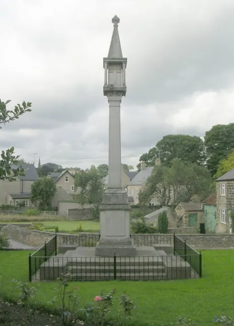
© Betty Longbottom · Geograph · CC BY-SA 2.0
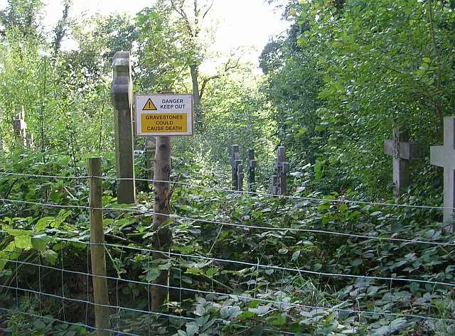
© Betty Longbottom · Geograph · CC BY-SA 2.0
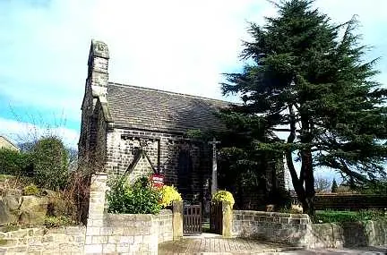
© Bill Henderson · Geograph · CC BY-SA 2.0
Images © their respective photographers, licensed under CC BY-SA 2.0 and reused here with attribution. Photographs depict listed buildings, churches and monuments near this settlement and may show neighbouring villages.
Data derived from the Open Domesday project (opendomesday.org), based on the Domesday Book dataset compiled by Professor J.J.N. Palmer and team. The Domesday Book (1086) is in the public domain.
Found an inaccuracy? [email protected]