Sefton in the Domesday Book (1086)
Sefton appears in the Domesday Book of 1086, entered under the hundred of [West] Derby in Cheshire.
Other Settlements in [West] Derby
- Ainsdale
- Allerton
- Argarmeles
- Aughton
- Barton
- Bootle
- Childwall
- Dalton
- Downholland
- Formby
- Halsall
- Hurlston
- Huyton
- Ince [Blundell]
The Meaning of the Name
The name Sefton is of Anglo-Saxon origin. Its final element derives from the Old English word tūn, a farmstead or village. The first element is most likely a personal name or an early descriptive term, now difficult to recover with certainty. Taken together the name probably meant something close to ‘a farmstead’.
Remarkably, the name has changed little since 1086, when the Domesday scribes wrote it as Sefton.
Listed Buildings Near Sefton
Historic England records 19 listed buildings within about a mile of Sefton. Listing protects structures of special architectural or historic interest, graded I (exceptional), II* (particularly important) and II.
Grade I
- Church of St Helen - 0.2 km
Grade II
- Punch Bowl Hotel - 0.16 km
- Cross Base to North of Lych Gate to South West of St Helen’s - 0.2 km
- Sundial Approximately 11 Metres South of Church of St Helen - 0.22 km
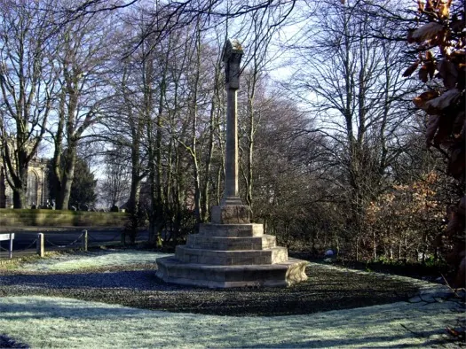
- War Memorial Opposite St Helen’s Church - 0.23 km
- Wall to Churchyard of St Helen’s - 0.23 km
- 1 to 4, Sefton Mill Court - 0.24 km
- Well Cottage - 0.27 km
- 5 and 6, Sefton Mill Court - 0.27 km
- Former Grange Farmhouse and Outbuilding - 0.43 km
- Former Old Hall Farmhouse and Barn - 0.46 km
- The Chestnuts - 0.87 km
- Lunt House Farmhouse - 0.89 km
- The Tythe Barn - 0.9 km
- Manor House Lodge - 1.13 km
- Remains of Ancient Arch at Left Hand Hand End of Left Return of Manor House - 1.16 km
- Nos 1-12 Manor House - 1.17 km
- Manor House - 1.21 km
- Stone Structure Approximately 70 Metres to North-east of Manor House - 1.25 km
Scheduled Monuments Near Sefton
Scheduled monuments are nationally important archaeological sites given legal protection. 2 lie within roughly a mile of Sefton:
- Sefton Old Hall moated site and fishponds, Sefton. - 0.34 km
- Maghull Manor moated site - 1.22 km
Sefton Today
Today Sefton records a population of 1,020 at the 2021 census. Nine and a half centuries separate that figure from the small rural community the Domesday survey recorded here in 1086.
Read more about modern Sefton on Wikipedia .
Nearby Domesday Settlements
Other places recorded in the 1086 survey within a few miles:
- Thornton - 1.0 km W
- Maghull - 2.2 km NE
- Lydiate - 3.2 km N
- Ince Blundell - 3.6 km NW
- Melling - 4.1 km E
- Great and Little Crosby - 4.5 km SW
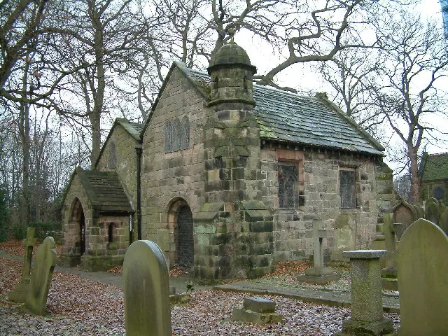
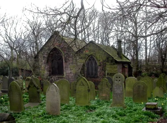
Heritage Around Sefton
Photographs of churches, listed buildings and monuments in the vicinity, contributed by volunteers to the Geograph project and reused here under a Creative Commons licence.
© Tom Pennington · Geograph · CC BY-SA 2.0
© Peter Hodge · Geograph · CC BY-SA 2.0
© Tom Pennington · Geograph · CC BY-SA 2.0
Images © their respective photographers, licensed under CC BY-SA 2.0 and reused here with attribution. Photographs depict listed buildings, churches and monuments near this settlement and may show neighbouring villages.
Data derived from the Open Domesday project (opendomesday.org), based on the Domesday Book dataset compiled by Professor J.J.N. Palmer and team. The Domesday Book (1086) is in the public domain.
Found an inaccuracy? [email protected]