Scargill in the Domesday Book (1086)
Scargill is named in the Domesday Book, compiled by Norman commissioners in 1086, entered under the hundred of Land of Count Alan in Yorkshire.
Other Settlements in Land of Count Alan
- Achebi
- Agglethorpe
- Ainderby [Mires]
- Ainderby [Quernhow]
- Aiskew
- Aldbrough
- Allerthorpe [Hall]
- Ascam
- Ascham
- Asebi
- Aske [Hall]
- Askrigg
- Aysgarth
- Baldersby
The Meaning of the Name
The name Scargill is of Scandinavian origin. Its final element derives from the Old Norse word gil, a narrow ravine. The first element is most likely a personal name or an early descriptive term, now difficult to recover with certainty. Taken together the name probably meant something close to ‘a ravine’.
Names of this type are a fingerprint of Scandinavian settlement: they cluster across the old Danelaw, where Norse-speaking settlers renamed or founded villages from the late 9th century onward.
Remarkably, the name has changed little since 1086, when the Domesday scribes wrote it as Scargill.
Listed Buildings Near Scargill
Historic England records 7 listed buildings within about a mile of Scargill. Listing protects structures of special architectural or historic interest, graded I (exceptional), II* (particularly important) and II.
Grade II*
- Scargill Castle - 0.35 km
Grade II
- Foundations and Fragment of A Chapel - 0.12 km
- Garden Wall to South of Castle Farmhouse - 0.4 km
- Castle Farmhouse and Byre With Loft to Left - 0.41 km
- Cottage, Byre and Loose Boxes, 10 Metres North of Castle Farmhouse - 0.43 km
- Cowclose House and Adjacent Byre - 1.19 km
- Brignall Mill House - 1.22 km
Scheduled Monuments Near Scargill
Scheduled monuments are nationally important archaeological sites given legal protection. 10 lie within roughly a mile of Scargill:
- Medieval chapel 350m south east of Castle Farm - 0.13 km
- Scargill fortified house, medieval settlement and associated field system - 0.43 km
- Ring cairn at the northern end of Scale Knoll Allotment, 750m WNW of Haythwaite - 1.32 km
- A cairn and a carved rock west of Cowclose Gill, in Scale Knoll Allotment, 460m west of Haythwaite, Barningham Moor - 1.36 km
- Ring cairn 350m east of Haythwaite, Barningham Moor - 1.37 km
- Unenclosed settlement, 260m south east of Cowclose House, Barnigham Moor - 1.44 km
- Prehistoric enclosure on the west side of Scale Knoll Gill, 400m WSW of Haythwaite, Barningham Moor - 1.49 km
- Carved rock and Romano-British settlement known as Greystone, 250m south of Moorcock Farm, Barningham Moor - 1.53 km
- Prehistoric enclosure 530m and a rubble bank 500m east of Haythwaite in Scale Knoll Allotment, Barningham Moor - 1.54 km
- Carved rock and cairn in Rowley Intake, 410m south east of Cowclose House, Barningham Moor - 1.59 km
Scargill Today
Today Scargill lies within the administrative area of County Durham, and the settlement recorded a population of 39 at the 2021 census. Nine and a half centuries separate that figure from the small rural community the Domesday survey recorded here in 1086.
Read more about modern Scargill on Wikipedia .
Nearby Domesday Settlements
Other places recorded in the 1086 survey within a few miles:
- Brignall - 2.8 km NE
- Barningham - 3.0 km E
- Newsham - 5.0 km E
- Mortham Tower - 5.0 km NE
- Rokeby Hall - 5.0 km NE
- Broughton House - 5.1 km E
Heritage Around Scargill
Photographs of churches, listed buildings and monuments in the vicinity, contributed by volunteers to the Geograph project and reused here under a Creative Commons licence.
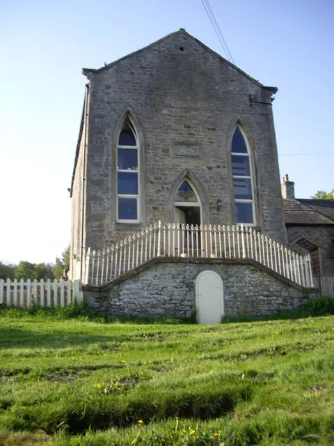
© Stanley Howe · Geograph · CC BY-SA 2.0
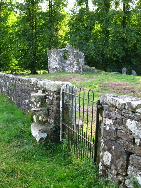
© David Rogers · Geograph · CC BY-SA 2.0
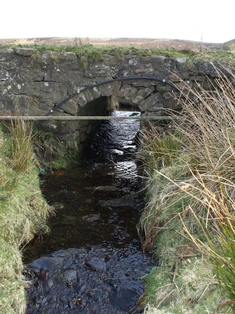
© Matthew Hatton · Geograph · CC BY-SA 2.0
Images © their respective photographers, licensed under CC BY-SA 2.0 and reused here with attribution. Photographs depict listed buildings, churches and monuments near this settlement and may show neighbouring villages.
Location
54.4897°N, -1.9151°W · Land of Count Alan hundred, Yorkshire
View larger map on OpenStreetMap →Data derived from the Open Domesday project (opendomesday.org), based on the Domesday Book dataset compiled by Professor J.J.N. Palmer and team. The Domesday Book (1086) is in the public domain.
Found an inaccuracy? [email protected]