Scampston in the Domesday Book (1086)
The 1086 Domesday survey records the settlement of Scampston, entered under the hundred of Scard in Yorkshire. The survey assessed Scampston at 6 carucates of taxable land.
At the time of the survey, Scampston supported a recorded population of 30 villagers, 26 smallholders, working 13 ploughs between them.
By 1086 Scampston was worth 18 shillings, up from 12.5 shillings before the Conquest – which sets it apart from the many nearby villages left waste or devalued.
Resources Recorded at Scampston (1086)
- Mills: 1 mill (valued at 4d)
- Meadow: 2 acres
- Woodland: 100 swine render
Other Settlements in Scard
- Birdsall
- Buckton [Holms]
- Burdale
- Duggleby
- Kennythorpe
- Langton
- Linton
- Norton
- Rillington
- Scagglethorpe
- Settrington
- Sutton [Grange]
- Thorpe [Bassett]
- Towthorpe
The Meaning of the Name
The name Scampston is of Anglo-Saxon origin. Its final element derives from the Old English word tūn, a farmstead or village. The first element is most likely a personal name or an early descriptive term, now difficult to recover with certainty. Taken together the name probably meant something close to ‘a farmstead’.
Remarkably, the name has changed little since 1086, when the Domesday scribes wrote it as Scampston.
Listed Buildings Near Scampston
Historic England records 19 listed buildings within about a mile of Scampston. Listing protects structures of special architectural or historic interest, graded I (exceptional), II* (particularly important) and II.
Grade II*
- Palladian Bridge Approximately 90 Metres North-east of Scampston Hall - 0.12 km
- Scampston Hall and Gateways, Walls and Terminal Piers Attached to South Front - 0.15 km
- Deer Park House - 1.18 km
Grade II
- Pump house approximately 80 metres east of Scampston Hall and attached walls sunk in ground on south side. - 0.1 km
- Garden Wall, Gate and Gate Piers Approximately 80 Metres South of Scampston Hall - 0.11 km
- Sundial Approximately 50 Metres South of Scampston Hall - 0.12 km
- Stableyard Buildings and Attached Wall, Gates and Gateposts Approximately 30 Metres North-east of Scampston Hall - 0.16 km
- Ice House Approximately 5 Metres East of Weir Between Low and Middle Fish Ponds - 0.21 km
- Field Building - 0.22 km
- Entrance Gates and Gate Piers Approximately 180 Metres West of Scampston Hall - 0.35 km
- Keeper’s Cottage - 0.39 km
- Cundill Cottage and Dallimore Cottage - 0.4 km
- Church of St Martin - 0.5 km
- Scampston Bridge - 0.68 km
- Gates, Gate Piers, Flanking Walls and Railings Approximately One Metre South of the Lodge to Scampston Hall - 0.74 km
- The Lodge to Scampston Hall - 0.75 km
- Milestone Approximately 40 Metres West of the Gates to Scampston Hall - 0.79 km
- Rillington Manor - 1.08 km
- Stable Block Approximately Twenty Metres South-west of Rillington Manor - 1.11 km
Scheduled Monuments Near Scampston
Scheduled monuments are nationally important archaeological sites given legal protection. 1 lies within roughly a mile of Scampston:
- Iron Age barrow cemetery, East Field - 1.39 km
Scampston Today
Today Scampston lies within the administrative area of Ryedale, and the settlement recorded a population of 352 at the 2021 census. Nine and a half centuries separate that figure from the small rural community the Domesday survey recorded here in 1086.
Read more about modern Scampston on Wikipedia .
Nearby Domesday Settlements
Other places recorded in the 1086 survey within a few miles:
- Rillington - 1.4 km SW
- Knapton - 2.0 km E
- Thorpe Bassett - 2.2 km SW
- Wintringham - 2.8 km SE
- Newton - 3.6 km SE
- Loft Marishes - 4.1 km N
Heritage Around Scampston
Photographs of churches, listed buildings and monuments in the vicinity, contributed by volunteers to the Geograph project and reused here under a Creative Commons licence.
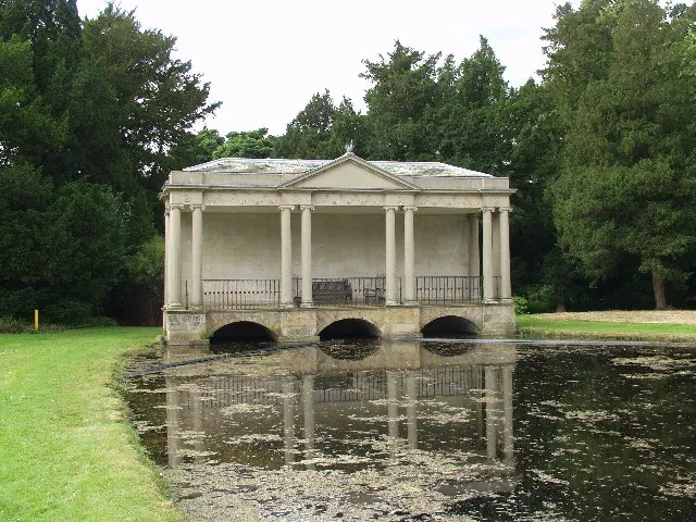
© Peter Mattock · Geograph · CC BY-SA 2.0
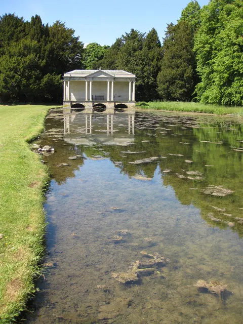
© Pauline E · Geograph · CC BY-SA 2.0
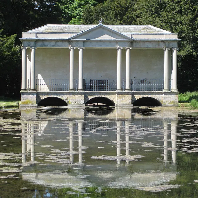
© Pauline E · Geograph · CC BY-SA 2.0
Images © their respective photographers, licensed under CC BY-SA 2.0 and reused here with attribution. Photographs depict listed buildings, churches and monuments near this settlement and may show neighbouring villages.
Data derived from the Open Domesday project (opendomesday.org), based on the Domesday Book dataset compiled by Professor J.J.N. Palmer and team. The Domesday Book (1086) is in the public domain.
Found an inaccuracy? [email protected]