Sawley in the Domesday Book (1086)
Sawley is named in the Domesday Book, compiled by Norman commissioners in 1086, entered under the hundred of Burghshire in Yorkshire.
Other Settlements in Burghshire
- Addlethorpe
- Aismunderby
- Aldfield
- Allerton [Mauleverer]
- Arkendale
- Askwith
- Azerley
- Barrowby [Grange]
- Beckwith [House]
- Besthaim
- Bestham
- Bewerley
- Bilton
- Birstwith
The Meaning of the Name
The name Sawley is of Anglo-Saxon origin. Its final element derives from the Old English word lēah, a woodland clearing or glade. The first element is most likely a personal name or an early descriptive term, now difficult to recover with certainty. Taken together the name probably meant something close to ‘a clearing’.
Remarkably, the name has changed little since 1086, when the Domesday scribes wrote it as Sawley.
Listed Buildings Near Sawley
Historic England records 15 listed buildings within about a mile of Sawley. Listing protects structures of special architectural or historic interest, graded I (exceptional), II* (particularly important) and II.
Grade II*
- Hog Hall - 1.15 km
Grade II
- Gravestone of Thomas Lonsdale Approximately 5 Metres East of South Porch of Church of St Michael - 0.44 km
- Church Farmhouse - 0.45 km
- Lacon Hall - 0.64 km
- Hill Top Farmhouse With Flanking Walls and West Garden Wall - 0.68 km
- Lacon Cross - 0.83 km
- Brook House With Attached Barn - 0.88 km
- Hall Gates Farmhouse - 0.97 km
- Gowbusk - 1.03 km
- West Gowbusk Farmhouse - 1.07 km
- Garden Building and Enclosure Wall Approximately 200 Metres West of Sawley Hall - 1.08 km
- Hind House Farmhouse - 1.1 km
- Horse Engine House Approximately 10 Metres North of Stables to Sawley Hall - 1.21 km
- Mile Post Approximately 50 Metres North of the Black A Moor Public House - 1.23 km
- Sawley Hall - 1.23 km
Scheduled Monuments Near Sawley
Scheduled monuments are nationally important archaeological sites given legal protection. 1 lies within roughly a mile of Sawley:
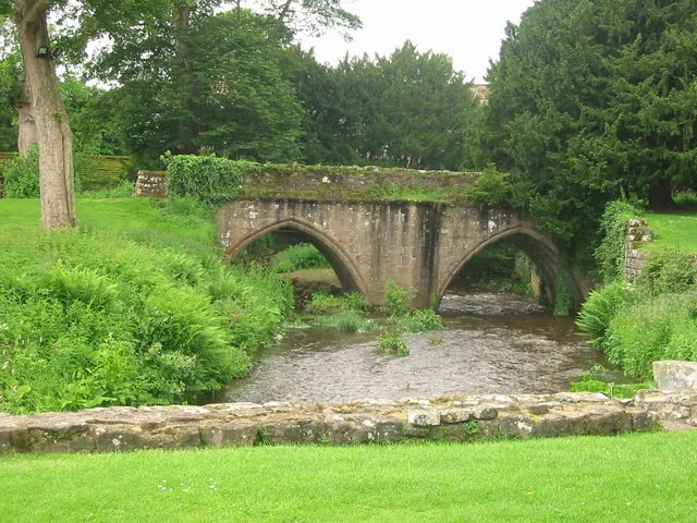
- Butterton Bridge - 1.26 km
Sawley Today
Today Sawley lies within the administrative area of North Yorkshire, and the settlement recorded a population of 293 at the 2021 census. Nine and a half centuries separate that figure from the small rural community the Domesday survey recorded here in 1086.
Read more about modern Sawley on Wikipedia .
Nearby Domesday Settlements
Other places recorded in the 1086 survey within a few miles:
- Eavestone - 2.2 km NW
- Aldfield - 2.8 km NE
- How Hill - 3.0 km E
- High Grantley - 3.2 km N
- Knaresford - 3.6 km NW
- Winksley - 4.1 km N
Heritage Around Sawley
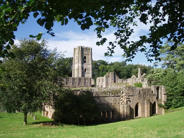
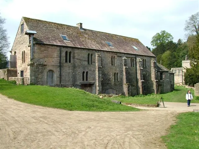
Photographs of churches, listed buildings and monuments in the vicinity, contributed by volunteers to the Geograph project and reused here under a Creative Commons licence.
© P Glenwright · Geograph · CC BY-SA 2.0
© J Scott · Geograph · CC BY-SA 2.0
© Pete burnett · Geograph · CC BY-SA 2.0
Images © their respective photographers, licensed under CC BY-SA 2.0 and reused here with attribution. Photographs depict listed buildings, churches and monuments near this settlement and may show neighbouring villages.
Data derived from the Open Domesday project (opendomesday.org), based on the Domesday Book dataset compiled by Professor J.J.N. Palmer and team. The Domesday Book (1086) is in the public domain.
Found an inaccuracy? [email protected]