Sandiacre in the Domesday Book (1086)
The 1086 Domesday survey records the settlement of Sandiacre, entered under the hundred of Morleystone in Derbyshire.
Other Settlements in Morleystone
- Bradley
- Breadsall
- Breaston
- Cellesdene
- Chaddesden
- Codnor
- Crich
- Denby
- Derby
- Draycott
- Duffield
- Hallam
- Heanor
- Herdebi
The Meaning of the Name
The origin of the name Sandiacre is not securely established from its modern form alone; like many settlement names in the North it likely combines an Old English or Old Norse personal name with a landscape term.
Remarkably, the name has changed little since 1086, when the Domesday scribes wrote it as Sandiacre.
Listed Buildings Near Sandiacre
Historic England records 13 listed buildings within about a mile of Sandiacre. Listing protects structures of special architectural or historic interest, graded I (exceptional), II* (particularly important) and II.
Grade I
- Church of St Giles - 0.9 km
Grade II
- Bobbin Milepost to South of Number 103 at Sk 4761 3640 - 0.12 km
- Dr Bland’s Almshouses - 0.14 km
- Dr Bland’s Almshouses - 0.16 km
- 25, Town Street - 0.38 km
- Offices to Springfield Mill Factory With Attached Wall and Lavatory Blocks - 0.4 km
- Springfield Mill Factory and Chimney - 0.44 km
- Canal Bridge at Sk 481 367 - 0.53 km
- Village Lock-up and Pound - 0.7 km
- Lock Keeper’s Cottage and Attached Outbuilding at Sandiacre Lock - 0.91 km
- Sandiacre Lock - 0.92 km
- Beech House at Sandiacre Lock - 0.92 km
- Bridge at Sandiacre Lock - 0.94 km
Scheduled Monuments Near Sandiacre
Scheduled monuments are nationally important archaeological sites given legal protection. 2 lie within roughly a mile of Sandiacre:
- Lock up and pinfold - 0.7 km
- Anglian high cross in the churchyard of St Helen’s Church - 1.57 km
Sandiacre Today
Today Sandiacre lies within the administrative area of Erewash, and the settlement recorded a population of 9,123 at the 2021 census. Nine and a half centuries separate that figure from the small rural community the Domesday survey recorded here in 1086.
Read more about modern Sandiacre on Wikipedia .
Nearby Domesday Settlements
Other places recorded in the 1086 survey within a few miles:
- Risley - 1.4 km SW
- Stanton -by-Dale - 1.4 km NW
- Hopwell - 3.0 km W
- Breaston - 3.6 km SW
- Long Eaton - 3.6 km SE
- Little? Hallam - 4.1 km N
Heritage Around Sandiacre
Photographs of churches, listed buildings and monuments in the vicinity, contributed by volunteers to the Geograph project and reused here under a Creative Commons licence.
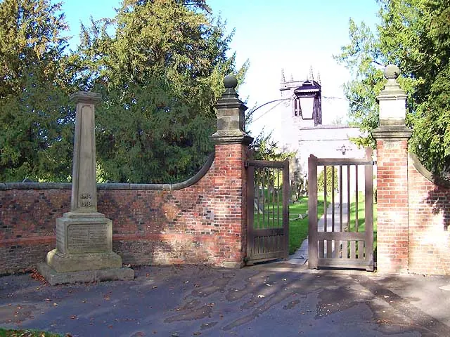
© Garth Newton · Geograph · CC BY-SA 2.0
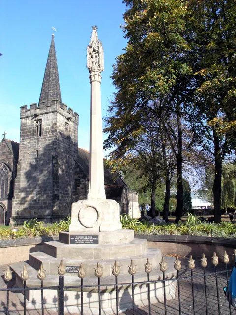
© David Lally · Geograph · CC BY-SA 2.0
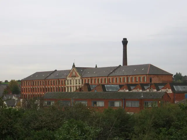
© Dave Bevis · Geograph · CC BY-SA 2.0
Images © their respective photographers, licensed under CC BY-SA 2.0 and reused here with attribution. Photographs depict listed buildings, churches and monuments near this settlement and may show neighbouring villages.
Data derived from the Open Domesday project (opendomesday.org), based on the Domesday Book dataset compiled by Professor J.J.N. Palmer and team. The Domesday Book (1086) is in the public domain.
Found an inaccuracy? [email protected]