Ruswick in the Domesday Book (1086)
Ruswick appears in the Domesday Book of 1086, entered under the hundred of Land of Count Alan in Yorkshire.
Other Settlements in Land of Count Alan
- Achebi
- Agglethorpe
- Ainderby [Mires]
- Ainderby [Quernhow]
- Aiskew
- Aldbrough
- Allerthorpe [Hall]
- Ascam
- Ascham
- Asebi
- Aske [Hall]
- Askrigg
- Aysgarth
- Baldersby
The Meaning of the Name
The name Ruswick is of Anglo-Saxon origin. Its final element derives from the Old English word wīc, a dwelling, dairy farm or trading settlement. The first element is most likely a personal name or an early descriptive term, now difficult to recover with certainty. Taken together the name probably meant something close to ‘a specialised farm’.
Remarkably, the name has changed little since 1086, when the Domesday scribes wrote it as Ruswick.
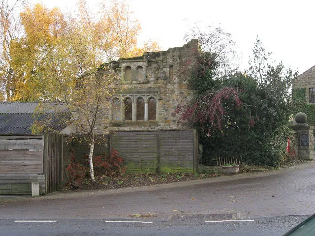
Listed Buildings Near Ruswick
Historic England records 6 listed buildings within about a mile of Ruswick. Listing protects structures of special architectural or historic interest, graded I (exceptional), II* (particularly important) and II.
Grade II*
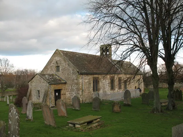
- Church of St Andrew - 0.87 km
Grade II
- Medieval Grave Cover Approximately 8 Metres South of Priest’s Door of Church of St Andrew - 0.86 km
- Chest Tomb of Matthew Edwards Approximately 6 Metres South West of South West Corner of Church of St Andrew - 0.87 km
- Naitby Memorial Approximately 10 Metres South West of Church of St Andrew - 0.87 km
- Nichol’s Stone - 1.19 km
- Leeming Beck Bridge - 1.24 km
Nearby Domesday Settlements
Other places recorded in the 1086 survey within a few miles:
- Fingall - 1.0 km W
- Newton le Willows - 2.0 km E
- Hesselton - 2.0 km N
- Patrick Brompton - 2.2 km NE
- Thornton Steward - 2.8 km SW
- Hutton Hang - 3.2 km W
Heritage Around Ruswick
Photographs of churches, listed buildings and monuments in the vicinity, contributed by volunteers to the Geograph project and reused here under a Creative Commons licence.
© Gordon Hatton · Geograph · CC BY-SA 2.0
© Roger Gilbertson · Geograph · CC BY-SA 2.0
© Stephen Craven · Geograph · CC BY-SA 2.0
Images © their respective photographers, licensed under CC BY-SA 2.0 and reused here with attribution. Photographs depict listed buildings, churches and monuments near this settlement and may show neighbouring villages.
Location
54.3006°N, -1.7003°W · Land of Count Alan hundred, Yorkshire
View larger map on OpenStreetMap →Data derived from the Open Domesday project (opendomesday.org), based on the Domesday Book dataset compiled by Professor J.J.N. Palmer and team. The Domesday Book (1086) is in the public domain.
Found an inaccuracy? [email protected]