Ruston in the Domesday Book (1086)
Ruston appears in the Domesday Book of 1086, entered under the hundred of Dic in Yorkshire. The survey assessed Ruston at 124 carucates of taxable land.
At the time of the survey, Ruston supported a recorded population of 262 villagers, 147 smallholders, 136 slaves, working 197 ploughs between them.
The survey records Ruston’s value at 170 shillings in 1086. No pre-Conquest figure survives – not unusual in the North, where records were disrupted by the Harrying and by the patchy coverage of the survey.
Resources Recorded at Ruston (1086)
- Mills: 10 mills (valued at 3.47 shillings)
Other Settlements in Dic
- Aislaby
- Allerston
- Appleton [le Moors]
- Aschelesmersc
- Aschilesmares
- Barton [le Street]
- Baschebi
- Baschesbi
- Brompton
- Burniston
- Burton [Dale]
- Cawthorn
- Cayton
- Chigogemers
The Meaning of the Name
The name Ruston is of Anglo-Saxon origin. Its final element derives from the Old English word tūn, a farmstead or village. The first element is most likely a personal name or an early descriptive term, now difficult to recover with certainty. Taken together the name probably meant something close to ‘a farmstead’.
Remarkably, the name has changed little since 1086, when the Domesday scribes wrote it as Ruston.
Listed Buildings Near Ruston
Historic England records 25 listed buildings within about a mile of Ruston. Listing protects structures of special architectural or historic interest, graded I (exceptional), II* (particularly important) and II.
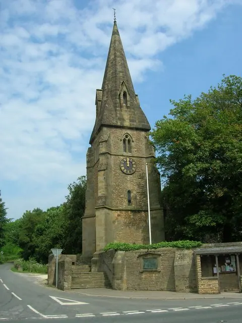
Grade II*
- All Saints Church - 0.87 km
Grade II
- Number 65 and Attached Outbuildings - 0.3 km
- Number 63 and Attached Outbuilding - 0.31 km
- Ruston Lodge - 0.42 km
- Lora Terrace - 0.44 km
- Manor Farmhouse and Manor Farm Cottage - 0.46 km
- Butterfield Cottages and Attached Outbuilding - 0.47 km
- Number 46 and Attached Outbuilding - 0.48 km
- 52, Ruston Village - 0.5 km
- West Hill and Attached Outbuilding - 0.5 km
- Gates, Railings and Four Gate Piers - 0.6 km
- The Downe Arms - 0.82 km
- Bridge - 0.83 km
- Church Lychgate - 0.85 km
- Lora Cottages - 0.86 km
- 40 and 41, Wykeham Village - 0.86 km
- Icehouse Approximately 15 Metres North of All Saints Church - 0.87 km
- Yew Grange and Attached Outbuilding - 0.9 km
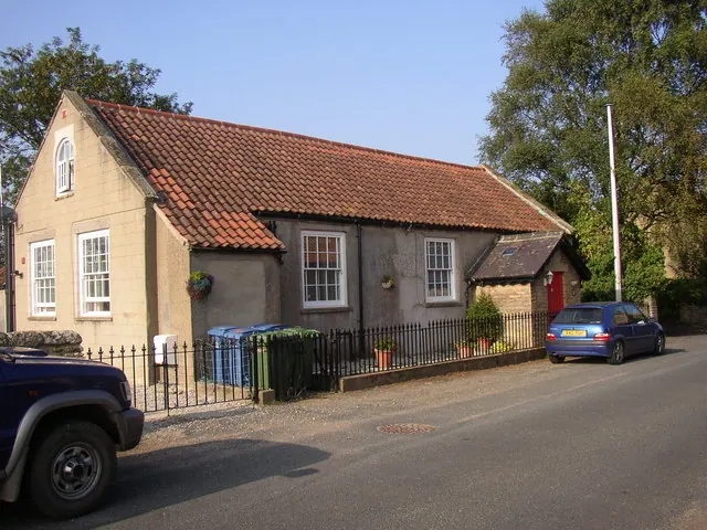
- School and Attached School House - 0.9 km
- Abbots Meadow - 0.91 km
- 23 and 24, Wykeham Village - 0.93 km
- Hill Farmhouse - 0.96 km
- North House and Attached Outbuildings - 0.97 km
- The Lodge - 1.21 km
…and 1 more listed structures in the area.
Ruston Today
Today Ruston lies within the administrative area of Wykeham.
Read more about modern Ruston on Wikipedia .
Nearby Domesday Settlements
Other places recorded in the 1086 survey within a few miles:
- Wykeham - 1.0 km E
- Martin Garth - 1.4 km NE
- Brompton - 1.4 km SW
- Hutton Buscel - 2.2 km NE
- Preston Hill - 2.2 km NE
- Newton - 3.2 km E
Heritage Around Ruston
Photographs of churches, listed buildings and monuments in the vicinity, contributed by volunteers to the Geograph project and reused here under a Creative Commons licence.
© JThomas · Geograph · CC BY-SA 2.0
© Humphrey Bolton · Geograph · CC BY-SA 2.0

© Alan Walker · Geograph · CC BY-SA 2.0
Images © their respective photographers, licensed under CC BY-SA 2.0 and reused here with attribution. Photographs depict listed buildings, churches and monuments near this settlement and may show neighbouring villages.
Data derived from the Open Domesday project (opendomesday.org), based on the Domesday Book dataset compiled by Professor J.J.N. Palmer and team. The Domesday Book (1086) is in the public domain.
Found an inaccuracy? [email protected]