Rufforth in the Domesday Book (1086)
The settlement of Rufforth is recorded in William I’s Domesday survey of 1086, entered under the hundred of Ainsty in Yorkshire.
Other Settlements in Ainsty
- Acaster [Malbis]
- Acaster [Selby]
- Acomb
- Appleton [Roebuck]
- Askham [Bryan]
- Askham [Richard]
- Bickerton
- Bilbrough
- Bilton
- Bishopthorpe
- Bithen
- Bolton [Percy]
- Catterton
- Colton
The Meaning of the Name
The name Rufforth is of Anglo-Saxon origin. Its final element derives from the Old English word ford, a river crossing. The first element is most likely a personal name or an early descriptive term, now difficult to recover with certainty. Taken together the name probably meant something close to ‘a ford’.
Remarkably, the name has changed little since 1086, when the Domesday scribes wrote it as Rufforth.
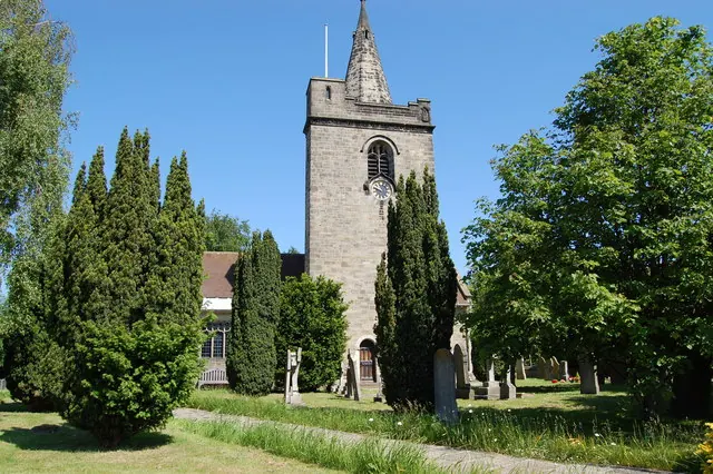
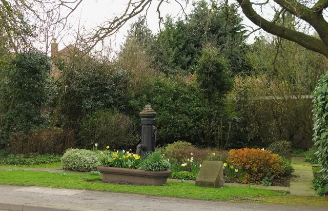
Listed Buildings Near Rufforth
Historic England records 4 listed buildings within about a mile of Rufforth. Listing protects structures of special architectural or historic interest, graded I (exceptional), II* (particularly important) and II.
Grade II
- Church of All Saints - 0.16 km
- Pear Tree Farmhouse - 0.22 km
- Village Pump and Trough - 0.3 km
- Pinfold - 0.57 km
Rufforth Today
Today Rufforth lies within the administrative area of Rufforth with Knapton, and the settlement recorded a population of 560 at recent figures. Nine and a half centuries separate that figure from the small rural community the Domesday survey recorded here in 1086.
Read more about modern Rufforth on Wikipedia .
Nearby Domesday Settlements
Other places recorded in the 1086 survey within a few miles:
- Long Marston - 2.0 km W
- Hessay - 2.0 km N
- Hutton Wandesley - 2.2 km SW
- Askham Richard - 3.2 km S
- Knapton - 4.1 km E
- Upper Poppleton - 4.2 km NE
Heritage Around Rufforth
Photographs of churches, listed buildings and monuments in the vicinity, contributed by volunteers to the Geograph project and reused here under a Creative Commons licence.
© SMJ · Geograph · CC BY-SA 2.0
© David Rogers · Geograph · CC BY-SA 2.0
© Nick Mutton 01329 000000 · Geograph · CC BY-SA 2.0
Images © their respective photographers, licensed under CC BY-SA 2.0 and reused here with attribution. Photographs depict listed buildings, churches and monuments near this settlement and may show neighbouring villages.
Data derived from the Open Domesday project (opendomesday.org), based on the Domesday Book dataset compiled by Professor J.J.N. Palmer and team. The Domesday Book (1086) is in the public domain.
Found an inaccuracy? [email protected]