Romaldkirk in the Domesday Book (1086)
Romaldkirk is named in the Domesday Book, compiled by Norman commissioners in 1086, entered under the hundred of Land of Count Alan in Yorkshire. The survey assessed Romaldkirk at 38.8 carucates of taxable land.
At the time of the survey, Romaldkirk supported a recorded population of 36 villagers, 12 smallholders, 25 slaves, working 36 ploughs between them.
By 1086 Romaldkirk was worth 39.6 shillings, up from 17.25 shillings before the Conquest – in contrast to many Yorkshire neighbours whose valuations collapsed.
The survey lists 11 manors at Romaldkirk under different lords. Splitting a single settlement between multiple tenants was common across the North – Saxon estates broken up and handed to William’s followers after 1066.
Resources Recorded at Romaldkirk (1086)
- Mills: 3 mills (valued at 19d)
- Salthouses: 19
- Meadow: 60 None
- Woodland: 1 * 1 leagues
Other Settlements in Land of Count Alan
- Achebi
- Agglethorpe
- Ainderby [Mires]
- Ainderby [Quernhow]
- Aiskew
- Aldbrough
- Allerthorpe [Hall]
- Ascam
- Ascham
- Asebi
- Aske [Hall]
- Askrigg
- Aysgarth
- Baldersby
The Meaning of the Name
The name Romaldkirk is of Scandinavian origin. Its final element derives from the Old Norse word kirkja, a church. The first element is most likely a personal name or an early descriptive term, now difficult to recover with certainty. Taken together the name probably meant something close to ‘a church’.
Names of this type are a fingerprint of Scandinavian settlement: they cluster across the old Danelaw, where Norse-speaking settlers renamed or founded villages from the late 9th century onward.
Remarkably, the name has changed little since 1086, when the Domesday scribes wrote it as Romaldkirk.
Listed Buildings Near Romaldkirk
Historic England records 62 listed buildings within about a mile of Romaldkirk. Listing protects structures of special architectural or historic interest, graded I (exceptional), II* (particularly important) and II.
Grade I
- Church of St Romald - 0.37 km
Grade II
- Former Privies, to Rear of Number 2 - 0.23 km
- 1, 2 and 3, Hutchinson Terrace - 0.24 km
- Water Pump, 3 Metres in Front of Number 2 - 0.24 km
- Beer Beck Low Bridge - 0.26 km
- Romaldkirk House, Glazed Walkway and Rear Yard Walls to Left - 0.32 km
- Church Hall - 0.33 km
- Beckwath - 0.34 km
- Garden Wall to West and South of Romaldkirk House - 0.37 km
- Lockey Headstone, 1 1/2 Metres South of Churh of St Romald - 0.38 km
- Waite Headstone, 3 Metres South of Church of St Romald - 0.38 km
- Kirkstile - 0.38 km
- Bell Headstone, 4 Metres South East of Church of St Romald - 0.38 km
- Horn Headstone, 5 Metres South of Church of St Romald - 0.38 km
- Headstone With Winged Skull, 7 Metres South of Church of St Romald - 0.38 km
- Sayer Headstone, 10 Metres South of Church of St Romald - 0.39 km
- Arkendale Number 5 and Wall to Left - 0.39 km
- 3 Headstones (Walton and Horn), 12 Metres South of Church of St Romald - 0.39 km
- Dent Headstone, 7 Metres South of Church of St Romald - 0.39 km
- Monks Cottage - 0.4 km
- 3 Headstones to Raine Family About 20 Metres South of Church of St Romald - 0.4 km
- Water Pump and Trough, 45 Metres East of Kirk Inn - 0.41 km
- The Shieling - 0.41 km
- 2 and 3, the Square - 0.41 km
…and 38 more listed structures in the area.
Romaldkirk Today
Today Romaldkirk lies within the administrative area of County Durham, and the settlement recorded a population of 164 at the 2021 census. Nine and a half centuries separate that figure from the small rural community the Domesday survey recorded here in 1086.
Read more about modern Romaldkirk on Wikipedia .
Nearby Domesday Settlements
Other places recorded in the 1086 survey within a few miles:
- Hunderthwaite - 1.4 km SW
- Mickleton - 3.2 km W
- Cotherstone - 3.6 km SE
- Lonton - 4.5 km NW
- Lartington - 5.8 km SE
- Startforth - 8.6 km SE
Heritage Around Romaldkirk
Photographs of churches, listed buildings and monuments in the vicinity, contributed by volunteers to the Geograph project and reused here under a Creative Commons licence.
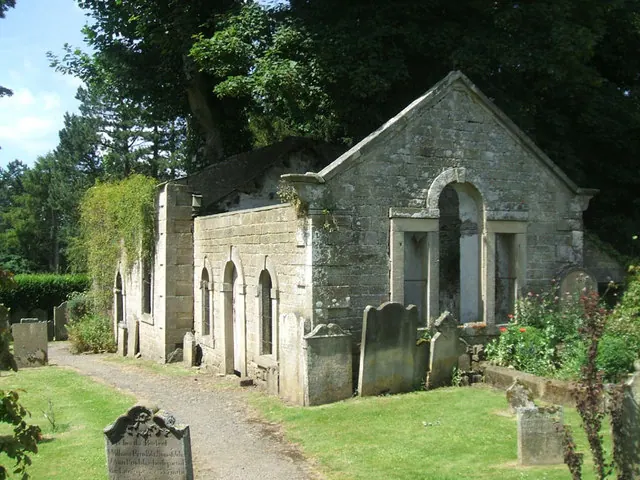
© Bill Henderson · Geograph · CC BY-SA 2.0
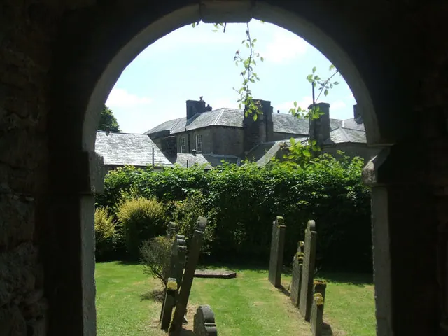
© Bill Henderson · Geograph · CC BY-SA 2.0
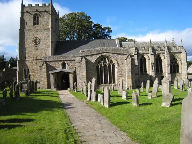
© Philip Barker · Geograph · CC BY-SA 2.0
Images © their respective photographers, licensed under CC BY-SA 2.0 and reused here with attribution. Photographs depict listed buildings, churches and monuments near this settlement and may show neighbouring villages.
Location
54.5975°N, -2.0077°W · Land of Count Alan hundred, Yorkshire
View larger map on OpenStreetMap →Data derived from the Open Domesday project (opendomesday.org), based on the Domesday Book dataset compiled by Professor J.J.N. Palmer and team. The Domesday Book (1086) is in the public domain.
Found an inaccuracy? [email protected]