Rodebestorp in the Domesday Book (1086)
The settlement of Rodebestorp is recorded in William I’s Domesday survey of 1086, entered under the hundred of Dic in Yorkshire. The survey assessed Rodebestorp at 2 carucates of taxable land.
By 1086 Rodebestorp was worth 5 shillings, up from 1.05 shillings before the Conquest – a sign this community came through the Conquest without being ruined.
Resources Recorded at Rodebestorp (1086)
- Mills: 1 mill
Other Settlements in Dic
- Aislaby
- Allerston
- Appleton [le Moors]
- Aschelesmersc
- Aschilesmares
- Barton [le Street]
- Baschebi
- Baschesbi
- Brompton
- Burniston
- Burton [Dale]
- Cawthorn
- Cayton
- Chigogemers
The Meaning of the Name
The origin of the name Rodebestorp is not securely established from its modern form alone; like many settlement names in the North it likely combines an Old English or Old Norse personal name with a landscape term.
Remarkably, the name has changed little since 1086, when the Domesday scribes wrote it as Rodebestorp.
Listed Buildings Near Rodebestorp
Historic England records 3 listed buildings within about a mile of Rodebestorp. Listing protects structures of special architectural or historic interest, graded I (exceptional), II* (particularly important) and II.
Grade II
- Gristhorpe Hall - 0.41 km
- Manor Farmhouse - 0.43 km
- Coach House Attached to Gristhorpe Hall at North-east - 0.44 km
Rodebestorp Today
Today Rodebestorp lies within the administrative area of Scarborough, and the settlement recorded a population of 418 at the 2021 census. Nine and a half centuries separate that figure from the small rural community the Domesday survey recorded here in 1086.
Read more about modern Gristhorpe on Wikipedia .
Nearby Domesday Settlements
Other places recorded in the 1086 survey within a few miles:
- Eterstorp - 0.0 km N
- Gristhorpe - 0.0 km N
- Roudeluestorp - 0.0 km N
- Scawthorpe - 0.0 km N
- Lebberston - 1.4 km NW
- Killerby Hall - 2.2 km NW
Heritage Around Rodebestorp
Photographs of churches, listed buildings and monuments in the vicinity, contributed by volunteers to the Geograph project and reused here under a Creative Commons licence.
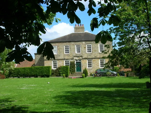
© JThomas · Geograph · CC BY-SA 2.0
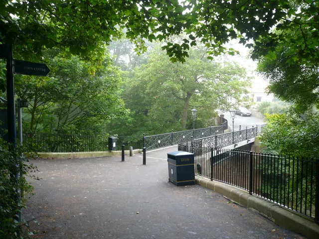
© Alan Heardman · Geograph · CC BY-SA 2.0
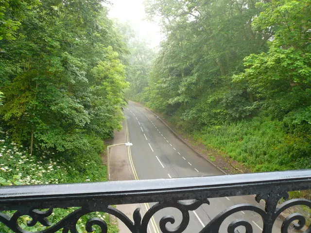
© Alan Heardman · Geograph · CC BY-SA 2.0
Images © their respective photographers, licensed under CC BY-SA 2.0 and reused here with attribution. Photographs depict listed buildings, churches and monuments near this settlement and may show neighbouring villages.
Data derived from the Open Domesday project (opendomesday.org), based on the Domesday Book dataset compiled by Professor J.J.N. Palmer and team. The Domesday Book (1086) is in the public domain.
Found an inaccuracy? [email protected]